Oak Ridge in Anderson County, Tennessee — The American South (East South Central)
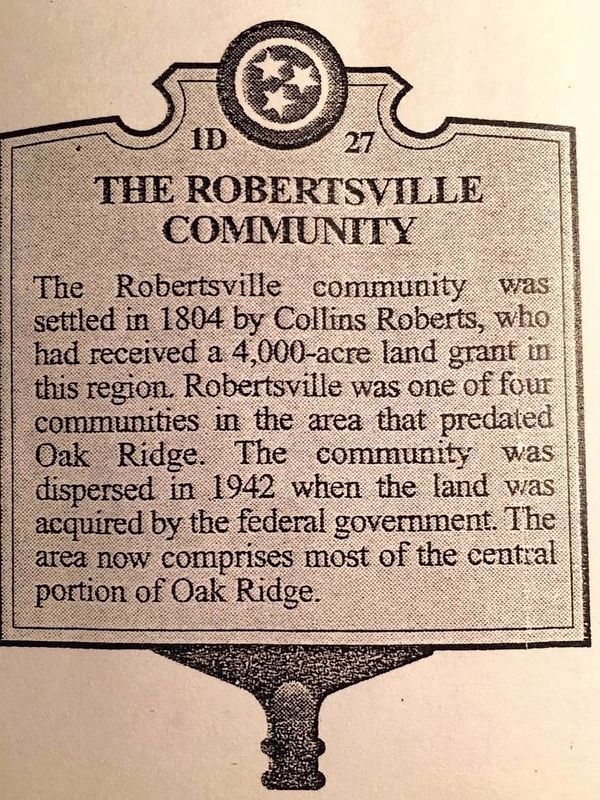
The Robertsville Community
Erected by Tennessee Historical Commission. (Marker Number 1D 27.)
Topics and series. This historical marker is listed in this topic list: Settlements & Settlers. In addition, it is included in the Tennessee Historical Commission series list. A significant historical year for this entry is 1804.
Location. 36° 0.769′ N, 84° 16.527′ W. Marker is in Oak Ridge, Tennessee, in Anderson County. Marker is on Robertsville Road, on the right when traveling east. Marker was originally located near Robertsville School. It was removed for several years after having been damaged and stored in the Robertsville school furnace room. Eventually it became missing. The marker was replaced in June, 2021. It is near the original location on Robertsville Road in front of the Robertsville Middle School. The "4,000" acres is questionable and may well be a misprint as "400" acres seems much more reasonable. Touch for map. Marker is in this post office area: Oak Ridge TN 37830, United States of America. Touch for directions.
Other nearby markers. At least 8 other markers are within walking distance of this marker. The Swimming Hole (approx. half a mile away); Grove Center (approx. 0.6 miles away); Midtown Community Center (approx. 0.6 miles away); The Emery Road (approx. 0.6 miles away); Oak Ridge Municipal Outdoor Swimming Pool (approx. 0.6 miles away); International Friendship Bell (approx. ¾ mile away); Oak Ridge Schools (approx. ¾ mile away); Dedicated to the Memory of Those from Oak Ridge Who Gave Their Lives That Freedom Might Live (approx. one mile away). Touch for a list and map of all markers in Oak Ridge.
Credits. This page was last revised on July 12, 2021. It was originally submitted on July 10, 2016, by Donald Raby of Knoxville, Tennessee. This page has been viewed 620 times since then and 35 times this year. Last updated on July 10, 2021, by Ray Smith of Oak Ridge, Tennessee. Photo 1. submitted on July 10, 2016, by Donald Raby of Knoxville, Tennessee. • Devry Becker Jones was the editor who published this page.
