Mount Savage in Allegany County, Maryland — The American Northeast (Mid-Atlantic)
Mount Savage In The Great War
(Sidebar):
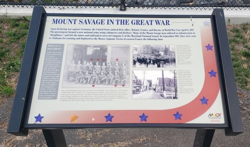
WHAT IS A DOUGHBOY?
In 1916, American foot soldiers involved with U.S. military operations on the Mexican border were marching in Pershing's Expeditionary Force south of the border to light rebel Pancho Villa. The white adobe from unpaved roads covered them and the soldiers were called "adobes" or "dobies" by mounted troops. Within a few months, these dobies, or Doughboys, were redeployed to Europe. Several men pictured at right were also "Dobies." Source: https://www.theworldwar.org/doughboys
(Photo Captions):
Only 7 of the 16 Doughboys pictured here in 1917 have been identified: 1. Lloyd J. Hartman; 2. Colen Graham, 3. William "Bill" Rice, 4. Frank Crowe, 5. David Crump, 6. George Witt, and 7. Edward Gears. All served in France and returned to Mr. Savage. The 1918 Flu Pandemic took its toll among American troops: Hartman, James H. Shaller and Walter H. Green died in France, while J. Edward Carney, Joseph B. Hammers and Lawrence B. Miller died in stateside training camps in Fall 1918. Pvt. Henry Earl Snyder was killed in action on September 26, 1918 in Meuse Argonne, France (Photo courtesy of Colen Kennell)
On Sunday, August 18, 1917 families and friends gathered to dedicate the Honor Roll board (behind the stage) that listed the names of the 147 men and 2 Army nurses, Martha L. Mont and Mary Angela Boyle who served in World War I. (Photo courtesy of Mount Savage Historical Society)
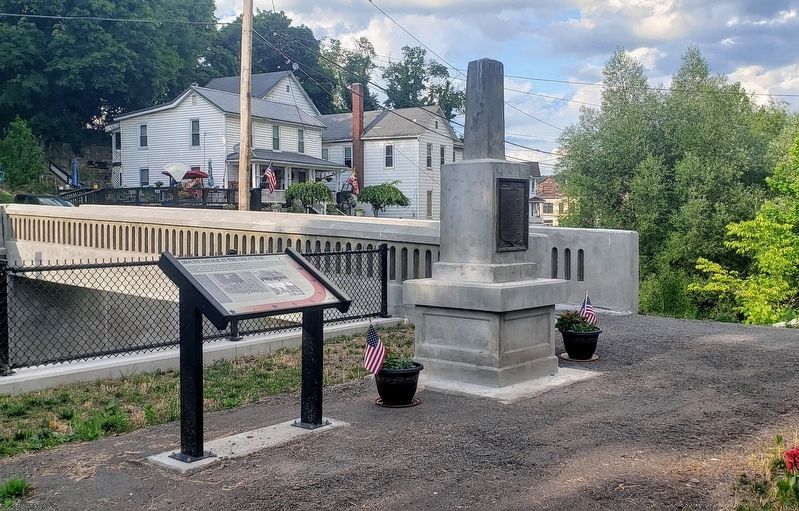
By 1923, the concrete Memorial Pedestrian Bridge (right) had been constructed to honor Mount Savage's men and women who served In the war. The bronze plaque listing the names of the dead was added in 1929. (Photo courtesy of Paula Fuller and Mount Savage Historical Society).
Erected by Maryland Department of Transportation State Highway Administration.
Topics. This historical marker is listed in this topic list: War, World I. A significant historical date for this entry is April 6, 1917.
Location. 39° 41.699′ N, 78° 52.737′ W. Marker is in Mount Savage, Maryland, in Allegany County. Marker is on Mount Savage Road NW (Maryland Route 36) east of Iron Rail Street, on the right when traveling east. Marker is across the footbridge on the south side of Mount Savage Road NW. Touch for map. Marker is in this post office area: Mount Savage MD 21545, United States of America. Touch for directions.
Other nearby markers. At least 8 other markers are within walking distance of this marker. In Honor of the Sons and Daughters of Mount Savage (a few steps from this marker); On This Site in 1844 (about 400 feet away, measured in a direct line); St Patrick School Monument (about 400 feet away); Faidley Field (about 400 feet away); St. Ignatius Stone (about 500 feet away); Veterans Memorial (about 500 feet away); The Castle (approx. ¼ mile away); Mount Savage Iron Works (approx. ¼ mile away). Touch for a list and map of all markers in Mount Savage.
Credits. This page was last revised on July 17, 2021. It was originally submitted on July 11, 2021, by Bradley Owen of Morgantown, West Virginia. This page has been viewed 192 times since then and 22 times this year. Photos: 1. submitted on July 11, 2021, by Bradley Owen of Morgantown, West Virginia. 2. submitted on July 13, 2021, by Bradley Owen of Morgantown, West Virginia. • Bill Pfingsten was the editor who published this page.

