The Mysterious Ferguson Rock
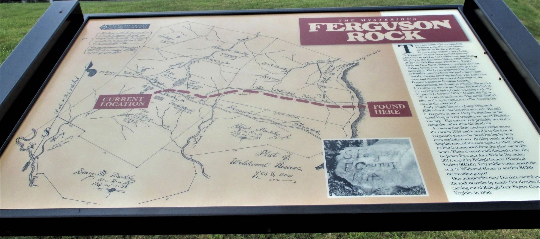
There are many tales surrounding Ferguson rock, the oldest known landmark in Beckley, Raleigh County. One popular story holds “S. Ferguson” to have been an “old pioneer” who came to grief in 1814 while traveling from Virginia to the Kanawha Valley. After riding all day on Old Bluestone Road from Pack’s Ferry on New River, Ferguson reached the ford of Piney Creek near the current sewage treatment plant. His horse, frightened by a bear or panther running from the bush, threw him into the stream, breaking his leg. The horse ran away and showed up several days later at the Ferguson home in Franklin County.
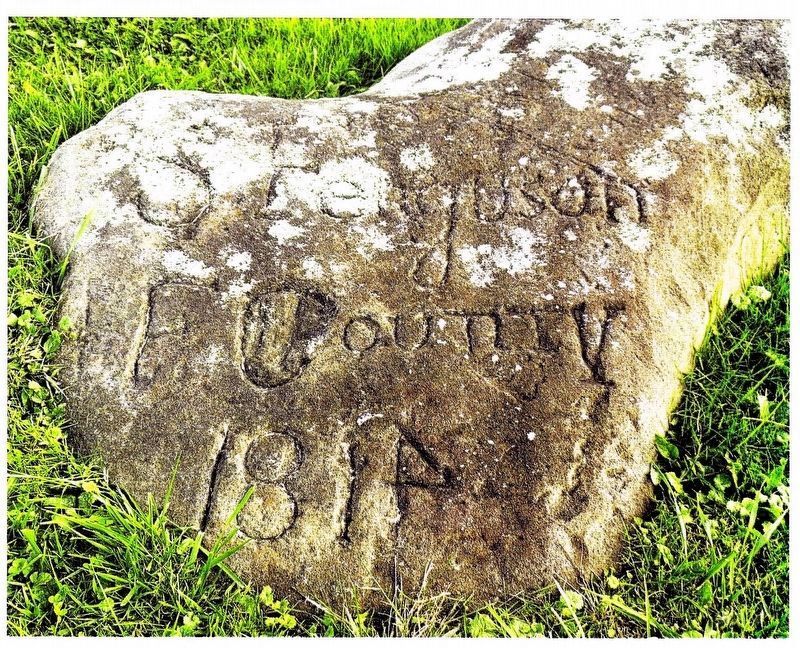
Backtracking, his family eventually discovered his corpse on the stream bank. He had died after carving his epitaph into a nearby rock: “S. Ferguson F. County 1814.” Oddly, the figure “4” was carved backwards. The family buried his remains on the spot, without a coffin, leaving the rock in the creek bed.
Early county historian Judge Winton A. Riffe related a far less romantic tale. He contended S. Ferguson was more “a member of the noted Ferguson fur-trapping family of Franklin County, Virginia.” The carved rock probably
this page online
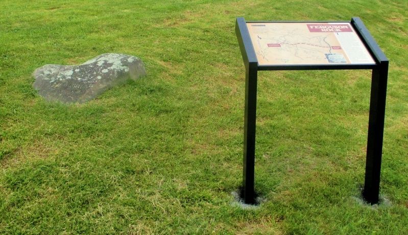
H A construction firm came across the rock in 1939 and moved it to the foot of Ferguson’s grave—the head having by then been asphalted over. Beckley resident Ray Sutphin rescued the rock again in 1984, when he had it transported from the plant site to his home. There it rested until donated to the city by James Bays and Amy Kirk in November 2017, urged by the Raleigh County Historical Society (RCHS). City public works moved the rock to Wildwood House as another RCHS preservation project.
One indisputable fact: The date carved on the rock precedes by nearly four decades the carving out of Raleigh from Fayette County, Virginia, in 1850.
Erected by City of Beckley Parks & Recreation, Raleigh County Historical Society.
Topics. This historical marker is listed in these topic lists: Industry & Commerce • Railroads & Streetcars • Settlements & Settlers. A significant historical year for this entry is 1814.
Location. 37° 46.316′ N, 81° 10.399′ W. Marker is in Beckley, West Virginia, in Raleigh County. It is at the intersection of South Kanawha Streeet (West Virginia Route 210)

Regionally, this marker is in West Virginia’s New River Gorge. It is also in the American South, specifically in the Upper South, in Appalachia, and specifically in Southern Appalachia. Globally, it is in North America, the Western Hemisphere, the Western World, and the Anglosphere. Historically, it finds itself in what was once the territory of the Mississippian Culture.
Other nearby markers. At least 8 other markers are within walking distance of this marker: Alfred Beckley / Wildwood (a few steps from this marker); Ferguson Rock (within shouting distance of this marker); Civil War Site (within shouting distance of this marker); Wildwood (within shouting distance of this marker); Old Bluestone Road (within shouting distance of this marker); Stratton High School (approx. 0.4 miles away); Bill Withers (approx. 0.4 miles
Credits. This page was last revised on April 4, 2022. It was originally submitted on July 10, 2021, by Merle T. Cole of Daniels, West Virginia. This page has been viewed 670 times since then and 38 times this year. Last updated on July 12, 2021, by Merle T. Cole of Daniels, West Virginia. Photos: 1, 2, 3. submitted on July 10, 2021, by Merle T. Cole of Daniels, West Virginia. • Devry Becker Jones was the editor who published this page.
