Near Fort Ransom in Ransom County, North Dakota — The American Midwest (Upper Plains)
Pyramid Hill / Fort Ransomís Remarkable Survival
Inscription.
Pyramid Hill
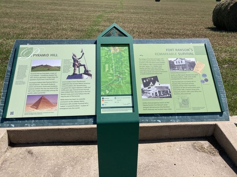
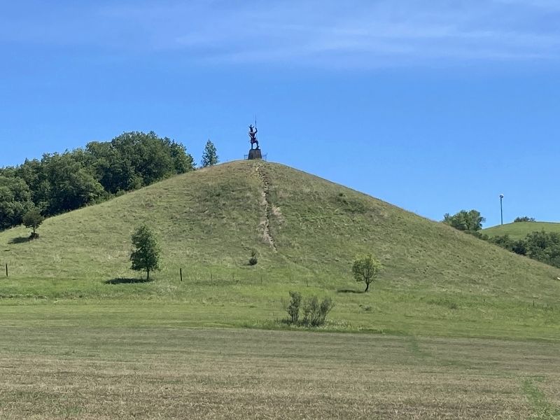
Pyramid Hill has long been a topic of local debate sometimes heated. The hill's obvious geometric shape begs the question of just how it was formed.
Geologists believe that Pyramid Hill is a natural featureóthe result of glacial action and erosion. Some area residents, however, believe the top one-third of the hill is man-made and possibly among the world's oldest pyramids!
Local resident Snorri Thorfinnson suggested that ancient Native American mound builders, the Tewaukonians, occupied this region between 5,000 and 9,000 years ago. Several burial mounds have indeed been discovered in the Fort Ransom area, and some believe this hill may be part of that group.
While there has been no scientific conclusion to this debate, Native Americans still consider Pyramid Hill a ďwakan" or powerful place-a place of emergence into this world.
Fort Ransomís Remarkable Survival
The Village of Fort Ransom began with J.D. Currie's general store in 1878. It was located on the hill where Scenic Heights now stands. In 1881, Currie's brother-in-law Tyler James ("T.J.") Walker built lumber and flour mills here. Other merchants and settlers followed. The town grew slowly and took its name from a nearby abandoned military fort.
Unlike most prosperous towns on the Dakota frontier, Fort Ransom never enjoyed railroad access (the Northern Pacific Railroad was located many miles north), nor did a grain elevator ever grace the town's skylineóboth were usually prerequisites for frontier success.
That Fort Ransom survived at all is a mystery. The community thrived, however, and by 1920, it boasted a population of 200 served by stores, grain and lumber mills, a harness shop, bank, restaurant, doctor's office, post office, two churches, and a pool hall.
"The mound is not a true pyramid, being 650 feet long and 520 feet wide Iris approximately 100 feet high level on top with the north, west, and south sides of uniform slope While all the other hills along this valley have many rocks and huge boulders, this mound is free of rock except for two flat stones laid on top of the northwest and southwest corners." -Snorri Thorfinnson, Ransom County History, Ransom County Historical Society Publishers, 1975.
[Captions:]
The Viking statue atop Pyramid Hill was erected in 1972 to honor the region's large Norwegian population.
The 14-foot-toll statue constructed of steel-reinforced fiberglass, fell victim to high storm winds several years ago, and though repaired, the Viking manifests a distinct backward lean.
Pyramid Hill is approximately 100 feet high-in
comparison, the Chefren Pyramid in Giza, Egypt is almost 500 feet tall.
The Currie family and Fort Ransom's first general store.
Emmet Steven Lovelace's imposing general store carried everything "from bridal veils to burial caskets."
Fort Ransom's lands were surveyed in 1881 and "squatters" became resident land owners.
Erected by Federal Highway Administration, Garrison Diversion Recreation Grant, Valley City Food & Beverage Tax Fund for Ransom Community Club and NDDOT.
Topics. This historical marker is listed in these topic lists: Forts and Castles • Industry & Commerce • Railroads & Streetcars • Settlements & Settlers. A significant historical year for this entry is 1878.
Location. 46° 31.377′ N, 97° 55.41′ W. Marker is near Fort Ransom, North Dakota, in Ransom County. Marker is at the intersection of Walt Hjelle Parkway and Valley Road, on the right when traveling north on Walt Hjelle Parkway. Touch for map. Marker is in this post office area: Fort Ransom ND 58033, United States of America. Touch for directions.
Other nearby markers. At least 8 other markers are within 7 miles of this marker, measured as the crow flies. Fort Ransom Historic Site (approx. 0.9 miles away); Historic Fort Ransom / Life at the Fort (approx. 0.9 miles away); Writing Rock / Native American Legends (approx. 0.9 miles away); Standing Rock Lutheran Church (approx. 1.7 miles away); Timber Trestle Bridge (approx. 1.9 miles away); An Ancient Sea / Glacial Meltwater Trench (approx. 2.3 miles away); Native Prairies / Ecosystem Under Siege (approx. 2.3 miles away); Standing Rock Hill Historic Site (approx. 7 miles away). Touch for a list and map of all markers in Fort Ransom.
Credits. This page was last revised on March 3, 2024. It was originally submitted on July 12, 2021, by Connor Olson of Kewaskum, Wisconsin. This page has been viewed 1,735 times since then and 335 times this year. Last updated on July 12, 2021, by Connor Olson of Kewaskum, Wisconsin. Photos: 1, 2. submitted on July 12, 2021, by Connor Olson of Kewaskum, Wisconsin. • Mark Hilton was the editor who published this page.

