Newport in Lincoln County, Oregon — The American West (Northwest)
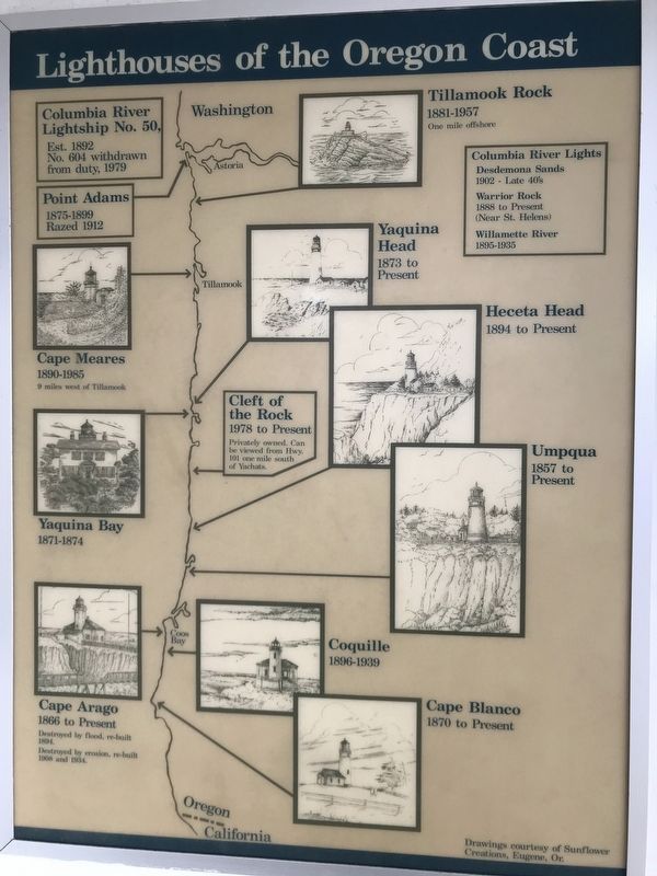
Lighthouses of the Oregon Coast
Photographed by Duane and Tracy Marsteller, June 28, 2021
1. Lighthouses of the Oregon Coast Marker
Point Adams: 1875-1899 • Razed 1912
Columbia River Lights: Desdemona Sands: 1902 - Late 40's • Warrior Rock: 1888 to Present (Near St. Helens) • Willamette River: 1895-1935
Tillamook Rock: 1881-1957 • One mile offshore
Cape Meares: 1890-1985 • 9 miles west of Tillamook
Yaquina Head: 1873 to Present
Yaquina Bay: 1871-1874
Cleft of the Rock: 1978 to Present • Privately owned • Can be viewed from Hwy. 101 one mile south of Yachats.
Heceta Head: 1894 to Present
Umpqua: 1857 to Present
Cape Arago: 1866 to Present • Destroyed by flood, re-built 1894 • Destroyed by erosion, re-built 1908 and 1934
Coquille: 1896-1939
Cape Blanco: 1870 to Present
Drawings courtesy of Sunflower Creations, Eugene, Or.
Erected by Friends of Yaquina Bay Lighthouse • Oregon State Parks and Recreation Department.
Topics and series. This historical marker is listed in this topic list: Notable Buildings. In addition, it is included in the Lighthouses series list. A significant historical year for this entry is 1866.
Location. 44° 37.42′ N, 124° 3.773′ W. Marker
this page online

Regionally, this marker is on the Oregon Coast. It is also on the American Pacific Coast, in the Pacific Northwest, and in the Lewis & Clark Corridor. Globally, it is in North America, on the Ring of Fire, on the Pacific Rim, in the Western Hemisphere, in the Western World, and in the Anglosphere.
Other nearby markers. At least 8 other markers are within walking distance of this marker: Yaquina Bay Light (here, next to this marker); Lighthouses Weren't Enough (here, next to this marker); Safety at Yaquina Bay Today (here, next to this marker); Yaquina Bay Bridge (within shouting distance of this marker); Yaquina Bay (within shouting distance of this marker); United States Coast Guard Motor Lifeboat CG 36503 (approx. 0.3 miles away); Protecting the Coast (approx. half a mile away); Reeling Them In
Photographed by Duane and Tracy Marsteller, June 28, 2021
2. Lighthouses of the Oregon Coast Marker
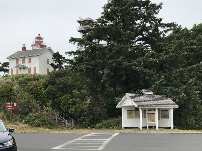
Marker is in this kiosk near Yaquina Bay Lighthouse (background).
More about this marker. The order of text in the inscription has been altered to list the lighthouses from north to south.
Credits. This page was last revised on July 13, 2021. It was originally submitted on July 13, 2021, by Duane and Tracy Marsteller of Murfreesboro, Tennessee. This page has been viewed 279 times since then and 33 times this year. Photos: 1, 2. submitted on July 13, 2021, by Duane and Tracy Marsteller of Murfreesboro, Tennessee.
