Sioux City in Woodbury County, Iowa — The American Midwest (Upper Plains)
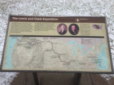
The Lewis and Clark Expedition
Lewis and Clark National Historic Trail
The landscape has changed since Lewis and Clark explored it: rivers have been dammed, forests cut over, prairies plowed under, and roads built to the horizon. Although remnants of wilderness still exist, imagine this land as Lewis and Clark first saw it two centuries ago.
The United States Purchased the Louisiana territory - more than 830,000 square miles - from France in 1803. President Jefferson selected Meriwether Lewis to lead an expedition there.
With Jefferson's permission, Lewis asked his friend and former commanding officer, William Clark, to be co-leader. Although opposite in temperament, they worked harmoniously throughout the two year journey.
Erected by National Park Service, U.S. Department of the Interior.
Topics and series. This historical marker is listed in these topic lists: Exploration • Settlements & Settlers . In addition, it is included in the Former U.S. Presidents: #03 Thomas Jefferson, and the Lewis & Clark Expedition series lists. A significant historical year for this entry is 1803.
Location. Marker has been reported missing. It was located near 42° 27.756′ N, 96° 22.648′ W. Marker was in Sioux City, Iowa, in Woodbury County. Marker could be reached from South Lewis Boulevard, 0.3 miles Lincoln Way. Marker is located on the east side the the Floyd Monument at the base of the monument. Touch for map. Marker was in this post office area: Sioux City IA 51106, United States of America. Touch for directions.
Other nearby markers. At least 8 other markers are within one mile of this location, measured as the crow flies. Sergeant Floyd Monument (a few steps from this marker); The Lewis & Clark Expedition (a few steps from this marker); The Death of Sergeant Floyd (a few steps from this marker); Sergeant Charles Floyd (within shouting distance of this marker); Floyd Monument (within shouting distance of this marker); First Bride's Grave (approx. 0.3 miles away); Herbert Quick Ravine (approx. 0.4 miles away); MA1 (EXW) John Douangdara (approx. 1.1 miles away in Nebraska). Touch for a list and map of all markers in Sioux City.
Credits. This page was last revised on July 16, 2021. It was originally submitted on February 29, 2016, by Ruth VanSteenwyk of Aberdeen, South Dakota. This page has been viewed 609 times since then and 43 times this year. Last updated on July 14, 2021. Photo 1. submitted on February 29, 2016, by Ruth VanSteenwyk of Aberdeen, South Dakota. • Mark Hilton was the editor who published this page.
