Silverton in San Juan County, Colorado — The American Mountains (Southwest)
Rails Into the San Juans
Colorado
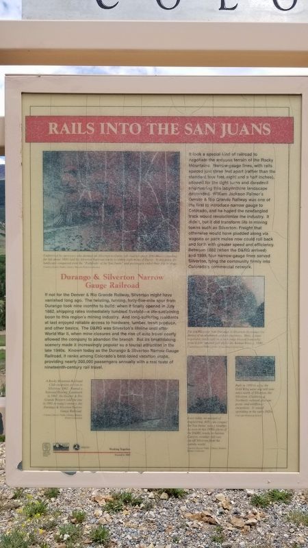
Durango & Silverton Narrow Gauge Railroad
If not for the Denver & Rio Grande Railway, Silverton might have vanished long ago. The twisting, turning, forty-five-mile spur from Durango took nine months to build; when it finally opened in July 1882, shipping rates immediately tumbled fivefold - a life-sustaining boon to this region's mining industry. And long-suffering residents at last enjoyed reliable access to hardware, lumber, fresh produce, and other basics. The D&RG was Silverton's lifeline until after World War II, when mine closures and the rise of auto travel nearly allowed the company to abandon the branch. But its breathtaking scenery made it increasingly popular as a tourist attraction in the late 1940s. Known today as the Durango & Silverton Narrow Gauge Railroad, it ranks among Colorado's best-loved vacation stops, providing nearly 200,000 passengers annually with a real taste of nineteenth-century rail travel.
It took a special kind of railroad to negotiate the arduous terrain of the Rocky Mountains. Narrow-gauge lines, with rails spaced just three feet apart (rather than the standard four feet, eight and a half inches), allowed for the tight turns and daredevil engineering this labyrinthine landscape demanded. William Jackson Palmer's Denver & Rio Grande Railway was one of the first to introduce narrow gauge to Colorado, and he hoped the newfangled track would revolutionize the industry. It didn't, but it did transform life in mining towns such as Silverton: Freight that otherwise would have plodded along via wagons or pack mules now could roll back and forth with greater speed and efficiency. Between 1882 (when the D&RG arrived) and 1899, four narrow-gauge lines served Silverton, tying the community firmly into Colorado's commercial network.
Captions
1. Undeterred by surveyors who deemed his Silverton-to-Ouray toll road too steep, Otto Meers (stabding far left about 1900) laid his Silverton Railroad tracks to within eight miles of Ouray. At this point, the landscape conquered even the "Pathfinder of the San Juans" and passengers ended their trip by stage.
Courtesy Denver Public Library, Western History Collection
2. A Rocky Mountain Railroad Club excursion arrives in Silverton 1962. Named a National Historic Landmark in 1967, the Denver & Rio Grande Western sold the line in 1981 to today's owners, the Durango & Silverton Narrow Gauge Railroad.
Courtesy Denver Public Library, Western History Collection
3. The D&RG route from Durange to Silverton showcases the daring of its nineteenth-century engineers. Here, a train negotiates tracks laid on a rock ledge blasted from sold granite four hundred feet above the Animas River, c.1896.
Courtesy Denver Public Library, Western History Collection
4. Built in 1899 to serve the Gold King mine and mill nine miles north of Silverton, the Silverton, Gladstone & Northerly railroad also ran picnic and wildflower excursions. It ceased operating in the early 1920s.
Colorado Historical Society
5. Even today, no amount of engineering skills can conquer the San Juans' snowy weather. As seen in this 1890s photo of the D&RG tracks in Animas Canyon, weather still can cut off Silverion from the outside world.
Courtesy Denver Public Library, Western History Collection
Erected 2002 by Colorado Historical Society and Colorado Department of Transportation.
Topics. This historical marker is listed in this topic list: Railroads & Streetcars. A significant historical month for this entry is July 1882.
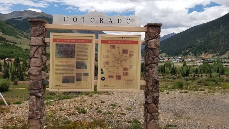
Location. 37° 48.294′ N, 107° 40.564′ W. Marker is in Silverton, Colorado, in San Juan County. The marker is part of a group of four historical panels by the side of the road. Touch for map. Marker is in this post office area: Silverton CO 81433, United States of America. Touch for directions.
Other nearby markers. At least 8 other markers are within walking distance of this marker. Hard Rock Resiliency (here, next to this marker); Silverton (here, next to this marker); Swivel End-Dump Car (approx. 0.3 miles away); Shaft "Can" Skip (approx. 0.3 miles away); Silver By The Ton (approx. 0.3 miles away); Silverton's Railroads (approx. 0.3 miles away); 1060 Reese (approx. 0.7 miles away); 1069 Greene (approx. 0.7 miles away). Touch for a list and map of all markers in Silverton.
Credits. This page was last revised on July 17, 2021. It was originally submitted on July 17, 2021, by James Hulse of Medina, Texas. This page has been viewed 168 times since then and 20 times this year. Photos: 1, 2, 3. submitted on July 17, 2021, by James Hulse of Medina, Texas.


