Kings Park in Suffolk County, New York — The American Northeast (Mid-Atlantic)
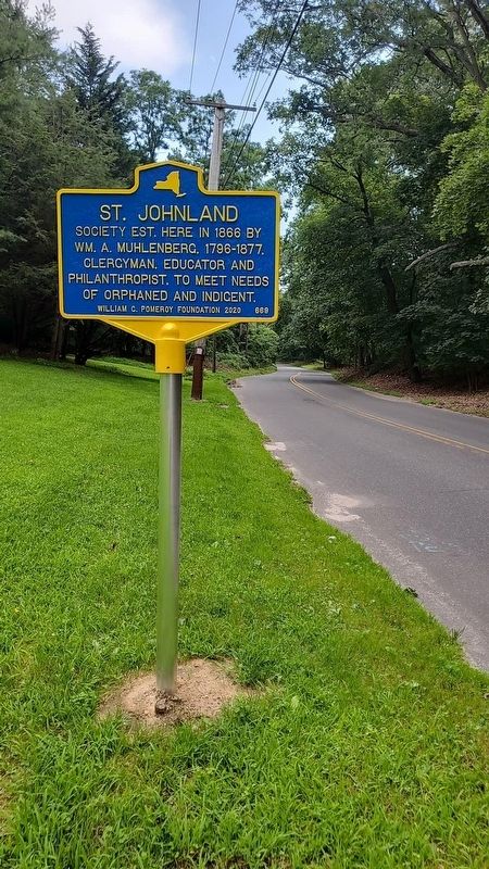
St. Johnland
Erected 2021 by William G. Pomeroy Foundation. (Marker Number 669.)
Topics. This historical marker is listed in these topic lists: Charity & Public Work • Churches & Religion. A significant historical year for this entry is 1866.
Location. 40° 54.124′ N, 73° 14.61′ W. Marker is in Kings Park, New York, in Suffolk County. Marker is on Sunken Meadow Road, 0.2 miles west of Old Dock Road, on the left when traveling east. Touch for map. Marker is at or near this postal address: 395 Sunken Meadow Road, Kings Park NY 11754, United States of America. Touch for directions.
Other nearby markers. At least 8 other markers are within 3 miles of this marker, measured as the crow flies. Home of Obadiah Smith (approx. 0.9 miles away); Platt Homestead (approx. 1.1 miles away); Suffrage Tour (approx. 1.2 miles away); Train Station (approx. 1.4 miles away); Original Settlement of Smithtown (approx. 2.2 miles away); Nissequogue School (approx. 2˝ miles away); Richard Smith (approx. 2.7 miles away); Indian Head Farm (approx. 2.9 miles away). Touch for a list and map of all markers in Kings Park.
Also see . . . William G. Pomeroy Foundation | St. Johnland. (Submitted on July 17, 2021, by Jordan Romano of Kings Park, New York.)
Credits. This page was last revised on July 19, 2021. It was originally submitted on July 17, 2021, by Jordan Romano of Kings Park, New York. This page has been viewed 217 times since then and 31 times this year. Photo 1. submitted on July 17, 2021, by Jordan Romano of Kings Park, New York. • Bill Pfingsten was the editor who published this page.
