Near Concord in Contra Costa County, California — The American West (Pacific Coastal)
Disaster
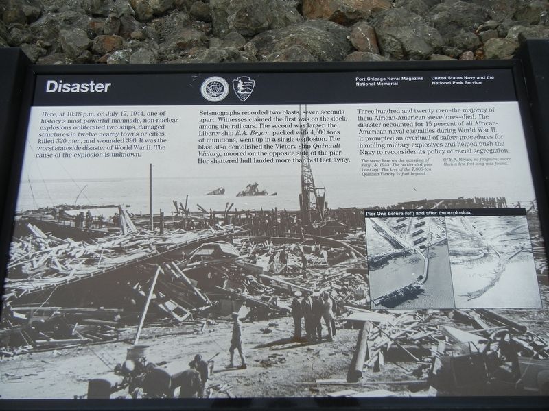
Seismographs recorded two blasts, seven seconds apart. Witnesses claimed the first was on the dock, among the rail cars. The second was larger: the Liberty ship E.A. Bryan, packed with 4,600 tons of munitions, went up in a single explosion. The blast also demolished the Victory ship Quinault Victory, moored on the opposite side of the pier. Her shattered hull landed more than 500 feet away.
Three hundred and twenty men — the majority of them African-American stevedores — died. The disaster accounted for 15 percent of all African-American naval casualties during World War II. It prompted an overhaul of safety procedures for handling military explosives and helped push the Navy to reconsider its policy of racial segregation.
Captions
(Background photo) The scene here on the morning of July 18, 1944. The obliterated pier is at left. The keel of the 7,000-ton Quinault Victory is just beyond. Of E.A. Bryan, no fragment more than a few feet long was found.
(Inset) Pier One before (left) and after the explosion.
Erected by United States Navy • National Park Service.
Topics. This historical marker is listed in these topic lists: African Americans • Disasters • Forts and Castles • War, World II. A significant historical date for this entry is July 17, 1944.
Location. This marker has been replaced by another marker nearby. It was located near 38° 3.452′ N, 122° 1.772′ W. Marker was near Concord, California, in Contra Costa County. Marker was on Kinney Boulevard. Marker was at Port Chicago Naval Magazine National Memorial. Touch for map. Marker was in this post office area: Concord CA 94520, United States of America. Touch for directions.
Other nearby markers. At least 8 other markers are within 5 miles of this location, measured as the crow flies. (Port Chicago) Disaster (here, next to this marker); Port Chicago Naval Magazine National Memorial (a few steps from this marker); Dangerous Work (within shouting distance of this marker); Port Chicago Naval Magazine (within shouting distance of this marker); The Only Train Stop in Clyde (approx. 2.4 miles away); De Anza Expedition 1775-1776 (approx. 4.3 miles away); Don Fernando Pacheco Adobe (approx. 4.3 miles away); A Window into the Past (approx. 4.3 miles away). Touch for a list and map of all markers in Concord.
Credits. This page was last revised on July 25, 2021. It was originally submitted on July 21, 2021, by Duane and Tracy Marsteller of Murfreesboro, Tennessee. This page has been viewed 154 times since then and 9 times this year. Photos: 1. submitted on July 21, 2021, by Duane and Tracy Marsteller of Murfreesboro, Tennessee. 2. submitted on July 25, 2021, by Duane and Tracy Marsteller of Murfreesboro, Tennessee.

