Arthurdale in Preston County, West Virginia — The American South (Appalachia)
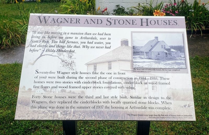
Wagner And Stone Houses
"It was like moving in a mansion than we had been living in before we came to Arthurdale, over to Scott's Run. You had furnace, you had water, you had electric and things like that. Why we never had before" — Hilda Hendershot
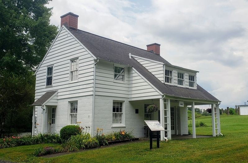
Seventy-five Wagner style houses (like the one in front of you) were built during the second phase of construction in 1934 - 1935. These homes were two stories with cinderblock foundations, cinderblock or wood framed first floors and wood framed upper stories covered with siding.
Forty Stone houses were the third and last style built. Similar in design to the Wagners, they replaced the cinderblocks with locally quarried stone blocks. When this phase was done in the summer of 1937 the housing at Arthurdale was complete.
[Captions:]
The Stone style of Arthurdale houses, the last type completed.
The Wagner houses were larger than the first style of houses built at Arthurdale.
Erected 2014 by West Virginia University.
Topics. This historical marker is listed in these topic lists: Architecture • Settlements & Settlers. A significant historical year for this entry is 1934.
Location. 39° 29.631′ N, 79° 48.989′ W. Marker is in Arthurdale , West Virginia, in Preston County. Marker is on Q Road, 0.1 miles south of North Mountaineer Highway (West Virginia Route 92), on the right when traveling south. Touch for map. Marker is at or near this postal address: 112 Q Rd, Arthurdale WV 26520, United States of America. Touch for directions.
Other nearby markers. At least 8 other markers are within walking distance of this marker. Food Storage (a few steps from this marker); History of the Houses (about 400 feet away, measured in a direct line); Arthurdale (about 400 feet away); The Community Center (about 400 feet away); Honor Roll (about 400 feet away); The Great Hall (about 500 feet away); Community At Arthurdale (about 500 feet away); Administration Building (about 600 feet away). Touch for a list and map of all markers in Arthurdale.
Credits. This page was last revised on July 23, 2021. It was originally submitted on July 23, 2021, by Bradley Owen of Morgantown, West Virginia. This page has been viewed 109 times since then and 20 times this year. Photos: 1, 2. submitted on July 23, 2021, by Bradley Owen of Morgantown, West Virginia. • Devry Becker Jones was the editor who published this page.

