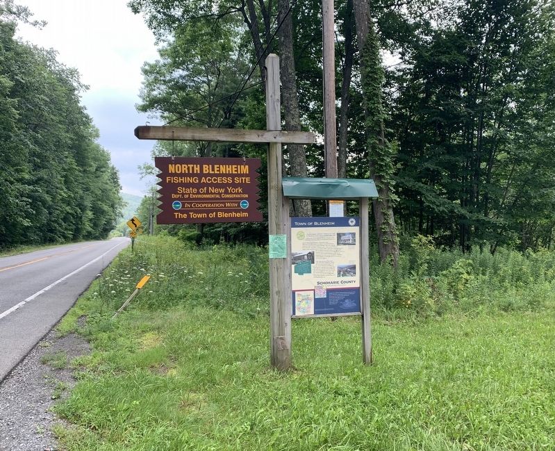
Near North Blenheim in Schoharie County, New York — The American Northeast (Mid-Atlantic)
Town of Blenheim
Schoharie County
— Right in the Heart of New York State —
The first European settlements in Blenheim were made by Dutch and German Palatines sometime before 1761.
Taking its name from the 40,000-acre Blenheim Patent given to forty men by King George III in 1769, the town was officially formed in 1797.
Our Revolutionary Connection
Many of the early settlers went on to be soldiers in the American Revolution, among them Fregift Patchin and Captain Jacob Hager. Hager was in command of the Upper Fort – one of three in Schoharie County - when a thousand British regulars, royalists and Indians entered the Schoharie Valley. Captain Hager ordered warning shots to alert the other forts to the British advance, and his quick action deterred the British from attacking the fort. Fregift Patchin was one of several men taken prisoner by Joseph Brant in 1780. He was imprisoned for more than two years. On returning to Blenheim, Patchin established a successful mill and went on to serve in the New York State Legislature.
The Blenheim Bridge And Other Attractions
One of the most prominent attractions in the town is the 226-foot Blenheim Covered Bridge, the longest single-span, single-arch two-lane wooden bridge in the world. Just up the road you'll find the Blenheim Gilboa Pumped Storage Power Project of the New York Power Authority and historic Lansing Manor a 19th century country estate. Minekill State Park provides boating, fishing, picnicking, swimming, hiking, sports and a waterfall overlook area.
Although much of Blenheim is hilly upland broken by deep stream ravines, there is a wide flat that extends along the Schoharie Creek, offering land as rich as any in the county. Farming has always been the chief occupation and in earlier times farmers here grew wheat, hops, broom corn and tobacco. Today our land yields primarily timothy, alfalfa and silage corn.
Upper Right Photo: Lansing Manor is an 19th century country estate open to the public. Three floors of period furnishings and decor show what life was like for the well-to-do in the early 1800s.
Middle Left Photo: Blenheim Bridge
Longest single span wooden bridge in world. Built by Blenheim Bridge Company, incorporated in 1828. Last of its kind in this region.
Bottom Right Photo: The New York Power Authority Visitors Center offers visitors displays the show how electricity is generated and the importance of preserving our natural resources.
Erected by Schoharie County, Mohawk Valley Heritage Corridor Commission.
Topics. This historical marker is listed in this topic list: Settlements & Settlers. A significant historical year for this entry is 1761.
Location. 42° 29.992′ N, 74° 25.143′ W. Marker is near North Blenheim, New York, in Schoharie County. Marker is on New York State Route 30, 2.2 miles north of East Side Road, on the left when traveling north. Marker is at the North Blenheim Fishing Access Site. Touch for map. Marker is in this post office area: Fultonham NY 12071, United States of America. Touch for directions.
Other nearby markers. At least 8 other markers are within 3 miles of this marker, measured as the crow flies. Captain Jacob Hager (approx. 0.7 miles away); Indian Trail (approx. 1.7 miles away); Blenheim Bridge (approx. 2.2 miles away); Old Blenheim Bridge (approx. 2.2 miles away); a different marker also named Blenheim Bridge (approx. 2.2 miles away); The Creation (approx. 2.3 miles away); The Life (approx. 2.3 miles away); The Floods (approx. 2.3 miles away). Touch for a list and map of all markers in North Blenheim.
Also see . . .
1. Town of Blenheim. (Submitted on July 28, 2021, by Michael Herrick of Southbury, Connecticut.)
2. Blenheim, New York (Wikipedia). (Submitted on July 28, 2021, by Michael Herrick of Southbury, Connecticut.)
Credits. This page was last revised on July 28, 2021. It was originally submitted on July 27, 2021, by Steve Stoessel of Niskayuna, New York. This page has been viewed 261 times since then and 31 times this year. Photos: 1, 2. submitted on July 27, 2021, by Steve Stoessel of Niskayuna, New York. • Michael Herrick was the editor who published this page.

