Keokuk in Lee County, Iowa — The American Midwest (Upper Plains)
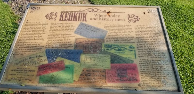
Keokuk
Where Today and History Meet
The city of Keokuk has long been associated with thriving commerce and transportation even before it was incorporated in 1847. The location of the Des Moines Rapids in the Mississippi River made it necessary for steamboats to unload passengers and freight and arrange for portage around the rapids. Packets, excursion boats, tows, and rats navigated up and down the river stopping at Keokuk along their way. Many businesses flourished at the foot of these rapids making the settlement a major stopping off point for people and products continuing up the river or being transferred to prairie schooners that transported goods to interior areas.
Most of the earlier commerce was carried on around the "levee", at the foot of Main and Johnson Streets, and in an area called "Rat Row." At this time the city had not expanded up the timber covered bluffs above the river.
Another natural barrier was the Mississippi River itself and attempting crossing from east to west was sometimes hazardous. The ferry "Salina" was one of the local boats that carried passengers as well as freight across to the opposite banks. In the winter crossings were made on the ice with sledges and sleighs.
Consequently, in 1866 the Keokuk & Hamilton Mississippi Bridge Co. was formed with the construction beginning in 1869 and continuing for two years until April of 1871. This was the first combination roadway and railway bridge built across the Mississippi River. The construction contact was awarded to the Keystone Bridge Company of Pittsburgh which was one of Andrew Carnegie's first business ventures at a cost of $850,000.
The new "Iron Bridge" furnished another link for commerce between east and west and for freight and immigration. It was said that this bridge was one of the wonders of the nineteenth century - at least to the people of Keokuk. The total length of the bridge was 3800 feet and accommodated railroad cars, horse and wagon teams, and foot passengers.
Keokuk was the terminus of five different railroads: the Toledo, Wabash & Western, the Toledo, Peoria & Warsaw, the Keokuk & St. Louis, the Keokuk & St. Paul, and the Des Moines Valley Railroad. A locomotive named the "Iowa" was the first to cross the Keokuk - Hamilton Bridge on April 19, 1871. The bridge was opened to the public on June 14, 1871.
In 1916, the bridge remodeling project was completed adding an elevated roadway that accommodated wagons, automobiles and pedestrians. Today, the old iron bridge is used for trail traffic on the loser level while the upper level road is used for an observation deck allowing one of the finest views of Lock and Dam #19, the Keokuk hydro-electric plant, the Geo. M. Verity Riverboat museum and the Keokuk Union Depot.
Erected by Keokuk Area Convention and Tourism Bureau.
Topics. This historical marker is listed in this topic list: Settlements & Settlers.
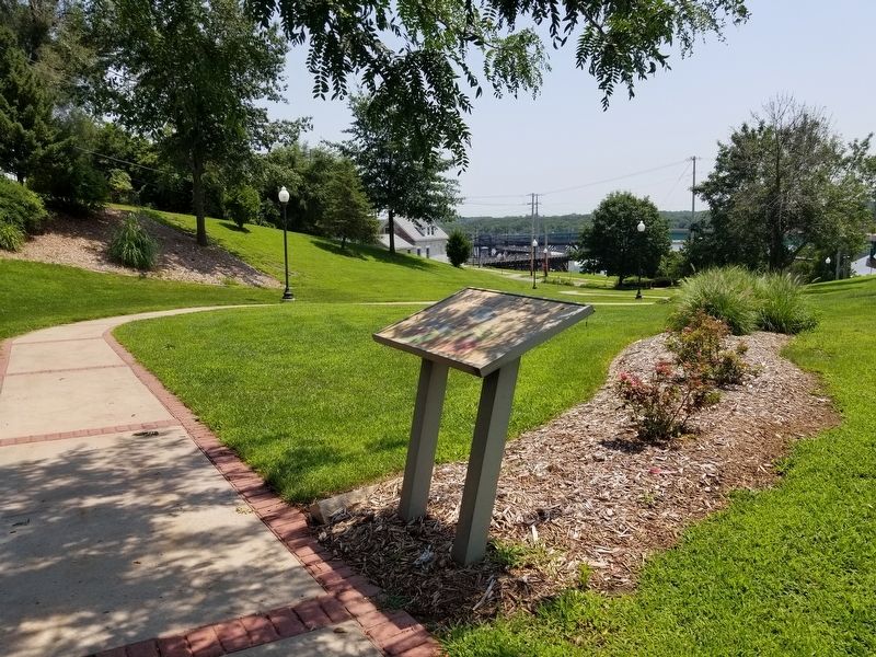
Location. 40° 23.605′ N, 91° 22.837′ W. Marker is in Keokuk, Iowa, in Lee County. Marker is on Main Street (U.S. 136) near North Second Street, on the right. Touch for map. Marker is in this post office area: Keokuk IA 52632, United States of America. Touch for directions.
Other nearby markers. At least 8 other markers are within walking distance of this marker. Mark Twain (within shouting distance of this marker); Welcome to Keokuk (about 500 feet away, measured in a direct line); Water When Needed (about 700 feet away); Samuel Clemens (approx. 0.2 miles away); Annie Wittenmyer (approx. 0.2 miles away); Waterpower - Dream and Reality (approx. 0.2 miles away); Keokuk Union Depot (approx. 0.2 miles away); Samuel Ryan Curtis / Keokuk Soldiers Monument (approx. 0.2 miles away). Touch for a list and map of all markers in Keokuk.
Credits. This page was last revised on July 30, 2021. It was originally submitted on July 30, 2021, by Cajun Scrambler of Assumption, Louisiana. This page has been viewed 137 times since then and 9 times this year. Photos: 1, 2. submitted on July 30, 2021, by Cajun Scrambler of Assumption, Louisiana.

