Near Millican in Brazos County, Texas — The American South (West South Central)
William Templeton Millican
Photographed by Brian Anderson, August 8, 2021
1. William Templeton Millican Marker
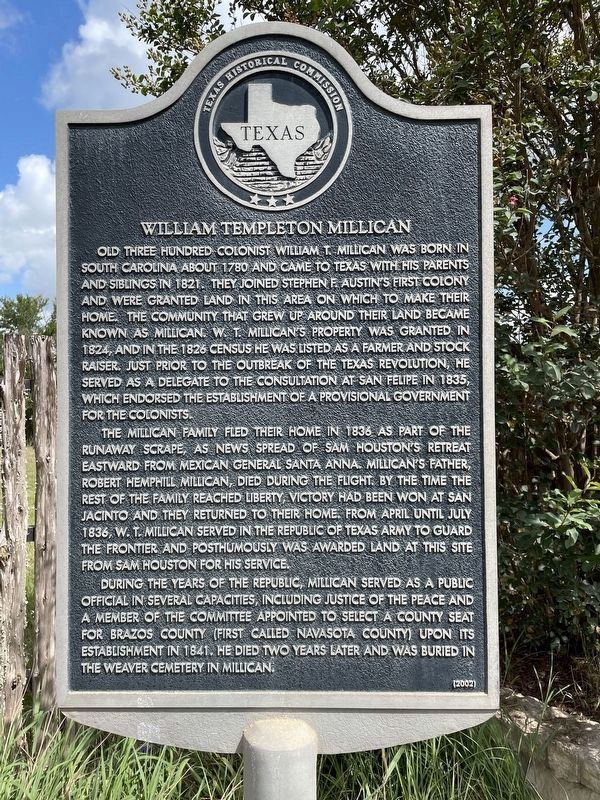
Old Three Hundred Colonist William T. Millican was born in South Carolina about 1780 and came to Texas with his parents and siblings in 1821. They joined Stephen F. Austin's first colony and were granted land in this area on which to make their home. The community that grew up around their land became known as Millican. W. T. Millican's property was granted in 1824, and in the 1826 census he was listed as a farmer and stock raiser. Just prior to the outbreak of the Texas Revolution, he served as a delegate to the consultation at San Felipe in 1835, which endorsed the establishment of a provisional government for the colonists.
The Millican family fled their home in 1836 as part of the Runaway Scrape, as news spread of Sam Houston's retreat eastward from Mexican general Santa Anna. Millican's father, Robert Hemphill Millican, died during the flight. By the time the rest of the family reached Liberty, victory had been won at San Jacinto and they returned to their home. From April until July 1836, W. T. Millican served in the Republic of Texas Army to guard the frontier and posthumously was awarded land at this site from
this page online
During the years of the Republic, Millican served as a public official in several capacities, including Justice of the Peace and a member of the committee appointed to select a county seat for Brazos County (first called Navasota County) upon its establishment in 1841. He died two years later and was buried in the Weaver Cemetery in Millican.
Erected 2002 by Texas Historical Commission. (Marker Number 12753.)
Topics. This historical marker is listed in these topic lists: Settlements & Settlers • War, Texas Independence.
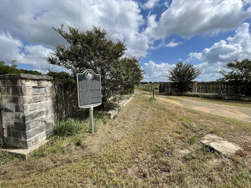
Location. 30° 27.865′ N, 96° 15.641′ W. Marker is near Millican, Texas, in Brazos County. It is on High Prairie Road 1.6 miles west of Wellborn Road (Farm to Market Road 2154), on the right when traveling west. Touch for map. Marker is in this post office area: Millican TX 77866, United States of America. Touch for directions.

Regionally, this marker is in the Prairies & Lakes Region. It is also in the American South. Globally, it is in North America, a Gulf of Mexico state, the Western Hemisphere, the Western World,
Photographed by Brian Anderson, August 8, 2021
2. William Templeton Millican Marker
Other nearby markers. At least 8 other markers are within 10 miles of this marker, measured as the crow flies: Millican, C.S.A. (approx. 3.3 miles away); Millican Massacre (approx. 3.4 miles away); Wellborn Cemetery (approx. 5.3 miles away); Rock Prairie School and Church (approx. 8.4 miles away); A & M College Consolidated Rural School (approx. 9½ miles away); The Luke Patranella Memorial Center (approx. 10.1 miles away); Shiloh Community (approx. 10.1 miles away); College Station Cemetery (approx. 10.1 miles away).
Also see . . . William Templeton Millican - The Handbook of Texas Online. Texas State Historical Association (TSHA) (Submitted on August 9, 2021, by Brian Anderson of New Albany, Ohio.)
Credits. This page was last revised on August 9, 2021. It was originally submitted on August 9, 2021, by Brian Anderson of New Albany, Ohio. This page has been viewed 728 times since then and 63 times this year. Photos: 1, 2. submitted on August 9, 2021, by Brian Anderson of New Albany, Ohio.
