Near Olney in Montgomery County, Maryland — The American Northeast (Mid-Atlantic)
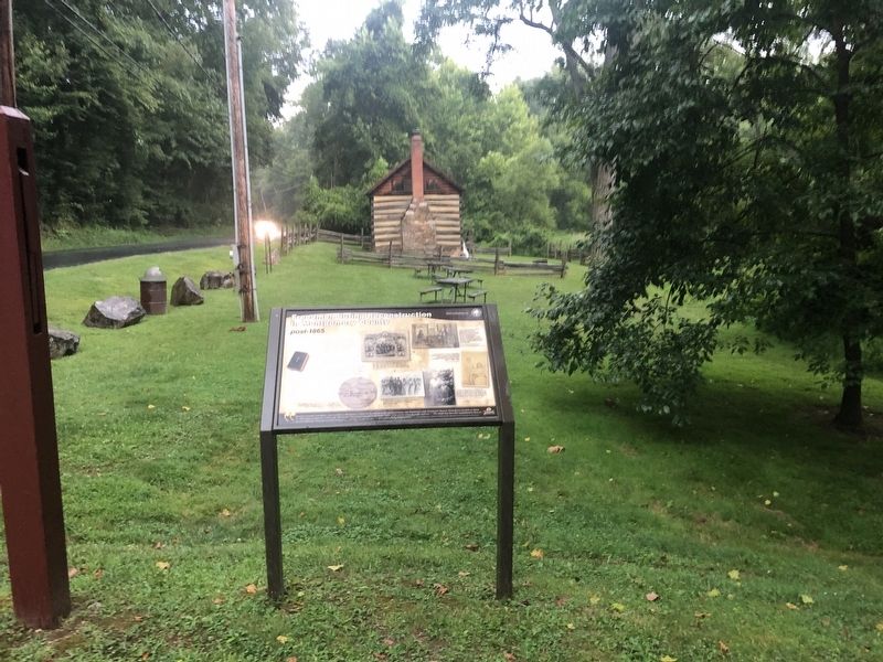
Freedmen during Reconstruction in Montgomery County
post-1865

Photographed By Devry Becker Jones (CC0), August 10, 2021
1. Freedmen during Reconstruction in Montgomery County Marker
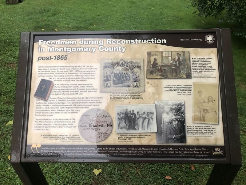
With the shackles of slavery removed following the end of the Civil War, freed blacks in Montgomery County made strides to achieve successful lives for their families. During Reconstruction (1865 - 1877), African Americans established churches, created schools and formed social organizations and clubs that nourished their fledgling communities. With wages earned earned from their labor, African Americans invested in homes, farms and businesses to sustain these new networks.
At the heart of any freedmen settlement was the church. In Montgomery County, African American churches were predominantly Protestant denominations, particularly Methodist and Baptist, and there was at least one Catholic Church located in Mt. Zion.
Growing African American communities devoted funds toward the creation of schools for its children. Initial classrooms were held in local churches and community local churches and community lodges. Public schools for African American churches were not funded in Montgomery County until 1872, at which time each electoral district was allotted one public facility. Regardless of property taxes to fund operations, African Americans found their county schools deficient, with outdated and cast-off textbooks from the white schools.
Despite achievements accomplished after the Civil War, African Americans still confronted racism and increased segregation in Maryland. Many whites watched the growth of the freedmen community with contempt and fear.
"Hostilities towards local blacks were recorded in Montgomery County by the Bureau of Refugees, Freedmen, and Abandoned Lands (Freedman's Bureau). Philip Brown recalled on March 22, 1866 being assaulted by a white man. Brown was "shot and wounded in the head....while riding quietly riding along the public highway…" This attack may have also exacerbated by Brown's wartime affiliation. When he was shot, he heard his assailant's companion say, "… he's nothing but a Union Soldier."
[Captions:]
This 1878 Harper's Weekly image depicts several significant changes during Reconstruction: increased literacy among former slaves, involvement in local governmental affairs, and the ability to acquire material goods through wages earned on the open market.
The portrait of these unidentified children with an open book illustrated new educational opportunities available for African Americans after 1865. c. 1865 - 1870.
"The Result of the 15th Amendment and the First Vote." With the 1870 ratification of the 15th Amendment to the U.S. Constitution, African American men gained the right to vote.
1879 Hopkins map of Oakley

Photographed By Devry Becker Jones (CC0), August 10, 2021
2. Freedmen during Reconstruction in Montgomery County Marker
Illustration showing an African American soldier at his wedding in Vicksburg, Mississippi, 1866.
Prior to Maryland's abolition of slavery in 1864, slave marriages were illegal. Former slave Frank Dorsey, of Montgomery County, took pride in his wedding vows to his bride in 1893.
Erected by Montgomery Parks; Maryland Heritage Area Authority.
Topics. This historical marker is listed in these topic lists: African Americans • Churches & Religion • Education • Settlements & Settlers. A significant historical date for this entry is March 22, 1866.
Location. 39° 10.831′ N, 77° 4.352′ W. Marker is near Olney, Maryland, in Montgomery County. Marker is on Brookeville Road, 0.2 miles east of Grayheaven Manor Road, on the right when traveling east. Touch for map. Marker is at or near this postal address: 3610 Brookeville Rd, Olney MD 20832, United States of America. Touch for directions.
Other nearby markers. At least 8 other markers are within walking distance of this marker. Oakley Cabin (about 600 feet away, measured in a direct line); Newlin’s Mill (approx. 0.6 miles away); Valley Mill House (approx. 0.6 miles away); The Moore Cottage (approx. 0.7 miles away); Murphy House (approx. 0.7 miles away); Margaret Brooke House (approx. 0.7 miles away); Brookeville (approx. ¾ mile away); August 26, 1814 (approx. ¾ mile away).
Credits. This page was last revised on August 10, 2021. It was originally submitted on August 10, 2021, by Devry Becker Jones of Washington, District of Columbia. This page has been viewed 176 times since then and 24 times this year. Photos: 1, 2. submitted on August 10, 2021, by Devry Becker Jones of Washington, District of Columbia.