College Park in Prince George's County, Maryland — The American Northeast (Mid-Atlantic)
It's A Bird, A Plane, An Airport?!
College Park Airport, College Park, MD
Throughout the early 20th century, numerous aviation experiments and innovations occurred at College Park by start-up businesses as well as various governmental agencies. The field took on the nickname—Field of Firsts due to significant aviation firsts that happened here.
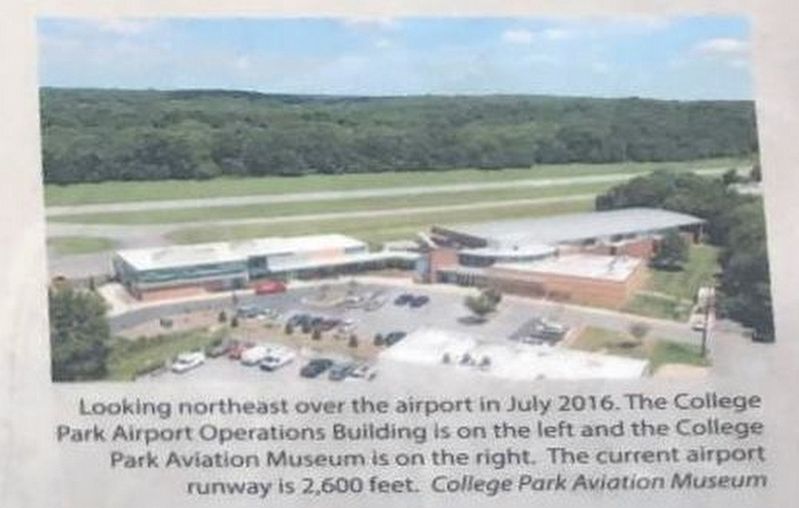
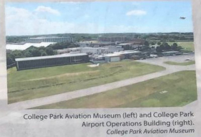
From where you stand, your view includes two large buildings: the College Park Aviation Museum and the College Park Airport Operations building. Visit the museum to discover stories about this historic airfield and the people connected to it, participate in exciting programs, and experience new exhibits. Enjoy your lunch or simply take a break from your ride on the airport observation deck or picnic tables nearby.
Look further down the field and there is an airplane hangar (it has a rounded roof). This is the historic airmail hangar dating to 1919. Keep riding or walking to get more information and find more panels like this one at the far end of the field!
Erected by Maryland Heritage Areas Authority.
Topics. This historical marker is listed in this topic list: Air & Space.
Location. 38° 58.699′ N, 76° 55.15′ W. Marker is in College Park, Maryland, in Prince George's County. Marker can be reached from Northeast Branch Trail. On the NE Branch Trail of the Anacostia Tributary Trail System, near the southern end of the airport runway. Touch for map. Marker is in this post office area: College Park MD 20740, United States of America. Touch for directions.
Other nearby markers. At least 8 other markers are within walking distance of this marker. College Park Airport (approx. ¼ mile away); a different marker also named College Park Airport (approx. 0.3 miles away); Arthur "Al" Welsh, 1881-1912: Pioneer Aviator (approx. 0.3 miles away); Michael Singer (approx. 0.4 miles away); Flying the Mail (approx. 0.4 miles away); America's Military Takes Flight (approx. half a mile away); a different marker also named College Park Airport (approx. half a mile away); Patrick Zentz (approx. half a mile away). Touch for a list and map of all markers in College Park.
Photographed By Ray Gurganus
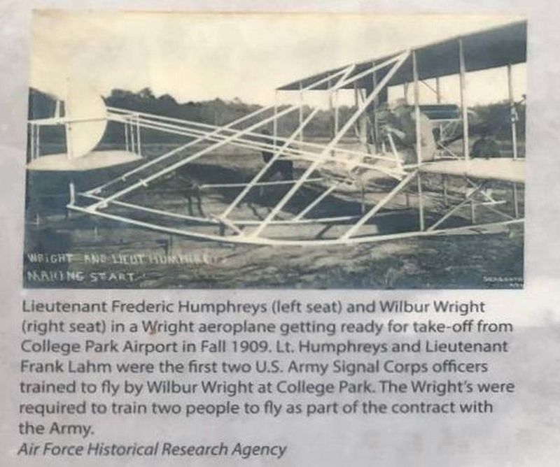
3. Wright and Lieut Humphreys Making Start
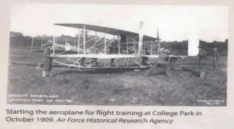
Lieutenant Frederic Humphreys (left seat) and Wilbur Wright (right seat) in a Wright aeroplane getting ready for take-off from College Park Airport in Fall 1909. Lt. Humphreys and Lieutenant Frank Lahm were the first two U. S. Army Signal Corps officers trained by Wilbur Wright at College Park. The Wright's were required to train two people to fly as part of the contract with the Army.
Air Force Historical Research Agency
Photographed By Ray Gurganus
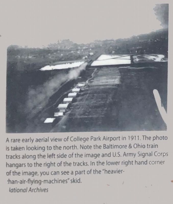
4. Aerial view of College Park Airport
A rare early aerial view of College Park Airport in 1911. The photo is taken looking to the north. Note the Baltimore & Ohio train tracks along the left side of the image and U. S. Army Signal Corps hangars to the right of the tracks. In the lower right hand corner of the image, you can see a part of the "heavier-than-air-flying machines" skid.
National Archives.
Credits. This page was last revised on August 19, 2021. It was originally submitted on August 15, 2021, by Ray Gurganus of Washington, District of Columbia. This page has been viewed 167 times since then and 12 times this year. Photos: 1, 2, 3, 4, 5, 6. submitted on August 15, 2021, by Ray Gurganus of Washington, District of Columbia. • Bill Pfingsten was the editor who published this page.
