Near Ivy in Albemarle County, Virginia — The American South (Mid-Atlantic)
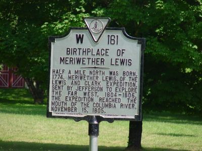
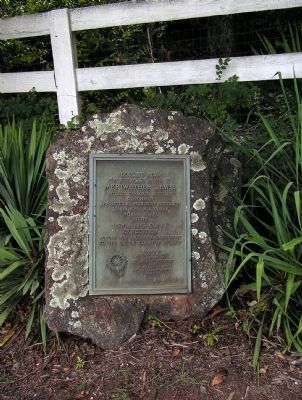
Birthplace of Meriwether Lewis
Erected 1942 by Virginia Conservation Commission. (Marker Number W-161.)
Topics and series. This historical marker is listed in this topic list: Settlements & Settlers. In addition, it is included in the Lewis & Clark Expedition, and the Virginia Department of Historic Resources (DHR) series lists. A significant historical date for this entry is November 15, 1805.
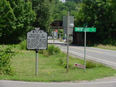
Location. 38° 3.435′ N, 78° 35.847′ W. Marker is near Ivy, Virginia, in Albemarle County. Marker is at the intersection of Ivy Road (U.S. 250) and Owensville Road (County Route 678) on Ivy Road. Touch for map. Marker is in this post office area: Ivy VA 22945, United States of America. Touch for directions.
Other nearby markers. At least 8 other markers are within 5 miles of this marker, measured as the crow flies. Jackson's Valley Campaign (approx. 2.6 miles away); Revolutionary Soldiers Graves (approx. 4˝ miles away); Union Occupation of Charlottesville (approx. 4˝ miles away); Albemarle Barracks Burial Site (approx. 4.6 miles away); Convention Army The Barracks (approx. 4.7 miles away); Charlottesville (approx. 4.8 miles away); Technical Sergeant Frank D. Peregory (approx. 5.1 miles away); Dr. W. W. Yen (approx. 5.1 miles away).
Also see . . . A “Voyage of Discovery”: Walking in the Footsteps of Meriwether Lewis. Article by By John Mathis in Albemarle Family. (Submitted on July 21, 2007.)
Credits. This page was last revised on February 2, 2023. It was originally submitted on July 21, 2007, by J. J. Prats of Powell, Ohio. This page has been viewed 9,781 times since then and 115 times this year. Photos: 1, 2. submitted on July 21, 2007, by J. J. Prats of Powell, Ohio. 3. submitted on September 5, 2009, by PaulwC3 of Northern, Virginia.


