East Bloomington in Hennepin County, Minnesota — The American Midwest (Upper Plains)
A Bridge to the Past
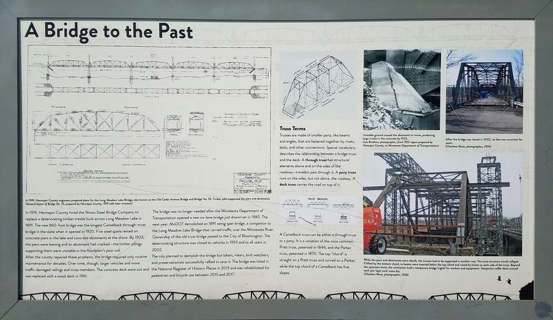
After the county repaired these problems, the bridge required only routine maintenance for decades. Over time, though, larger vehicles and more traffic damaged railings and truss members. The concrete deck wore out and was replaced with a wood deck in 1961.
The bridge was no longer needed after the Minnesota Department of Transportation opened a new six-land bridge just downriver in 1980. The next year, MnDOT demolished an 1981 swing span bridge, a companion to the Long Meadow Lake Bridge that carried traffic over the Minnesota River. Ownership of the old truss bridge passed to the City of Bloomington. The deteriorating structure was closed to vehicles in 1993 and to all users in 2002.
The city planned to demolish the bridge but bikers, hikers, bird-watchers, and preservationists successfully rallied to save it. The bridge was listed in the National Register of Historic Places in 2013 and was rehabilitated for pedestrian and bicycle use between 2015 and 2017.
Truss Terms
Trusses are made of smaller parts, like beams and angles, that are fastened together by rivets, bolts, and other connections. Special vocabulary describes the relationship between a bridge truss and the deck. A through truss has structural elements above and on the sides of the roadway—travelers pass through it. A pony truss runs on the sides, but not above, the roadway. A deck truss carries the road on top of it.
A Camelback truss can be either a through truss or a pony. It is a variation of the once common Pratt truss, patented in 1844, and the Parker truss, patented in 1870. The top "chord" is straight on a Pratt truss and curved on a Parker, while the top chord of a Camelback has five slopes.
Photo Caption: In 1919, Hennepin County engineers prepared plans for the Long Meadow Lake Bridge, also known as the Old Cedar Avenue Bridge and Bridge No. 55. Timber piles supported the piers and abutments.
(General layout of Bridge No. 55, prepared by Hennepin County, 1919 with later revisions)
Caption: Unstable ground caused the abutment to move, producing large cracks in the concrete by 1923.
(Lee Brothers, photographer; from 1923 report prepared by Hennepin County, at Minnesota Department of Transportation)
Caption: After the bridge was closed in 2002, its fate was uncertain for years.
(Charlene Roise, photographer, 2014)
Caption: While the piers and abutments were rebuilt, the trusses had to be supported in another way. The truss structure would collapse if lifted by the bottom chord, so beams were inserted below the top chord and raised by hoists on each side of the truss. Beyond the upstream hoise, the contractor built a temporary bridge (right) for workers and equipment. Temporary coffer dams around each pier kept work areas dry.
(Charlene Roise, photographer, 2016)
Topics. This historical marker is listed in this topic list: Bridges & Viaducts. A significant historical year for this entry is 1920.
Location. 44° 49.84′ N, 93° 14.621′ W. Marker is in Bloomington, Minnesota, in Hennepin County. It is in East Bloomington. Marker can be reached from Old Cedar Avenue South. Touch for map. Marker is in this post office area: Minneapolis MN 55425, United States of America. Touch for directions.
Other nearby markers. At least 8 other markers are within 2 miles of this marker, measured as the crow flies. Rodney J. Putz (approx. 1½ miles away); Pond Dakota Mission Park (approx. 1.8 miles away); 1856 Federal Style Gideon H. Pond House (approx. 1.8 miles away); Gideon and Agnes Pond House (approx. 1.8 miles away); Dakota Missions on the Frontier (approx. 1.8 miles away); Missionaries to the Dakota (approx. 1.8 miles away); Pond Family Heritage Timeline (approx. 1.8 miles away); Samuel W. and Gideon H. Pond (approx. 1.8 miles away). Touch for a list and map of all markers in Bloomington.
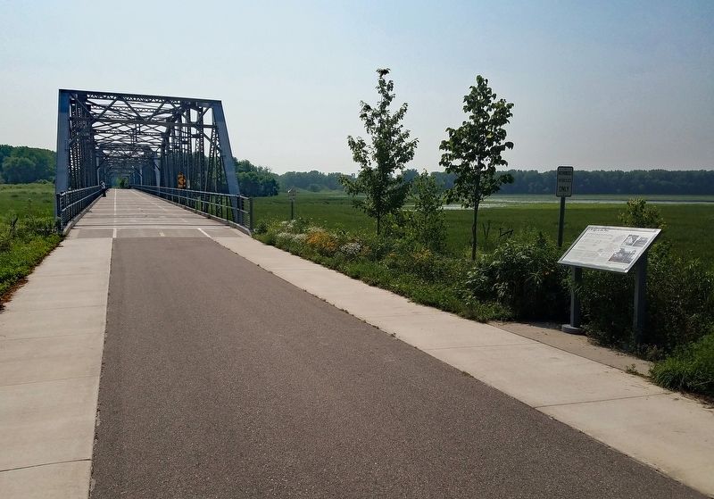
More about this marker. Located in the Minnesota Valley National Wildlife Refuge, on the Old Cedar Avenue Trail, just before the bridge. It is a short, paved walk from the trailhead parking lot.
Credits. This page was last revised on February 12, 2023. It was originally submitted on September 3, 2021, by McGhiever of Minneapolis, Minnesota. This page has been viewed 160 times since then and 21 times this year. Photos: 1, 2. submitted on September 3, 2021, by McGhiever of Minneapolis, Minnesota. • Mark Hilton was the editor who published this page.

