Foggy Bottom in Northwest Washington in Washington, District of Columbia — The American Northeast (Mid-Atlantic)
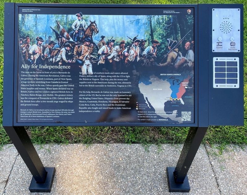
Ally for Independence
National Mall and Memorial Parks
— Bernardo de Gálvez —
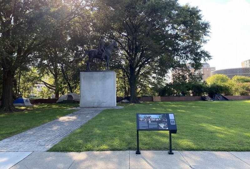
The man on the horse in front of you is Bernardo de Gálvez. During the American Revolution, Gálvez was the governor of Spanish Louisiana, part of New Spain, a huge territory stretching from Canada to Central America. Early in the war, Gálvez quietly gave the United States supplies and money. When Spain declared war on Britain, Gálvez and his soldiers captured British forts in Natchez, Baton Rouge, and Mobile. His greatest victory was the conquest of Pensacola in 1781. Gálvez defeated the British force after a two-month siege waged by ships and ground troops.
Spain's control of southern lands and waters allowed France, military ally of Spain, along with the U.S. to fight the British in Virginia. This help, plus the money and supplies sent to the Americans during the war, ultimately led to the British surrender in Yorktown, Virginia in 1781.
For his help, Bernardo de Gálvez was made an honorary citizen of the US. But he was not the only Spaniard to aid the fledging United States. Hispanics from present day Mexico, Guatemala, Honduras, Nicaragua, El Salvador, Costa Rica, Cuba, Puerto Rico, and the Dominican Republic also fought and raised funds to make American independence a reality.
[Captions:]
Bernardo de Gálvez (on horseback) and his troops marched 100 miles through swamps to attack British forts. Assembled in New Orleans, the army was made up of Spaniards, American and French militiamen, free blacks, and Native Americans, all of them inhabitants of Spanish Louisiana.
To learn more about the people and events behind Spain's support of US independence, visit unveilingmemories.com or scan the code to the right.
Erected 2021 by National Park Service, U.S. Department of the Interior.
Topics. This historical marker is listed in this topic list: War, US Revolutionary. A significant historical year for this entry is 1781.
Location. 38° 53.74′ N, 77° 2.906′ W. Marker is in Northwest Washington in Washington, District of Columbia. It is in Foggy Bottom. Marker is at the intersection of Virginia Avenue Northwest and D Street Northwest, on the right when traveling east on Virginia Avenue Northwest. Marker is located directly in front of the Bernardo De Gálvez memorial. Touch for map. Marker is at or near this postal address: 5307 E St Expy, Washington DC 20052, United States of America. Touch for directions.
Other nearby markers. At least 8 other markers are within walking distance of this marker. Bernardo de Gálvez Memorial (here, next to this marker); Department of State (about 600 feet away, measured in a direct line); The George Washington University (about 600 feet away); Anniversary Park (about 600 feet away); Radford House (about
700 feet away); Remembering Dr. Dorothy Height (approx. 0.2 miles away); U.S. Naval Observatory / The Prime Meridian (approx. 0.2 miles away); Benjamin Rush (approx. 0.2 miles away). Touch for a list and map of all markers in Northwest Washington.
More about this marker. An audio box is located adjacent to the exhibit panel which plays a recorded message describing both the exhibit and the Bernardo De Gálvez monument.
Credits. This page was last revised on January 30, 2023. It was originally submitted on September 8, 2021, by Shane Oliver of Richmond, Virginia. This page has been viewed 104 times since then and 10 times this year. Photos: 1, 2. submitted on September 9, 2021, by Shane Oliver of Richmond, Virginia. • Devry Becker Jones was the editor who published this page.

