Pioneer Square in Seattle in King County, Washington — The American West (Northwest)
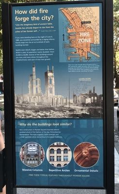
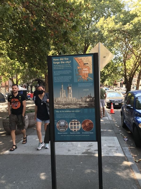
How Did Fire Forge the City?
Photographed by Duane and Tracy Marsteller, August 29, 2021
1. How Did Fire Forge the City? Marker
"Like the imaginary bird of ancient fable, Seattle has already begun to rise from the ashes of her former self … " — Seattle Times, July 2, 1889If you were standing here on the night of June 6, 1889, you would be surrounded by a raging inferno. Flames leapt into the air as hundreds of early buildings burned.
Seattle soon rebuilt, bigger and better than before. Within a year, its population nearly doubled — from 25,000 to 43,000. Several of the buildings around you now, and many others throughout this neighborhood, were part of that new growth.
Why do the buildings look similar?
New construction in Pioneer Square's business district grabbed ahold of the fashion of the day: Richardsonian Romanesque. The style suggests a solid strength and a bold optimism while connecting to European traditions.
Find these typical features throughout Pioneer Square.
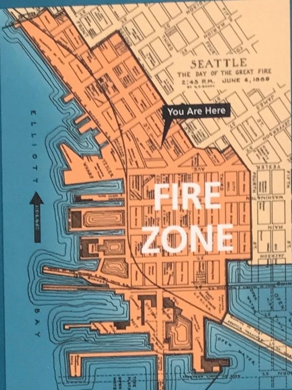
Caption: When fire swept through about 30 square blocks, it left nothing but rubble and ashes. Most of the wooden buildings were destroyed, but the few brick buildings in the business district also crumbled in the withering heat. Within a month, rebuilding had begun.
Topics. This historical marker is listed in these topic lists: Architecture • Disasters. A significant historical date for this entry is June 6, 1889.
Location. 47° 36.142′ N, 122° 20.043′ W. Marker is in Seattle, Washington, in King County. It is in Pioneer Square. It is on 1st Avenue south of Cherry Street, on the right when traveling north. Touch for map. Marker is at or near this postal address: 616 1st Avenue, Seattle WA 98104, United States of America. Touch for directions.

Regionally, this marker is in the Puget Sound Region. It is also on the American Pacific Coast, in the Pacific Northwest, and in the Lewis & Clark Corridor. Globally,
this page online
Other nearby markers. At least 8 other markers are within walking distance of this marker: Site of Yesler’s Pavilion (within shouting distance of this marker); Pioneer Building (within shouting distance of this marker); Pioneer Building, Pergola and Totem Pole (within shouting distance of this marker); Mutual Life Building (within shouting distance of this marker); The Pioneer Square Pergola (within shouting distance of this marker); The Broderick Building (about 300 feet away, measured in a direct line); Merchant’s Cafe (about 300 feet away); What do you need to rush for gold? (about 300 feet away). Touch for a list and map of all markers in Seattle.
Another marker is no longer nearby. First School in Seattle (was about 300 feet away but has been confirmed missing).
Also see . . .
1. The Great Seattle Fire, Part 1. Historylink.org essay by John Caldbick originally posted September 19, 2020. Includes link to the second part of
Photographed by Duane and Tracy Marsteller, August 29, 2021
2. How Did Fire Forge the City? Marker
2. The Great Seattle Fire of 1889. Seattle Municipal Archives webpage with links to various documents related to the fire. (Submitted on September 9, 2021, by Duane and Tracy Marsteller of Murfreesboro, Tennessee.)
Photographed by Duane and Tracy Marsteller, August 29, 2021
3. Marker detail: Map of 1889 Seattle fire
Public domain / Stiched by Joe Mabel
4. Aftermath of The Great Seattle Fire
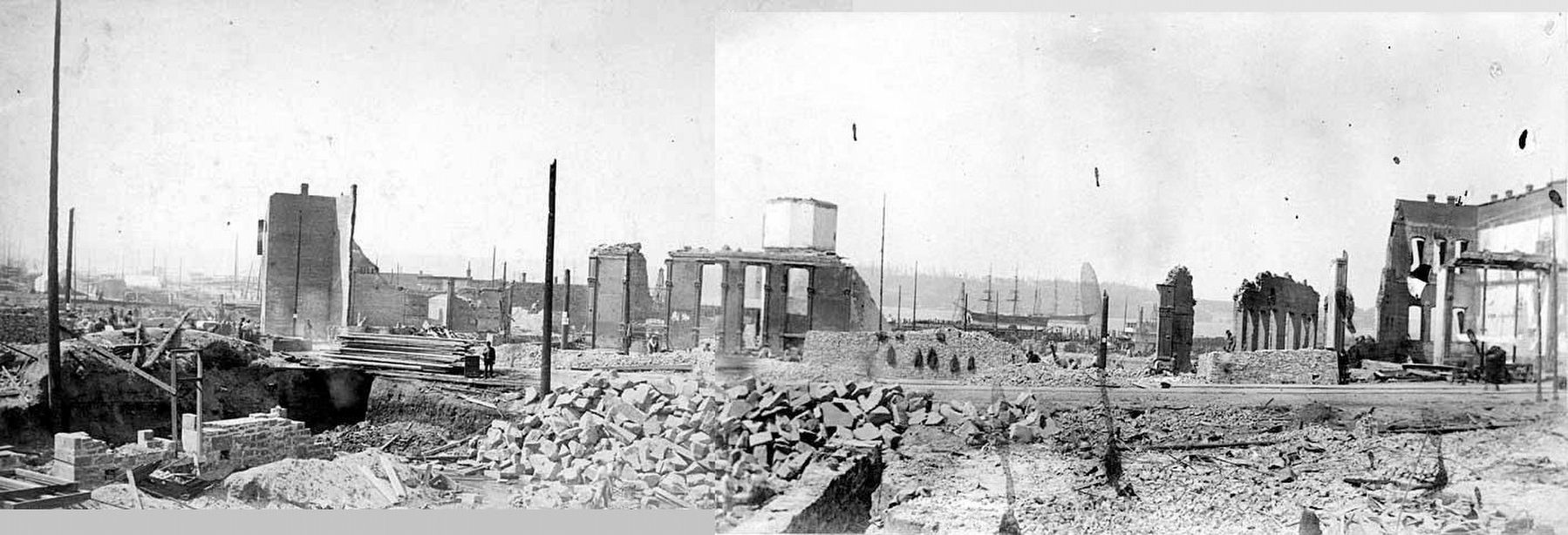
View toward Elliott Bay overlooking the destroyed business district.
Seattle fire album photograph collection, 1889
Archives West website entry: A collection of 21 digitized photographs of the Great Seattle Fire of 1889 and its aftermath, from the University of Washington Libraries, Special Collections.
Click for more information.
Seattle fire album photograph collection, 1889
Archives West website entry: A collection of 21 digitized photographs of the Great Seattle Fire of 1889 and its aftermath, from the University of Washington Libraries, Special Collections.
Click for more information.
Credits. This page was last revised on January 13, 2025. It was originally submitted on September 9, 2021, by Duane and Tracy Marsteller of Murfreesboro, Tennessee. This page has been viewed 1,365 times since then and 89 times this year. Photos: 1, 2, 3, 4. submitted on September 9, 2021, by Duane and Tracy Marsteller of Murfreesboro, Tennessee.
