Near Rices Landing in Greene County, Pennsylvania — The American Northeast (Mid-Atlantic)
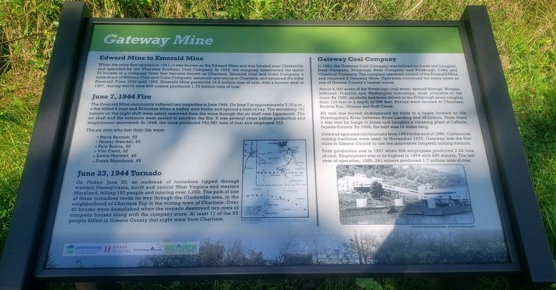
Gateway Mine
Edward Mine to Emerald Mine
When the mine first opened in 1921, it was known as the Edward Mine and was located near Clarksville and operated by the Chartiers Southern Coal Company. In 1923, the company constructed the initial 70 houses in a company town that became known as Chartiers. Emerald Coal and Coke Company, a subsidiary of Hillman Coal and Coke Company, assumed operations at Chartiers, and renamed the mine Emerald. From 1930 until 1962, Emerald Mine produced 19.5 million tons of coal, with a banner year in 1957, during which time 865 miners produced 1.73 million tons of coal.
June 7, 1944 Fire
The Emerald Mine community suffered two tragedies in June 1944. On June 7 at approximately 7:10 p.m., a fire killed 6 men and 30 horses when a trolley wire broke and ignited a bale of hay. The remaining 151 miners on the night shift were safely removed from the mine through the air shaft near Lippencott. The air shaft and the entrance were sealed to smother the fire. It was several years before production and employment recovered. In 1948, the mine produced 743,581 tons of coal and employed 723.
The six men who lost their life were:
• Steve Barnish, 55
• Homer Brendel, 45
• Pete Butina, 50
• Vito Carol, 52
• Lewis Horwait, 49
• Frank Maycheck, 49
June 23, 1944 Tornado
On Friday, June 23, an outbreak of tornadoes ripped through western Pennsylvania, north and central West Virginia and western Maryland, killing 153 people and injuring over 1,000. The path of one of these tornadoes made its way through the Clarksville area, in the neighborhood of Chartiers Top in the mining town of Chartiers. Over 40 houses were demolished when the tornado destroyed two rows of company houses along with the company store. At least 11 of the 23 people killed in Greene County that night were from Chartiers.
Gateway Coal Company
In 1963, the Gateway Coal Company was formed by Jones and Laughlin Steel Company, Pittsburgh Steel Company and Pittsburgh Coke and Chemical Company. The company assumed control of the Emerald Mine and renamed it Gateway Mine. Operation continued for many years as one of Greene County's largest mines.
About 8,000 acres of the Pittsburgh coal seam, spread through Morgan, Jefferson, Franklin and Washington townships, were available to the mine. By 1980, six shafts had been driven to the Pittsburgh seam ranging from 133 feet to a depth of 586 feet. Portals were located at Chartiers, Browns Run, Grimes and Ruff Creek.
All coal was moved underground by belts to a tipple located on the Monongahela River between Rices Landing and Millsboro. From there it was sent by barge to Jones and Laughlin's cleaning plant at LaBelle, Fayette County. By 1989, the belt was 16 miles long.
Gateway operated continuously from 1963 to the end of 1989. Continuous mining machines were used. In November 1970, Gateway was the first mine in Greene County to use the innovative longwall mining method.
Peak production was in 1967 when 556 employees produced 2.24 tons of coal. Employment was at its highest in 1979 with 685 miners. The last year of operation, 1989, 241 miners produced 1.7 million tons of coal.
Captions: View from Monongahela River of Gateway Mine tipple.
Erected 2020 by Pennsylvania Department of Conservation and Natural Resources, Rivers of Steel, Greene County Museum, Greene County Tourist Promotion Agency.
Topics. This historical marker is listed in these topic lists: Disasters • Industry & Commerce. A significant historical date for this entry is June 7, 1944.
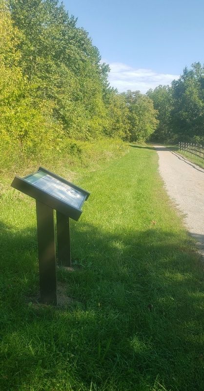
Location. 39° 57.235′ N, 80° 0.423′ W. Marker is near Rices Landing, Pennsylvania, in Greene County. Marker can be reached from Main Street north of Rices Landing Road (County Route 1010), on the left when traveling north. Marker is located on the Greene River Trail north of the Rices Landing Trailhead parking lot. The parking lot is located on Main Street across from Rices Landing United Methodist Church. Touch for map. Marker is at or near this postal address: 125 Main Street, Rices Landing PA 15357, United States of America. Touch for directions.
Other nearby markers. At least 8 other markers are within walking distance of this marker. Dilworth Mine (about 500 feet away, measured in a direct line); Coke & Coke Ovens (approx. 0.2 miles away); Railroad (approx. ¼ mile away); Rices Landing (approx. ¼ mile away); Monongahela River (approx. 0.3 miles away); Rice's Landing Jail (approx. half a mile away); Isaac Hewitt Pottery (approx. half a mile away); Foundry (approx. 0.6 miles away). Touch for a list and map of all markers in Rices Landing.
Credits. This page was last revised on September 14, 2021. It was originally submitted on September 12, 2021, by Bradley Owen of Morgantown, West Virginia. This page has been viewed 594 times since then and 111 times this year. Photos: 1, 2. submitted on September 13, 2021, by Bradley Owen of Morgantown, West Virginia. • Bill Pfingsten was the editor who published this page.

