Grand Island in Hall County, Nebraska — The American Midwest (Upper Plains)
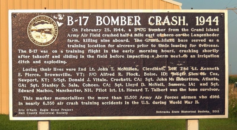
B-17 Bomber Crash, 1944
On February 25, 1944, a B-17G bomber from the Grand Island Army Air Field crashed half a mile east of here on the Langenheder farm, killing nine aboard. The Grand Island base served as a training location for aircrews prior to their leaving for overseas. The B-17 was on a training flight in the early morning hours, crashing shortly after takeoff and sliding in the field before impacting a berm next to an irrigation ditch and exploding.
Losing their lives were 2nd Lt. John T. McMillen, Cleveland, OH; 2nd Lt. Kenneth E. Pierce, Brownsville, VT; F/O Alfred R. Flock, Boise, ID; S/Sgt. Glen M. Cox, Newport, KY; S/Sgt. Donald J. Vitale, Crockett, CA; Sgt. John M. Robertson, Atlanta, GA; Sgt. Stanley S. Sala, Cohoes, CA; Sgt. Lloyd D. McNeil, Somers, IA; and Sgt. Edward Machos, Manchester, NH. Pilot 1st Lt. Howard T. Talbert was the lone survivor.
This marker memorializes the more than 15,500 Army Air Forces airmen who died in nearly 6,350 air crash training accidents in the U.S. during World War II.
Erected 2012 by Eric O'Neill, Eagle Scout Project; Hall County Historical Society; and Nebraska State Historical Society. (Marker Number 163.)
Topics and series. This memorial is listed in these topic lists: Air & Space • Disasters • Fraternal or Sororal Organizations • War, World II. In addition, it is included in the Nebraska State Historical Society series list. A significant historical date for this entry is February 25, 1944.
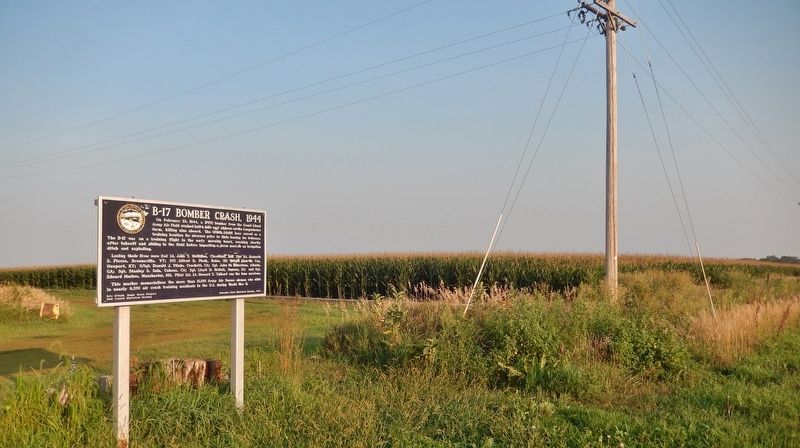
Location. 40° 59.808′ N, 98° 20.384′ W. Marker is on Grand Island, Nebraska, in Hall County. Memorial is on Saint Paul Road, half a mile north of East White Cloud Road (County Road 41), on the right when traveling north. Touch for map. Marker is at or near this postal address: 5537 Saint Paul Road, Grand Island NE 68801, United States of America. Touch for directions.
Other nearby markers. At least 8 other markers are within 4 miles of this marker, measured as the crow flies. Hall County Poor Farm Cemetery (approx. 1.9 miles away); Arrasmith Field (approx. 2.2 miles away); Central Nebraska Regional Airport (approx. 2.2 miles away); B-29 Superfortress / 6th Bomb Group / Tinian Island (approx. 2.2 miles away); 6th Bomb Group (approx. 3.6 miles away); Vietnam War Memorial (approx. 3.6 miles away); Hall County Veterans Memorial Park (approx. 3.6 miles away); Grand Island Veterans Home (approx. 3.8 miles away). Touch for a list and map of all markers in Grand Island.
Also see . . . B-17 "Flying Fortress" Bomber Crash
. (Submitted on September 12, 2021, by Cosmos Mariner of Cape Canaveral, Florida.)
Credits. This page was last revised on September 12, 2021. It was originally submitted on September 12, 2021, by Cosmos Mariner of Cape Canaveral, Florida. This page has been viewed 354 times since then and 74 times this year. Photos: 1, 2. submitted on September 12, 2021, by Cosmos Mariner of Cape Canaveral, Florida.

