Los Cerrillos in Santa Fe County, New Mexico — The American Mountains (Southwest)
Cerrillos through the Years
Cerrillos through the Years
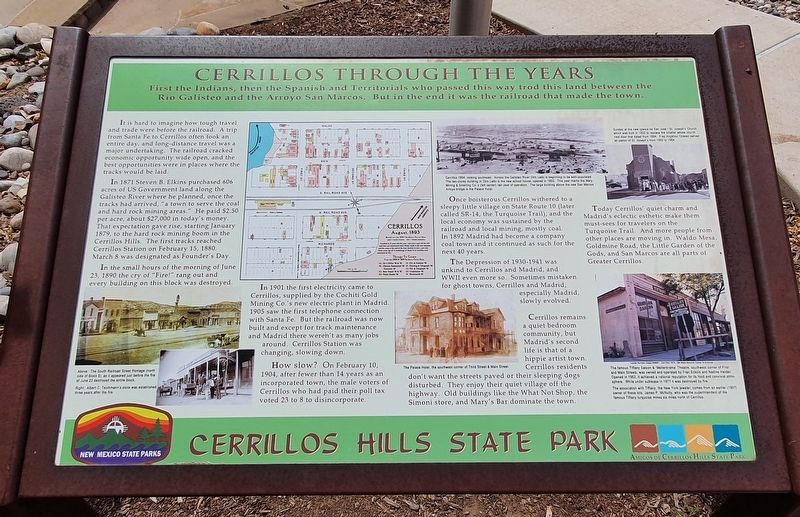
First the Indians, then the Spanish and Territorials who passed this way trod this land between Rio Galisteo and the Arroyo San Marcos. But in the end it was the railroad that made the town.
It is hard to imagine how tough travel and trade were before the railroad. A trip from Santa Fe to Cerrillos often took an entire day, and long-distance travel was a major undertaking. The railroad cracked economic opportunity wide open, and the best opportunities were in places where the tracks would be laid.
In 1871 Steven B. Elkins purchased 606 acres of US Government land along the Galisteo River where he planned, once the tracks had arrived, “a town to serve the coal and hard rock mining areas." He paid $2.50 per acre, about $27,000 in today's money. That expectation gave rise, starting January 1879, to the hard rock mining boom in the Cerrillos Hills. The first tracks reached Cerrillos Station on February 15, 1880. March 8 was designated as Founder's Day.
In the small hours of the morning of June 23, 1890 the cry of "Fire!" rang out and every building on this block was destroyed.
In 1901 the first electricity came to Cerrillos, supplied by the Cochiti Gold Mining Co.'s new electric plant in Madrid. 1905 saw the first telephone connection with Santa Fe. But the railroad was now built and except for track maintenance and Madrid there weren't as many jobs around. Cerrillos Station was changing, slowing down.
How slow? On February 10, 1904, after fewer than 14 years as an incorporated town, the male voters of Cerrillos who had paid their poll tax voted 23 to 8 to disincorporate.
Once boisterous Cerrillos withered to a sleepy little village on State Route 10 (later called SR-14, the Turquoise Trail), and the local economy was sustained by the railroad and local mining, mostly coal. In 1892 Madrid had become a company coal town and it continued as such for the next 40 years.
The Depression of 1930-1941 was unkind to Cerrillos and Madrid, and WWII even more so. Sometimes mistaken for ghost towns, Cerrillos and Madrid, especially Madrid, slowly evolved.
Cerrillos remains a quiet bedroom community, but Madrid's second life is that of a hippie artist town. Cerrillos residents don’t want the streets paved or their sleeping dogs disturbed. They enjoy their quiet village off the highway. Old buildings like the What Not Shop, the Simoni Store, and Mary’s Bar dominate the town.
Today Cerrillos’ quiet charm, and Madrid’s eclectic esthetic make them must-sees for travelers on the Turquoise Trail. And more people from other places are moving in. Waldo Mesa, Goldmine Road, the Little Garden of the Gods, and San Marcos are all parts of Greater Cerrillos.
Captions:
Cerrillos 1904, looking southeast. Across the Galisteo River Otro Lado is beginning to be well-populated. The two-storey building in Otro Lado is the new school house, opened in 1892. This year marks the Mary Mining & Smelting Co.'s (left center) last year of operation. The large building above the new San Marcos Arroyo bridge is the Palace Hotel.
Sunday at the new Iglesia de San José/St. Joseph’s Church, which was built in 1922 to replace the smaller adobe church next door that dated from 1884. Fray Angelico Chávez served as pastor of St. Joseph's from 1962 to 1964.
Above: The South Railroad Street frontage (north side of Block 9), as it appeared just before the fire of June 23 destroyed the entire block.
Right: Albert C. Teichmann’s store was established three years after the fire.
The Palace Hotel, the southwest corner of Third Street & Main Street.
The famous Tiffany Saloon & 'Mellerdrama’ Theatre, southwest corner of First and Main Streets, was owned and operated by Fran Eckols and Nadine Helden. Opened in 1962, it achieved a national reputation for its food and convivial atmosphere. While under sublease in 1977 it was destroyed by fire.
The association with Tiffany, the New York jeweler, comes from an earlier (1907) owner of these lots, James P. McNulty, who was the superintendent of the famous Tiffany turquoise mines six miles north of Cerrillos.
Erected by New Mexico State Parks and Amigos de Cerrillos Hills State Park.
Topics. This historical marker is listed in these topic lists: Industry & Commerce • Settlements & Settlers. A significant historical month for this entry is January 1879.
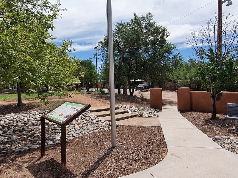
Location. 35° 26.232′ N, 106° 7.518′ W. Marker is in Los Cerrillos, New Mexico, in Santa Fe County. Marker is on Main Street west of 1st Street, on the right when traveling west. Touch for map. Marker is in this post office area: Cerrillos NM 87010, United States of America. Touch for directions.
Other nearby markers. At least 8 other markers are within walking distance of this marker. Welcome to Cerrillos (within shouting distance of this marker); The Cerrillos Bar (within shouting distance of this marker); Briggs Building (within shouting distance of this marker); DeLallo-Simoni-Torres Building (within shouting distance of this marker); The Simoni Store (within shouting distance of this marker); R. Granito's General Store (within shouting distance of this marker); C. Rael's Market (about 300 feet away, measured in a direct line); The Joe M. Granito Block (about 300 feet away). Touch for a list and map of all markers in Los Cerrillos.
Credits. This page was last revised on September 14, 2021. It was originally submitted on September 14, 2021, by J. Makali Bruton of Accra, Ghana. This page has been viewed 153 times since then and 29 times this year. Photos: 1, 2, 3. submitted on September 14, 2021, by J. Makali Bruton of Accra, Ghana.


