Near Wood River in Hall County, Nebraska — The American Midwest (Upper Plains)
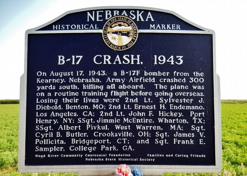
B-17 Crash, 1943
Erected by Wood River Community Centennial Foundation; Families and Caring Friends; and Nebraska State Historical Society. (Marker Number 435.)
Topics and series. This historical marker is listed in these topic lists: Air & Space • Disasters • Patriots & Patriotism • War, World II. In addition, it is included in the Nebraska State Historical Society series list. A significant historical date for this entry is August 17, 1943.
Location. 40° 53.261′ N, 98° 37.475′ W. Marker is near Wood River, Nebraska, in Hall County. Marker is on West Husker Highway, 0.9 miles west of State Highway 11, on the left when traveling west. Marker is located in a pull-out on the south side of the highway. Touch for map. Marker is in this post office area: Wood River NE 68883, United States of America. Touch for directions.
Other nearby markers. At least 8 other markers are within 12 miles of this marker, measured as the crow flies. Wood River Veterans Memorial (approx. 4.8 miles away); Original Townsite of Wood River (approx. 6 miles away); Cornhusker Army Ammunition Plant (approx. 6.1 miles away); Solon H. Borglum (approx. 9.3 miles away); Meisner Bank Building (approx. 9.4 miles away); Early Shelton Pioneers (approx. 9.4 miles away); Joseph E. Johnson and the Huntsman’s Echo (approx. 9.4 miles away); Martin Brothers Historic Memorial (approx. 11.4 miles away). Touch for a list and map of all markers in Wood River.
Also see . . . Nebraska WWII Fatal Crash Site. An instructor pilot was flying B-17F (43-30542) on a local familiarization flight with a crew based at the Kearney Army Air Field. Eyewitnesses observed the plane flying low and while in a steep bank, which brought the bomber almost perpendicular with the ground, the plane stalled and then crashed in a cornfield killing all eight occupants. Pilot error was listed as the cause of the crash despite at least two eyewitnesses who claimed to have seen one engine on fire. (Submitted on September 17, 2021, by Cosmos Mariner of Cape Canaveral, Florida.)
Credits. This page was last revised on September 17, 2021. It was originally submitted on September 17, 2021, by Cosmos Mariner of Cape Canaveral, Florida. This page has been viewed 319 times since then and 44 times this year. Photos: 1, 2. submitted on September 17, 2021, by Cosmos Mariner of Cape Canaveral, Florida.

