Brownsville in Cameron County, Texas — The American South (West South Central)
Border War / Guerra de fronteras
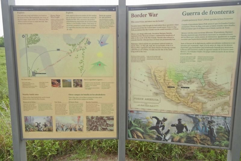
Inscription.
[English]
Who owned Texas, and where was the border?
President James Polk thought he had settled these questions when he announced that the United States would annex Texas in 1845. Polk proclaimed the Rio Grande was the south boundary of Texas.
Mexico saw things differently. President Mariano Paredes maintained that Mexican territory continued for hundreds of miles to the north of the Rio Grande. Paredes also refused to concede that the rebel province of Texas was permanently lost.
Diplomacy failed and the two presidents ordered armies to march. Here, on May 9th, 1846, the second battle of the U.S-Mexican War exploded in the dense thickets bordering a ravine called Resaca de la Palma. At stake was the fate of the lands lying north of the river.
Caption (map): War between Mexico and the United States first erupted here in the valley of the Rio Grande, then spread west to California and south to Mexico City. In the end, the northern half of Mexico became the southwestern third of the United States.
[Espanól]
¿A quién pertenecía Texas? ¿Dónde quedaba la línea fronteriza?
Cuando el presidente James Polk anunció que los Estados Unidos anexarían a Texas en 1845 creía que ya había resuelto estos detalles. Polk proclamó que el río Bravo era el límite sureño de Texas.
México veía las cosas en forma diferente. El presidente Mariano Paredes mantenía que el territorio mexicano se extendía al norte del río Bravo por varios cientos de kilómetros. Igualmente se negaba a aceptar que la provincia rebelde estaba permanentemente perdida.
Ante el fracaso de la diplomacia, ambos presidentes ordenaron a sus ejércitos que avanzaran. Aquí, el 9 de mayo de 1846, en los densos matorrales que bordeaban una hondonada llamada por mexicanos la Resaca del Guerrero estalló la segunda batalla de la Guerra entre México y los Estados Unidos. En juego estaba la suerte de las tierras al norte del río.
Subtítulo (mapa): La guerra estalló primero aqui en el valle del rio Bravo, luego se extendió hacia el oeste, a California y al sur, a la Ciudad de México. Al final, la mitad del territorio mexicano al norte se convirtió en el suroeste de los Estados Unidos.
Erected by National Park Service.
Topics. This historical marker is listed in this topic list: War, Mexican-American. A significant historical date for this entry is May 9, 1846.
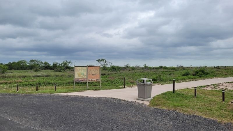
Location. 26° 1.213′ N, 97° 28.576′ W. Marker is in Brownsville, Texas, in Cameron County. Marker can be reached from Paredes Line Road (County Road 1847) north of State Highway 550, on the right when traveling north. Marker
is behind the visitor center in Palo Alto Battlefield National Historical Park. Touch for map. Marker is at or near this postal address: 7200 Paredes Line Road, Brownsville TX 78526, United States of America. Touch for directions.
Other nearby markers. At least 8 other markers are within 4 miles of this marker, measured as the crow flies. Chosen Ground / Arena decidida (approx. 0.2 miles away); Cavalry Charge / Se lanzaba la caballería (approx. 0.2 miles away); Palo Alto Battlefield (approx. 0.3 miles away); Three Hundred Supply Wagons / Trescientas carretas de viveres (approx. 0.4 miles away); a different marker also named Palo Alto Battlefield (approx. half a mile away); The Battle of Palo Alto (approx. half a mile away); Historic Battlefield Trail (approx. half a mile away); "Rancho Viejo" (approx. 3.7 miles away). Touch for a list and map of all markers in Brownsville.
Credits. This page was last revised on April 22, 2023. It was originally submitted on September 21, 2021, by Duane and Tracy Marsteller of Murfreesboro, Tennessee. This page has been viewed 174 times since then and 10 times this year. Photos: 1. submitted on September 21, 2021, by Duane and Tracy Marsteller of Murfreesboro, Tennessee. 2. submitted on April 22, 2023, by James Hulse of Medina, Texas.

