Old Saybrook Center in Middlesex County, Connecticut — The American Northeast (New England)
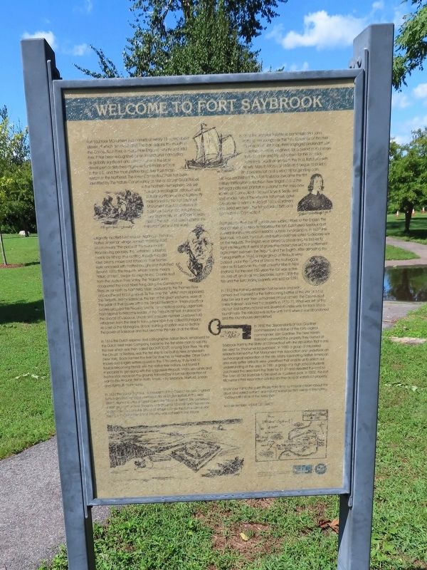
Welcome to Fort Saybrook
Fort Saybrook Monument Park consists of nearly 18 acres, about eleven of which are marshland. The park adjoins the mouth of the Connecticut River, a major New England estuary and tidal river. It has been recognized by an international convention as globally significant and contains one of the least developed or disturbed large-river tidal marsh systems in the U.S., and the most pristine large-river tidal marsh system in the Northeast. The lower Connecticut River has been identified by The Nature Conservancy as one of 40 Last Great Places in the Northern Hemisphere. This site has great ecological, historical and cultural significance and is presently maintained by the Fort Saybrook Monument Park Association. Fort Saybrook Monument Park offers a rare opportunity for all visitors to learn about the rich and varied past of this important place in the world.
Originally located here was Algonquin Nehantic Native American village named Pashbeshauke, which means the place at the river’s mouth." Peace loving peoples, the Nehantics subsisted mainly by fishing and hunting, though they did raise beans, maize and tobacco. Their homes were enclosed with matted boughs and thatched. Around 1590, the Pequots, whose name means "Killers of Men" began to migrate into Connecticut from the Hudson River Valley. The Pequots soon conquered the local tribes living along the Connecticut River as far north as Northfield, Mass. Eastward to the Thames River and southward to Long Island. By the time the "white" man appeared, the Pequots, led by Sassucus, the last of the great sachems, were at the peak of their power within the Pequot Federation. Internal political rivalries plagued the Pequots. Uncas, an ambitious young sagamore had aspired to become leader of the Pequots himself. Infuriated by the choice of Sassucus, Uncas and a sizable number of braves had withdrawn from the tribe to form a new tribe they called Mohegans. As chief of the Mohegans, Uncas’ burning ambition was to destroy the power of Sassacus and thus become the ruler of all the tribes.
In 1614 the Dutch explorer and cartographer Adrian Block employed by the Dutch West India Company, became the first white man to sail into the river which was then called Quonitocuti, or Long Tidal River. His ship the Onrust, or Restless, was the first ship to be built in New Amsterdam (New York). Block named the river De Versche, or Freshwater. Other Dutch traders and English settlers arrived in the 17th century. They had no trouble becoming friends win the native river Indians, but found it impossible to get along with the aggressive Pequots. Many skirmishes and battles took place on this ground, followed by a formal declaration of war on the Pequots (first in North America by Saybrook, Hartford, Boston and Plymouth Plantations).
In 1631 the Earl of Warwick was President of the Council for New England (which granted permission for all English settlers in the New World), signed a unique aeod called the Warwick Patent. This conveyed a vast section of New England to 15 Lords and Gentlemen to give them several places of refuge in case the Puritan Revolution raging in England failed and the king was restored to the throne.
In 1633 the Warwick Patentees commissioned John Winthrop the younger as the First Governor of the River Connecticut. Winthrop then engaged Lieutenant Lion Gardiner, a military engineer, for a period of four years to build a fort and lay out a town for the Warwick Patentees. Gardiner arrived in the bark Batchelor with his wife Mary in March of 1636 and began to build a stout palisade fort and a windmill for grinding corn. This was established, thus Fort Saybrook became the first military fortification in southern New England and the first legal patentee plantation (colony) in the area now known as Connecticut. Viscount Saye & Seale and Lord Brooke, two of the Warwick Patentees, gave Say-Brooke its name. In April of 1636, Gardiner’s son David was born, the first recorded birth of a non-native in Connecticut.
Frustrated by the loss of control over subject tribes to the English, Pequot Warriors constantly harassed the fort, butchered livestock and burned storehouses and haystacks outside the palisdes. In 1637 the Saybrook, Hartford, Plymouth and Boston colonies voted to declare war on the Pequots. The English were joined by Uncas and his braves to fight the Pequots. A series of gruesome massacres led to a settlement ageement between the Pequots and the English. After defeating the Narragansetts in 1644, a large group of Pequots were placed under the control of Uncas, the Mohegans went on to become the most powerful tribe in New England. For the next 150 years the fort was active on and off, on an as needed basis, but in 1808 the fort and surrounding property was sold for $391.
In 1812 the Fort was renamed Fort Fenwick and was armed and manned for the forthcoming battles of the War of 1812. After the war it was then unmanned and unarmed. The Connecticut Valley Railroad acquired the property in 1870-71. What was left of the old fort and battery mound was leveled to make way for track and a roundhouse. The railroad was active until 1915 when it was abandoned and the roundhouse demolished.
In 1930 the descendants of Lion Gardiner commissioned a statue of the fort's original commander, Lion Gardiner. The New Haven Railroad conveyed the property they owned at Saybrook Point to the State of Connecticut with the stipulation that it only be used for “monumental purposes”. In 1980 a group of interested residents formed the Fort Monument Park Association and undertook an archeological exploration of the site. Many fascinating Native American and early settler artifacts were unearthed that enable us to enrich our understanding of the area. In 1981 a group of jr. high school students purchased the area from the State for $1.27 and deeded the land to the town of Old Saybrook to be used as a passive park. In 2002, the Fort Monument Park Association added another acre of waterfront property.
Enjoy your visit to the park. Please take time to read and learn about the great and varied cultural and natural resources that reside in this historic and beautiful slice of the world pie. And remember - Leave No Trace
Topics. This historical marker is listed in this topic list: Forts and Castles. A significant historical month for this entry is March 1636.
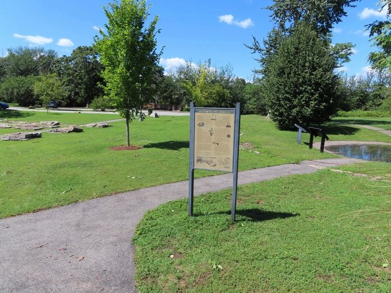
Location. This marker has been replaced by another marker nearby. It was located near 41° 17.068′ N, 72° 21.054′ W. Marker was in Old Saybrook, Connecticut, in Middlesex County. It was in Old Saybrook Center. Marker could be reached from College Street (Connecticut Route 154) east of Fenwick Street, on the left when traveling east. Located in Fort Saybrook Monument Park. Touch for map. Marker was in this post office area: Old Saybrook CT 06475, United States of America. Touch for directions.
Other nearby markers. At least 8 other markers are within walking distance of this location. Welcome to Fort Saybrook Monument Park (here, next to this marker); The Ferry (a few steps from this marker); Lighthouses and River Pilots (a few steps from this marker); Connecticut Valley Railroad Roundhouse & Turntable Site (within shouting distance of this marker); The Connecticut Valley Railroad (within shouting distance of this marker); a different marker also named Welcome to Fort Saybrook (within shouting distance of this marker); The Saybrook Bar (within shouting distance of this marker); Fishing on the Connecticut (within shouting distance of this marker). Touch for a list and map of all markers in Old Saybrook.
Related marker. Click here for another marker that is related to this marker. This marker has been replaced with the linked marker.
Also see . . .
1. Saybrook Fort & the Pequot War. (Submitted on September 22, 2021, by Michael Herrick of Southbury, Connecticut.)
2. Fort Saybrook Monument Park – Visit CT. (Submitted on September 22, 2021, by Michael Herrick of Southbury, Connecticut.)
Credits. This page was last revised on July 1, 2023. It was originally submitted on September 22, 2021, by Michael Herrick of Southbury, Connecticut. This page has been viewed 296 times since then and 64 times this year. Photos: 1, 2. submitted on September 22, 2021, by Michael Herrick of Southbury, Connecticut.

