Brownsville in Cameron County, Texas — The American South (West South Central)
Chosen Ground / Arena decidida
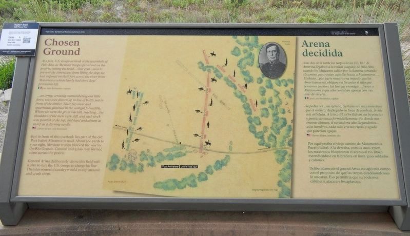
At 2 p.m. U.S. troops arrived at the waterhole of Palo Alto, as Mexican troops spread out on the prairie, cutting the road … Our goal … was to prevent the Americans from lifting the siege we had imposed on their fort across the river from Matamoros which barely had three days' provisions left. — Jose Luis Berlandier, captain
… an army, certainly outnumbering our little force, was seen drawn up in line of battle just in front of the timber. Their bayonets and spearheads glistened in the sunlight formidably. Where we were the grass was tall, reaching … the shoulders of the men, very stiff, and each stock was pointed at the top, and hard and almost as sharp as a darning needle. — Ulysses Grant, 2nd lieutenant
Just in front of this overlook lies part of the old Port Isabel-Matamoros road. About 300 yards to your right, Mexican troops blocked the way to the Rio Grande. Cannon and 3,200 men formed a line across the prairie.
General Arista deliberately chose this field with a plan to lure the U.S. troops to charge his line. Then his powerful cavalry would sweep around and crush them.
Caption: Map drawn 1847
A las dos de la tarde las tropas de los EE. UU. de América llegaban a la resaca o aguaje de Palo Alto, cuando los Mejicanos salían por la llanura cortando el camino que travían aquellas hacia a Matamoros … El objeto … por parte nuestra era impedir que los Americanos nos obligaren a levantar el sitio que teniamos puesto a las fuerzas enemigas … frente a Matamoros y que sólo contaban apenas con tres dias de víveres. — José Luis Berlandier, capitán
Se podia ver … un ejército, ciertamente más numeroso que el nuestro, desplegado en línea de combate, frente a la arboleda. A la luz del sol brillaban sus bayonetas y puntas de lanza formidablemente. En donde nos encontrábamos, el zacatal era alto, llegándonos … a los hombros, cada tallo era tan rigido y agudo que parecian agujas. — Ulysses Grant, teniente 2do
Por aquí pasaba el viejo camino de Matamoros a Puerto Isabel. A la derecha, como a unos 270 m, los mexicanos bloquearon el acceso al río Bravo extendiéndose en la pradera en línea 3200 soldados y cañones.
Deliberadamente el general Arista escogió este campo con el propósito de que las tropas estadounidenses lo atacaran. Eso permitiría que su poderosa caballeria atacara y los
aplastara.
Subtítulo: mapa preparado en 1847.
Erected by National Park Service.
Topics. This historical marker is listed in this topic list: War, Mexican-American. A significant historical date for this entry is May 9, 1846.
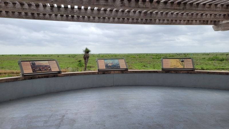
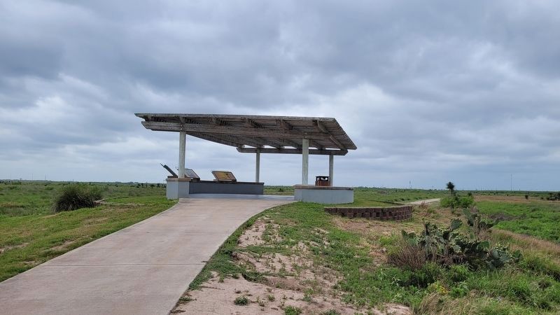
Location. 26° 1.269′ N, 97° 28.416′ W. Marker is in Brownsville, Texas, in Cameron County. Marker can be reached from Paredes Line Road (County Highway 1847) north of State Highway 550, on the right when traveling north. Marker is in Palo Alto Battlefield National Park. Touch for map. Marker is at or near this postal address: 7200 Paredes Line Road, Brownsville TX 78526, United States of America. Touch for directions.
Other nearby markers. At least 8 other markers are within 4 miles of this marker, measured as the crow flies. Cavalry Charge / Se lanzaba la caballería (within shouting distance of this marker); Border War / Guerra de fronteras (approx. 0.2 miles away); Three Hundred Supply Wagons / Trescientas carretas de viveres (approx. 0.2 miles away); Palo Alto Battlefield (approx. 0.4 miles away); a different marker also named Palo Alto Battlefield (approx. 0.6 miles away); The Battle of Palo Alto (approx. 0.6 miles away); Historic Battlefield Trail (approx. 0.7 miles away); "Rancho Viejo" (approx. 3.9 miles away). Touch for a list and map of all markers in Brownsville.
Also see . . . Battle of Palo Alto / Batalla de Palo Alto. History Channel overview of the battle. / Descripción general de History Channel de la batalla. (Submitted on September 30, 2021, by Duane and Tracy Marsteller of Murfreesboro, Tennessee.)
Credits. This page was last revised on April 22, 2023. It was originally submitted on September 26, 2021, by Duane and Tracy Marsteller of Murfreesboro, Tennessee. This page has been viewed 152 times since then and 16 times this year. Photos: 1. submitted on September 26, 2021, by Duane and Tracy Marsteller of Murfreesboro, Tennessee. 2, 3. submitted on April 22, 2023, by James Hulse of Medina, Texas. 4. submitted on September 30, 2021, by Duane and Tracy Marsteller of Murfreesboro, Tennessee.


