Deadwood in Lawrence County, South Dakota — The American Midwest (Upper Plains)
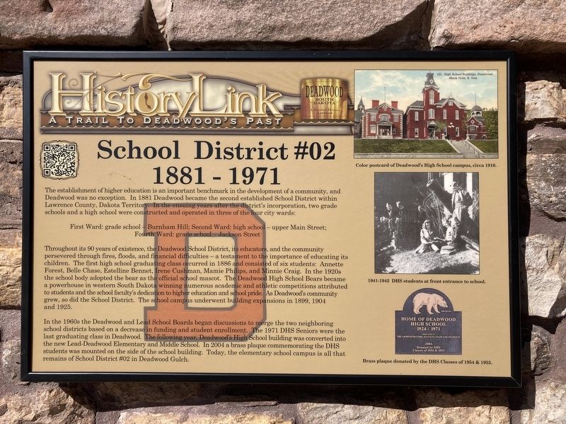
School District #02
1881 - 1971
| — | A Trail to Deadwood's Past | — |
Photographed by Connor Olson, October 6, 2021
1. School District #02 1881-1971 Marker
First Ward: grade school - Burnham Hill; Second Ward: high school - upper Main Street; Fourth Ward: grade school - Jackson Street
Throughout its 90 years of existence, the Deadwood School District, its educators, and the community persevered through fires, floods, and financial difficulties - a testament to the importance of educating its children. The first high school graduating class occurred in 1886 and consisted of six students: Annette Forest, Belle Chase, Estelline Bennet, Irene Cushman, Mamie Philips, and Minnie Craig. In the 1920s the school body adopted the bear as the official school mascot. The Deadwood High School Bears became a powerhouse in western South Dakota winning numerous academic and athletic competitions
this page online
In the 1960s the Deadwood and Lead School Boards began discussions to merge the two neighboring school districts based on a decrease in funding and student enrollment. The 1971 DHS Seniors were the last graduating class in Deadwood. The following year, Deadwood's High School building was converted into the new Lead-Deadwood Elementary and Middle School. In 2004 a brass plaque commemorating the DHS students was mounted on the side of the school building. Today, the elementary school campus is all that remains of School District #02 in Deadwood Gulch.
Captions:
Color postcard of Deadwood's High School campus, circa 1910.
1941-1942 DHS students at front entrance to school.
Brass plaque donated by the DHS Classes of 1954 & 1955.
Erected by Deadwood Historic Preservation Commission.
Topics. This historical marker is listed in this topic list: Education. A significant historical year for this entry is 1881.
Location. 44° 22.53′ N,
Photographed by Connor Olson, October 6, 2021
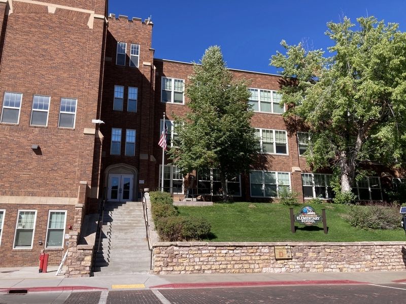
2. School building with marker seen in the lower right, on the retaining wall

Regionally, this marker is in West River. It is also in the American Black Hills, in the Lewis & Clark Corridor, on the prairies, and on the Northern Plains. Globally, it is in North America, the Western Hemisphere, the Western World, and the Anglosphere. Historically, it finds itself in what was once Rupert’s Land and also the Louisiana Purchase.
Other nearby markers. At least 8 other markers are within walking distance of this marker: Spanish-American War Memorial (a few steps from this marker); Deadwood Changing -- 1884, 1909 and Now (a few steps from this marker); Serving the Black Hills (within shouting distance of this marker); The Legend Begins… (about 300 feet away, measured in a direct line); Deadwood’s Grand Bandstand (about 300 feet away); Deadwood's Carnegie Library (about 300 feet away); History Buried Beneath Your Feet (about 300 feet away); Black Hills Trust and Savings Bank (about 400 feet away). Touch for a list and map of all markers in Deadwood.
Other markers no longer nearby. Generations of Change (was about 300 feet away but has been permanently removed); Ride High, T.C., Ride High (was about 300 feet away but has been permanently removed).
More about this marker. Marker is mounted in the former location of the Spanish-American Memorial marker.
Credits. This page was last revised on October 8, 2021. It was originally submitted on October 6, 2021, by Connor Olson of Menomonee Falls, Wisconsin. This page has been viewed 475 times since then and 34 times this year. Photos: 1, 2. submitted on October 6, 2021, by Connor Olson of Menomonee Falls, Wisconsin. • Mark Hilton was the editor who published this page.
