Near Deadwood in Lawrence County, South Dakota — The American Midwest (Upper Plains)
Mount Roosevelt
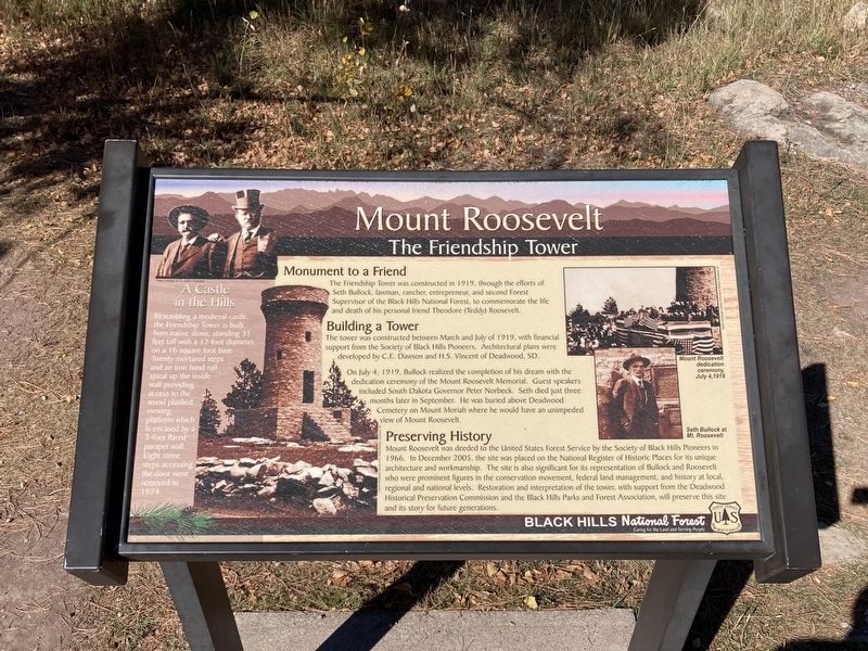
The Friendship Tower
The Friendship Tower was constructed in 1919, through the efforts of Seth Bullock, lawman, rancher, entrepreneur, and second Forest Supervisor of the Black Hills National Forest, to commemorate the life and death of his personal friend Theodore (Teddy) Roosevelt.
Building a Tower
The tower was constructed between March and July of 1919, with financial support from the Society of Black Hills Pioneers. Architectural plans were developed by C.E. Dawson and H.S. Vincent of Deadwood, SD.
On July 4, 1919, Bullock realized the completion of his dream with the dedication ceremony of the Mount Roosevelt Memorial. Guest speakers included South Dakota Governor Peter Norbeck. Seth died just three months later in September. He was buried above Deadwood Cemetery on Mount Moriah where he would have an unimpeded view of Mount Roosevelt.
Preserving History
Mount Roosevelt was deeded to the United States Forest Service by the Society of Black Hills Pioneers in 1966. In December 2005, the site was placed on the National Register of Historic Places for its unique architecture and workmanship. The site is also significant for its representation of Bullock and Roosevelt who were prominent figures in the conservation movement, federal land management, and history at local, regional and national levels. Restoration and interpretation of the tower, with support from the Deadwood Historical Preservation Commission and the Black Hills Parks and Forest Association, will preserve this site and its story for future generations.
A Castle in the Hills
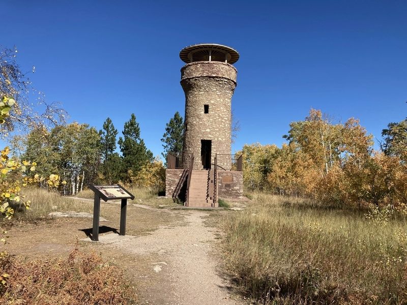
Resembling a medieval castle, the Friendship Tower is built from native stone, standing 31 feet tall with a 12 foot diameter, on a 16-square foot base. Twenty montared steps and an iron hand rail- spiral up the inside wall providing access to the wood planked viewing platform which is encased by a - 3-foot flared parapet wall. Eight stone steps accessing the door were removed in 1974.
Captions:
Mount Roosevelt dedication ceremony, July 4, 1919
Seth Bullock at Mount Roosevelt
Erected by US Forest Service, Department of Agriculture.
Topics. This historical marker is listed in this topic list: Architecture. A significant historical month for this entry is March 1919.
Location. 44° 23.878′ N, 103° 45.556′ W. Marker is near Deadwood, South Dakota, in Lawrence County. Marker can be reached from Mount Roosevelt Road west of Stage Run Road. Marker can be accessed from the Mount Roosevelt Trail. Touch for map. Marker is in this post office area: Deadwood SD 57732, United States of America. Touch for directions.
Other nearby markers. At least 8 other markers are within 2 miles of this marker, measured as the crow flies. Theodore Roosevelt “The American” (a few steps from this marker); Center of the Country (about 300 feet away, measured in a direct line); Mining & Logging (about 400 feet away); Buttes (about 500 feet away); Where It All Begins (approx. ¼ mile away); The Cowboy & The Conservationist (approx. ¼ mile away); Second Deadwood Gold Discovery (approx. 1.9 miles away); St. Johns Episcopal Church, Est. 1880 (approx. 2 miles away). Touch for a list and map of all markers in Deadwood.
Credits. This page was last revised on October 10, 2021. It was originally submitted on October 9, 2021, by Connor Olson of Kewaskum, Wisconsin. This page has been viewed 172 times since then and 19 times this year. Photos: 1, 2. submitted on October 9, 2021, by Connor Olson of Kewaskum, Wisconsin. • Mark Hilton was the editor who published this page.

