Northside in Ann Arbor in Washtenaw County, Michigan — The American Midwest (Great Lakes)
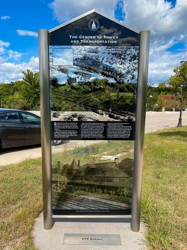
The Center of Power And Transportation
Early settlers and travelers arrived on foot, on horseback, or by stagecoach, following Indian trails that crossed the river where the bridge is today. Wagons carried supplies until the railroad reached Ann Arbor from Detroit in 1839.
Water was Ann Arbor's earliest source of power. By 1830 a dam upriver diverted water into the millrace (4), parallel to the river (5), to provide power for Lower Town's mills and later the Agricultural Works (see map above). In 1858, at a site south of the rail- road tracks (6), the Ann Arbor Gas Light Company began using coal to make artificial gas for street lamps, home heating, lighting, and cooking. Gas stored in large tanks was distributed through five miles of pipe. The gas works moved to this larger site north of the tracks in 1900, a few years after an explosion damaged the old works.
After the flour mill burned in 1904, its owners built a small hydroelectric power plant on the site (2). The next year the Edison Company acquired the dam and the power plant, which they later enlarged. In 1928 they built a warehouse across Broadway on the site of the former Agricultural Works. The gas company became part of Michigan Consolidated Gas in 1938 and merged with Edison into DTE Energy in 2002.
Erected by DTE Energy.
Topics. This historical marker is listed in these topic lists: Industry & Commerce • Settlements & Settlers. A significant historical year for this entry is 1839.
Location. 42° 17.317′ N, 83° 44.409′ W. Marker is in Ann Arbor, Michigan, in Washtenaw County. It is in Northside. Marker is on Broadway Street near Swift Street, on the right when traveling north. Touch for map. Marker is at or near this postal address: 987 Broadway St, Ann Arbor MI 48105, United States of America. Touch for directions.
Other nearby markers. At least 8 other markers are within walking distance of this marker. The Agricultural Works and Lower Town (a few steps from this marker); Early Power and Transportation (a few steps from this marker); From Industry to Parks (a few steps from this marker); Lower Town's Flour Mills (a few steps from this marker); Michigan Central Railroad Depot (about 700 feet away, measured in a direct line); Brown and Fuller's Addition—1832 (approx. ¼ mile away); Anson Brown and Early Lower Town (approx. ¼ mile away); Homes of Early Lower Town Settlers (approx. ¼ mile away). Touch for a list and map of all markers in Ann Arbor.

Photographed By J.T. Lambrou, September 10, 2021
3. The Center of Power And Transportation Marker
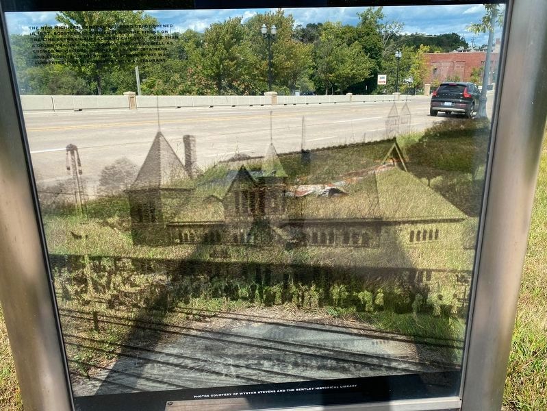
Inset photo (bottom) caption:
The new Michigan Central Railroad Depot opened in 1887. Boosters described it as "the finest on the line between Buffalo and Chicago." More than a dozen trains a day brought freight as well as crowds of visitors, businessmen, entertainers, and students. In 1969 the passenger depot was converted into the Gandy Dancer restaurant.

Photographed By J.T. Lambrou, September 10, 2021
4. The Center of Power And Transportation Marker
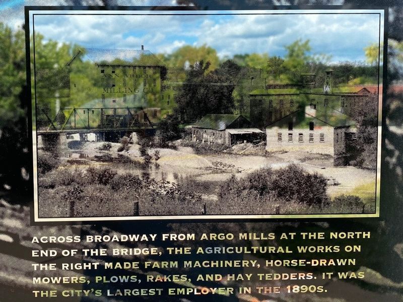
Inset photo (right) caption: Across Broadway from Argo Mills at the north end of the bridge, the Agricultural Works on the right made farm machinery, horse-drawn mowers, plows, rakes, and hay tedders. It was the city's largest employer in the 1890s.
Credits. This page was last revised on February 12, 2023. It was originally submitted on October 18, 2021, by J.T. Lambrou of New Boston, Michigan. This page has been viewed 66 times since then and 5 times this year. Photos: 1, 2, 3, 4. submitted on October 18, 2021, by J.T. Lambrou of New Boston, Michigan. • Mark Hilton was the editor who published this page.

