Santa Fe in Santa Fe County, New Mexico — The American Mountains (Southwest)
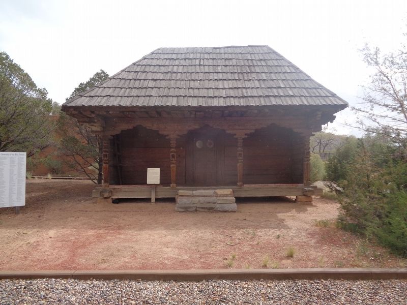
Mexican Colonial House
This type of structure was introduced to Mexico by Spanish settlers in the sixteenth century. The ornate corbels on the front porch are similar in form and decoration to corbels introduced throughout the New World - including New Mexico - by Spaniards for architectural purposes throughout the colonial period. The columns are regional variations of Spanish estipite columns, which feature a shaft that is narrow at the base and capital and wide and decorative in the middle. Other variations of estipite columns can be seen today throughout New Mexico.
The house made its way to the Museum of Spanish Colonial Art as a gift from the Denver Art Museum and Mrs. Althea Revere. It was reconstructed here by Santa Fe sculptor Luis Tapia and his son, Sergio, who - without benefit of a floor plan - fitted the massive 300 pound pine planks together like a giant jigsaw puzzle.
Topics. This historical marker is listed in these topic lists: Architecture • Settlements & Settlers. A significant historical year for this entry is 1780.
Location. 35° 39.947′ N, 105° 55.466′ W. Marker is in Santa Fe, New Mexico, in Santa Fe County. Marker can be reached from Camino Lejo south of Old Santa Fe Trail. Marker is on the grounds of the Museum of Spanish Colonial Art. Touch for map. Marker is at or near this postal address: 750 Camino Lejo, Santa Fe NM 87505, United States of America. Touch for directions.
Other nearby markers. At least 8 other markers are within 2 miles of this marker, measured as the crow flies. The Artist's Garden (a few steps from this marker); Trade Transforms Art (within shouting distance of this marker); Santa Fe Trail - Road to Opportunity (approx. 0.2 miles away); Journey's End (approx. 0.2 miles away); Kearny's Gap Bridge (approx. 0.2 miles away); Santa Fe Korean War Memorial (approx. 0.6 miles away); A Two Way Street (approx. 0.6 miles away); The Santa Fe Trail (approx. 1.4 miles away). Touch for a list and map of all markers in Santa Fe.
Credits. This page was last revised on October 25, 2021. It was originally submitted on October 25, 2021, by Jason Voigt of Glen Carbon, Illinois. This page has been viewed 181 times since then and 28 times this year. Photos: 1, 2. submitted on October 25, 2021, by Jason Voigt of Glen Carbon, Illinois.

