
Ōkārito in Westland District, West Coast Region, New Zealand — Southwestern Pacific Ocean
Frontier Building … Legendary Man
Courtesy of Thomas P. Martin, February 13, 2015
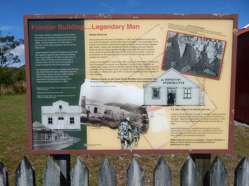
1. Frontier Building ... Legendary Man Marker
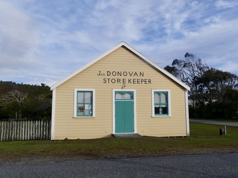
The timber-framed, weatherboard-clad building now known as Donovan's Store was built during the time of the first West Coast gold rush in the 1860s. Trading initially as the Club Hotel, it survives as the oldest building of its kind on the West Coast.
James Donovan bought the building around 1890 and opened a general store selling everything from 'axe handles to 10 bottles of pain killer a year'. Parts of the store were rebuilt after a tornado strike, but the current front gable is known to date from the Club Hotel days.
The subsequent owners of the store were Mr. and Mrs. Keith Robertson who continued to open the store twice a week until about 1985, selling mainly confectionery and drinks. They bequeathed the land and buildings to the Department of Conservation in 1987.
James Donovan
Jimmy Donovan was born in Hokitika in 1867 and attended his first gold rush, with his parents, at the tender age of 6 weeks. This connection to the frontier communities continued throughout his life as he lived and worked with miners, millers and farmers at Whataroa, Mapourika and Okarito. While his life will always be closely associated
this page online
Jimmy's commitment to local body affairs was truly remarkable. During the last 30 years of his service as a Westland County Council member he missed not a single ordinary meeting. Attendance at each meeting required a 90 mile trek to Hokitika, which he mostly did on horseback! At the time of his death, in 1956 at the age of 88, he was the oldest local body member in New Zealand.
"Without a doubt no man knew South Westland more intimately than he and no man had the interests of that district more deeply at heart".
It is 1866, height of the Okarito gold rush…
Imagine a bustling street frontage of theatres, hotels and bond stores. Prospectors are arriving daily on ships “The Bruce” or “Ballarat”, swelling the population of Okarito township to 1250 and that of outlying settlements Three Mile and Five Mile to 2500.
Against this backdrop a weatherboard building is quickly constructed from locally milled rimu, kahikatea, North Island kauri and imported baltic
Mike Dikison via WikiMedia (CC BY-SA 4.0), October 6, 2020
2. Donovan's Store
The building is now used as a community library.
Today Donovan's Store is a category 1 Historic Building, a place or site of special or outstanding historical significance or value.
Captions/credits
• Jimmy and Eva Donovan "When the sawmills, the harbour and Okarito itself are booming again, another memorial should go up smartly, to the Grand Old Man of the Coast — Jimmy Donovan — and his wife, both dinkum New Zealanders." The Evening Post, November 5, 1956 New Zealand Pictorial | Auckland | 1950s
• Below: Built in the mid-1860s, the Club Hotel was the forerunner of Donovan's Store.
• Bottom Left: Okarito Township about 1860. Newspaper | Unknown source | Department of Conservation
• Right: The Strand, Okarito. This photograph was taken after the height of the 1860s gold rushes. Alexander Turnbull Library
Erected by New Zealand Department of Conservation.
Topics. This historical marker is listed in these topic lists: Architecture • Industry & Commerce • Settlements & Settlers. A significant historical year for this entry is 1866.
Location. 43° 13.332′ S, 170° 9.899′ E. Marker is in Ōkārito, West Coast Region, in Westland District. It is on The Strand, on the right when traveling north. Touch for map. Marker is at or near this postal address: 17 The Strand, Ōkārito, West Coast Region 7886, New Zealand. Touch for directions.

Regionally, it is in Oceania, in Australasia, in Polynesia, in the Pacific Ocean, on the Ring of Fire, on the Pacific Rim, in the Western World, and in the Anglosphere. Historically, it finds itself in what was once a British colony.
Other nearby markers. At least 2 other markers are within 23 kilometers of this marker, measured as the crow flies: Don't let rowi become just a memory (approx. 18.3 kilometers away); Peter's Pool (approx. 22 kilometers away).
Also see . . . Donovan's Store. Wikipedia entry on the historic landmark. (Submitted on October 28, 2021, by Duane and Tracy Marsteller of Murfreesboro, Tennessee.)
Credits. This page was last revised on January 5, 2022. It was originally submitted on October 28, 2021, by Duane and Tracy Marsteller of Murfreesboro, Tennessee. This page has been viewed 194 times since then and 20 times this year. Photos: 1, 2. submitted on October 28, 2021, by Duane and Tracy Marsteller of Murfreesboro, Tennessee.
