North Utica in LaSalle County, Illinois — The American Midwest (Great Lakes)
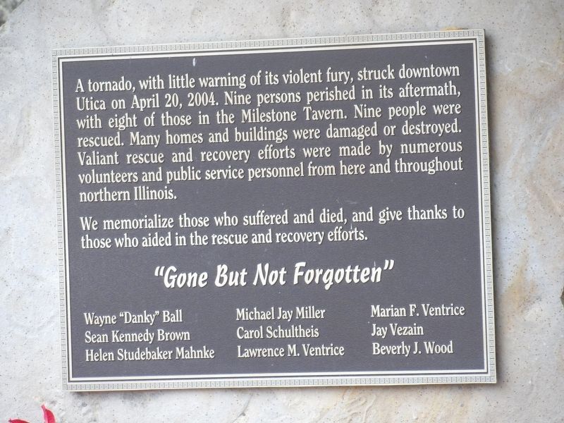
Tornado Memorial
We memorialize those who suffered and died, and give thanks to those who aided in the rescue and recovery efforts.
Topics. This historical marker and memorial is listed in this topic list: Disasters. A significant historical date for this entry is April 20, 2004.
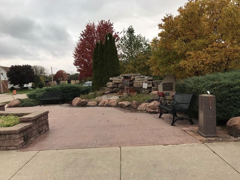
Location. 41° 20.496′ N, 89° 0.588′ W. Marker is in North Utica, Illinois, in LaSalle County. Marker is at the intersection of Church Street and Mill Street, on the right when traveling west on Church Street. Marker is in a plaza dedicated to the tornado victims. Touch for map. Marker is in this post office area: Utica IL 61373, United States of America. Touch for directions.
Other nearby markers. At least 8 other markers are within 2 miles of this marker, measured as the crow flies. Canal Warehouse (about 400 feet away, measured in a direct line); Aitken School (about 600 feet away); Père Marquette (approx. 0.2 miles away); René Robert Cavelier Sieur de La Salle (approx. 1.7 miles away); Starved Rock (approx. 1.7 miles away); This Plaque is Placed in Memory of the Patriots (approx. 1.7 miles away); Commemorating the Deeds of the Union Veterans of the Civil War (approx. 1.7 miles away); Fort St. Louis (approx. 1.7 miles away). Touch for a list and map of all markers in North Utica.
Also see . . .
1. The Deadly Utica Tornado: A Retrospective Look. The National Weather Service reviews the deadly twister with maps and photographs. (Submitted on November 4, 2021, by Duane and Tracy Marsteller of Murfreesboro, Tennessee.)
2. Tornado outbreak of April 20, 2004. The Utica tornado was among 30 that formed that day. It was the only one with fatalities. (Submitted on November 4, 2021, by Duane and Tracy Marsteller of Murfreesboro, Tennessee.)
Credits. This page was last revised on November 4, 2021. It was originally submitted on November 3, 2021, by Duane and Tracy Marsteller of Murfreesboro, Tennessee. This page has been viewed 609 times since then and 184 times this year. Photos: 1, 2. submitted on November 3, 2021, by Duane and Tracy Marsteller of Murfreesboro, Tennessee.

