Near Wickliffe in Ballard County, Kentucky — The American South (East South Central)
Lewis & Clark at Old Fort Jefferson
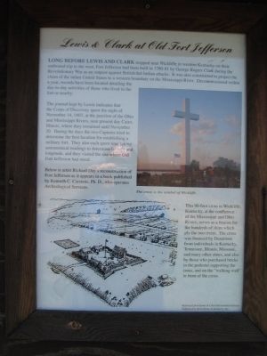
The journal kept by Lewis indicates that the Corps of Discovery spent the night of November 14, 1803, at the junction of the Ohio and Mississippi Rivers, near present day Cairo, Illinois, where they remained until November 20. During the days the two Captains tried to determine the best location for establishing a military fort. They also each spent time taking astronomical readings to determine latitude and longitude, and they visited the site where Old Fort Jefferson had stood.
Below is artist Richard Day's reconstruction of Fort Jefferson as it appears in a book published by Kenneth C. Carstens, Ph.D., who operates Archeological Services.
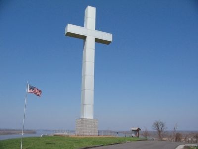
This 90-foot cross in Wickliffe, Kentucky, at the confluence of the Mississippi and Ohio Rivers, serves as a beacon for the hundreds of ships which ply the two rivers. The cross was financed by Donations from individuals in Kentucky, Tennessee, Illinois, Missouri, and many other states, and also by those who purchased bricks in the pedestal supporting the cross, and on the "walking wall" in front of the cross.
Topics and series. This historical marker is listed in this topic list: Exploration. In addition, it is included in the Lewis & Clark Expedition series list. A significant historical date for this entry is November 14, 1973.
Location. 36° 57.46′ N, 89° 5.537′ W. Marker is near Wickliffe, Kentucky, in Ballard County. Marker is on Westvaco Road (U.S. 51/62), on the right when traveling south. Located at the entrance to Fort Jefferson Memorial Cross Park. Touch for map. Marker is in this post office area: Wickliffe KY 42087, United States of America. Touch for directions.
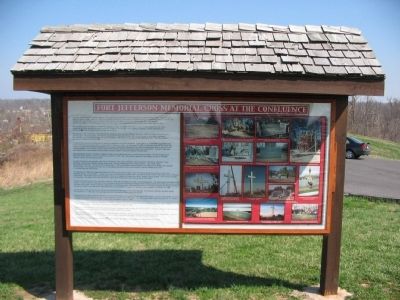
Other nearby markers. At least 8 other markers are within walking distance of this marker. Fort Jefferson Memorial Cross at the Confluence (within shouting distance of this marker); Fort Jefferson (approx. 0.2 miles away); Union Supply Base (approx. 0.2 miles away); Fort Jefferson Site / Indian Massacre (approx. 0.2 miles away); Lewis and Clark in Kentucky Fort Jefferson (approx. 0.2 miles away); County Named, 1842 (approx. 0.6 miles away); Private First Class Robert Monroe Hammonds (approx. 0.6 miles away); The Prince of the French Explorers (approx. 0.9 miles away). Touch for a list and map of all markers in Wickliffe.
More about this marker. On the right is a photo of the cross. To the lower left is the drawing referenced in the text showing the fort as it likely looked when completed.
Also see . . . Fort Jefferson Memorial Cross at the Confluence. (Submitted on May 2, 2009, by Craig Swain of Leesburg, Virginia.)
Credits. This page was last revised on June 16, 2016. It was originally submitted on May 2, 2009, by Craig Swain of Leesburg, Virginia. This page has been viewed 1,962 times since then and 34 times this year. Photos: 1, 2, 3. submitted on May 2, 2009, by Craig Swain of Leesburg, Virginia.


