Near Suisun City in Solano County, California — The American West (Pacific Coastal)
Travis Air Force Base
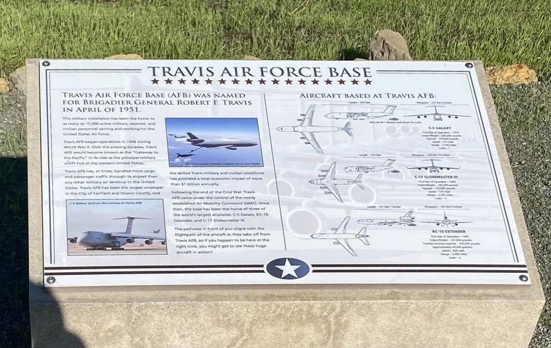
This military installation has been the home to as many as 15,000 active military, reservist, and civilian personnel serving and working for the United States Air Force.
Travis AFB began operations in 1943 during World War II. Over the ensuing decades, Travis AFB would become known as the "Gateway to the Pacific” in its role as the principal military airlift hub in the western United States.
Travis AFB has, at times, handled more cargo and passenger traffic through its airport than any other military air terminal in the United States. Travis AFB has been the largest employer in the City of Fairfield and Solano County, and the skilled Travis military and civilian workforce has provided a local economic impact of more than $1 billion annually.
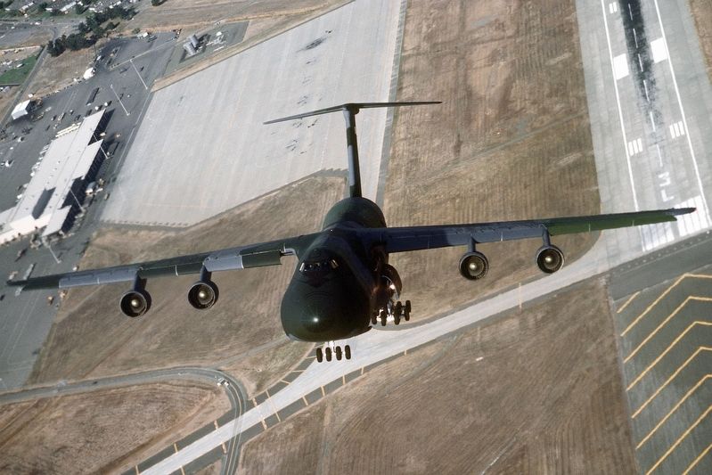
Following the end of the Cold War, Travis AFB came under the control of the newly established Air Mobility Command (AMC). Since then, the base has been the home of three of the world's largest airplanes: C-5 Galaxy, KC-10 Extender, and C-17 Globemaster III.
The pathway in front of you aligns with the flightpath of the aircraft as they take off from Travis AFB, so if you happen to be here at the right time, you might get to see these huge aircraft in action!
Topics. This historical marker is listed in this topic list: Air & Space. A significant historical month for this entry is April 1951.
Location. 38° 13.595′ N, 121° 58.711′ W. Marker is near Suisun City, California, in Solano County. Marker can be reached from Kildeer Road south of California Highway 12. Touch for map. Marker is in this post office area: Suisun City CA 94585, United States of America. Touch for directions.
Other nearby markers. At least 8 other markers are within 8 miles of this marker, measured as the crow flies. Suisun City (approx. 3.4 miles away); The Hump (approx. 5.8 miles away); The Valley (approx. 7.4 miles away); Rockville Stone Chapel (approx. 7.9 miles away); Rockville Station (approx. 7.9 miles away); Pioneer Monument (approx. 7.9 miles away); Peña Adobe Park (approx. 7.9 miles away); William Gordon Huff (approx. 7.9 miles away). Touch for a list and map of all markers in Suisun City.
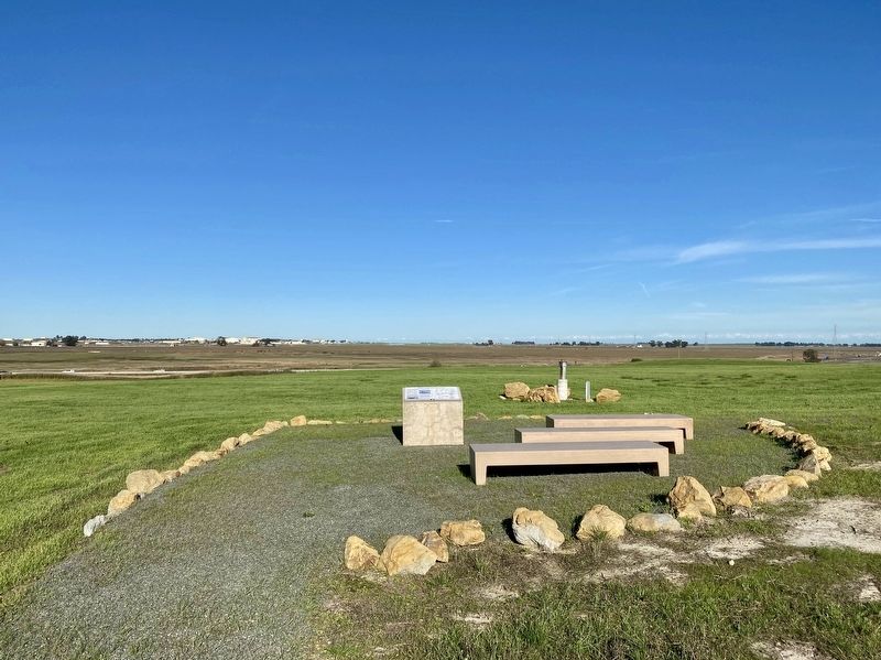
More about this marker. The marker is located at the top of a hill at the Suisun Marsh Overlook. The exit to reach the overlook from Highway 12 is signed "Scenic Overlook".
From the overlook parking lot, take the trail to the top of the hill. It is approximately 0.2 miles along a gravel-paved gentle uphill trail that winds its way partly around the hill as it ascends. Along the way there will be two interpretive panels (one for local fauna, one for the geology
of the Pacheco Hills and how landfills are constructed). The Travis AFB marker site at the top of the hill has a nice 360 degree view of the area, including Travis AFB to the east. In sum, it's a short and pleasant hike - much nicer than one might expect given the site is a former garbage dump.
Also see . . . History of Travis Air Force Base (Travis AFB Aviation Museum).
Excerpt: "Although today Travis is the home of the largest airlift organization in the Air Force, it began as an isolated airstrip with a few tar paper shacks set in the middle of a wind-swept prairie during World War II. Activated on 11 May 1943, the field was named Fairfield-Suisun Army Air Base, after the two closest--mostly agricultural--towns. Planned shortly after Pearl Harbor, the base served as home for medium bombers and fighters assigned to defend the West Coast. The first runway and temporary buildings were constructed by the Army Corps of Engineers in the summer of 1942...."(Submitted on November 9, 2021.)

SSGT Steve Mcgill/Department of Defense (courtesy of the National Archives at College Park), circa 1986
3. ...C-5 Galaxy as it takes off from Travis AFB, California
Full title: Air to air front view of a Air Mobility Command's 60th Military Airlift Wing's C-5 Galaxy as it takes off from Travis AFB, California
Credits. This page was last revised on November 9, 2021. It was originally submitted on November 9, 2021, by Andrew Ruppenstein of Lamorinda, California. This page has been viewed 152 times since then and 20 times this year. Photos: 1, 2, 3. submitted on November 9, 2021, by Andrew Ruppenstein of Lamorinda, California.

