Glen Falls in Warren County, New York — The American Northeast (Mid-Atlantic)
Lime Kiln Site
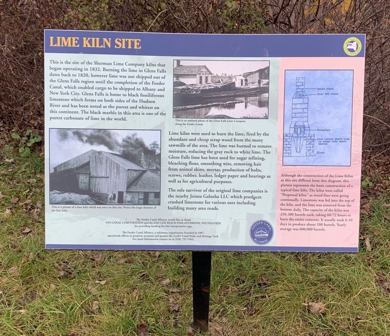
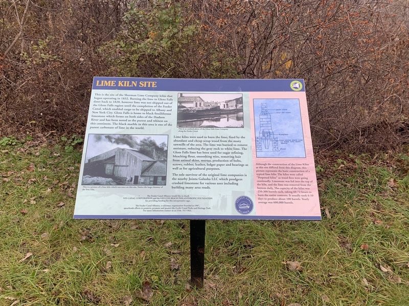
This is the site of the Sherman Lime Company kilns that began operating in 1832. Burning the lime in Glens Falls dates back to 1820, however lime was not shipped out of the Glens Falls region until the completion of the Feeder Canal, which enabled cargo to be shipped to Albany and New York City. Glens Falls is home to black fossiliferous limestone which forms on both sides of the Hudson River and has been noted as the purest and whitest on this continent. The black marble in this area is one of the purest carbonate of lime in the world.
This is an undated photo of the Glens Falls Lime Company along the Feeder Canal.
Lime kilns were used to burn the lime, fired by the abundant and cheap scrap wood from the many sawmills of the area. The lime was burned to remove moisture, reducing the gray rock to white lime. The Glens Falls lime has been used for sugar refining, bleaching flour, smoothing wire, removing hair from animal skins, mortar, production of bolts, screws, rubber, leather, ledger paper and bearings as well as for agricultural purposes.
The sole survivor of the original lime companies is the nearby Jointa Galusha LLC which produces crushed limestone for various uses including building many area roads.
This is a picture of a lime kiln which was once on this site. Notice the large chimney of the lime kiln.
(right inset:)
Although the construction of the Lime Kilns at this site differed from this diagram, this picture represents the basic construction of a typical lime kiln. The kilns were called "Perpetual kilns” as wood fires were going continually. Limestone was fed into the top of the kiln, and the lime was removed from the bottom daily. The capacity of the kilns was 250-300 barrels each, taking 60-72 hours to burn the entire contents. It usually took 6-10 days to produce about 100 barrels. Yearly average was 600,000 barrels.
The Feeder Canal Alliance would like to thank NYS Canal Corporation and the Leo Cox Beach Philanthropic Foundation for providing funding for this interpretative sign.
The Feeder Canal Alliance, a volunteer organization founded in 1987, spearheads efforts to preserve, promote and protect the Feeder Canal Parks and Heritage Trail. For more information contact us at (518) 792-5363.
Erected by Feeder Canal Alliance, New York Canal Corporation.
Topics. This historical marker is listed in this topic list: Industry & Commerce. A significant historical year for this entry is 1832.
Location. 43° 18.478′ N, 73° 37.577′ W. Marker is in Glen Falls, New York, in Warren County. Marker can be reached from Glen Falls Feeder Canalway Trail. Marker can be reached from Shermantown Road .1 mile south of Warren Street (NY 32). Touch for map. Marker is in this post office area: Queensbury NY 12804, United States of America. Touch for directions.
Other nearby markers. At least 8 other markers are within walking distance of this marker. 18th Separate Company Armory (approx. half a mile away); The onetime Dr. James Ferguson Office (approx. 0.7 miles away); The Mohican Nation – Yesterday and Today (approx. ¾ mile away); Glens Falls and James Fenimore Cooper (approx. ¾ mile away); The South Glens Falls Hydroelectric Project (approx. ¾ mile away); Cooper’s Cave (approx. ¾ mile away); Glens Falls/Chepontuc (approx. 0.8 miles away); Weber Furlong (approx. 0.9 miles away).
More about this marker. The trail runs through the Cement factory and limestone company adjacent to the marker.
Credits. This page was last revised on November 17, 2021. It was originally submitted on November 16, 2021, by Steve Stoessel of Niskayuna, New York. This page has been viewed 266 times since then and 70 times this year. Photos: 1, 2, 3. submitted on November 16, 2021, by Steve Stoessel of Niskayuna, New York. • Bill Pfingsten was the editor who published this page.


