Arlington in Middlesex County, Massachusetts — The American Northeast (New England)
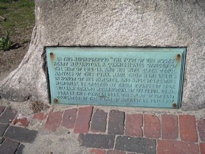
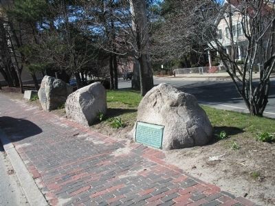
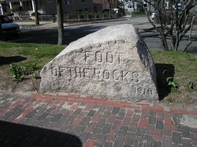
The Foot of the Rocks
Erected 1907 by Town of Arlington.
Topics. This historical marker is listed in these topic lists: Settlements & Settlers • War of 1812. A significant historical year for this entry is 1819.
Location. 42° 25.445′ N, 71° 10.687′ W. Marker is in Arlington, Massachusetts, in Middlesex County. Marker is at the intersection of Massachusetts Avenue and Lowell Street, on the right when traveling west on Massachusetts Avenue. Touch for map. Marker is in this post office area: Arlington MA 02474, United States of America. Touch for directions.
Other nearby markers. At least 8 other markers are within 2 miles of this marker, measured as the crow flies. A different marker also named The Foot of the Rocks (here, next to this marker); Arlington Reservoir (approx. 0.7 miles away); Jason Russell House (approx. 1.2 miles away); House of John Cutter (approx. 1.2 miles away); Robbins Cemetery (approx. 1.3 miles away); Captain Cooke’s Mill Lane (approx. 1.3 miles away); Old Men of Menotomy (approx. 1.4 miles away); Whittemore Park (approx. 1.4 miles away). Touch for a list and map of all markers in Arlington.
Credits. This page was last revised on October 8, 2020. It was originally submitted on May 3, 2009, by Bill Coughlin of Woodland Park, New Jersey. This page has been viewed 1,709 times since then and 38 times this year. Photos: 1, 2, 3. submitted on May 3, 2009, by Bill Coughlin of Woodland Park, New Jersey.


