Mount Adams in Cincinnati in Hamilton County, Ohio — The American Midwest (Great Lakes)
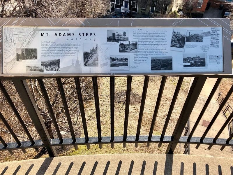
The History Behind the Mt. Adams Steps Pathway
Inscription.
Good Friday Tradition
Beginning in the 1860's, the faithful would climb the Mt. Adams hill to the Holy Cross Immaculate Church (formerly the Church of Immaculate Conception), believing it would be a remembrance of Jesus' ascent of calvary. The pilgrimage began at midnight on Holy Thursday and continues until midnight on Good Friday. A silent prayer is recited on every step, ending atop Mt. Adams at the church. The beginning of this devotion starts at the “Good-Friday Arch” on Adams Crossing (formerly Martin Street), continues across Columbia Parkway, up to Hill Street and to St. Gregory Street.
A little history about Mt. Adams
First named Mt. Ida, the hill was essentially vacant until the 1830's when Nicholas Longworth acquired property on the hill. He planted his vineyards on the hillside and encouraged much of the development on the hill. He donated land for the Cincinnati Observatory, which housed the first telescope to be used by the general public; former President John Quincy Adams dedicated the cornerstone in 1843 and the hill was then named in his honor. The Observatory later moved to Mt. Lookout and the property was used by the Order of Passionist Fathers for the Holy Cross Monastery.
By the late 1800's, Mt. Adams had become a thriving community and the hill became a booming town. The addition of the Mt. Adams Incline helped make it more easily accessible. The Highland House, next to the incline station atop the hill, became a popular and fashionable place to spend the evening. The Art Museum and Art Academy, along with the Rookwood Pottery helped make Mt. Adams a unique and creative community.
Captions
[Left, clockwise from top]
• The faithful kneel to pray at the crucifixion shrine after climbing the steps (ca. 1916)
• “Praying the Steps” (ca. 1916)
[Center, clockwise from top]
• The Cincinnati Observatory (ca. 1844); this site was later used for the Holy Cross Monastery (ca. 1896)
• The Rookwood Pottery came to Mt. Adams in 1880; its artists' pottery became desirable among collectors and homeowners.
[Right, top to bottom]
• The Mt. Adams Incline; travelers were hoisted to the hilltop on an incline plane. At the top, the car would roll directly onto the tracks in the station.
• The Art Museum and the Art Academy in Eden Park (ca. 1904)
Topics. This historical marker is listed in these topic lists: Architecture • Churches & Religion • Settlements & Settlers. A significant historical year for this entry is 1843.
Location. 39° 6.409′ N, 84° 29.802′ W. Marker is in Cincinnati, Ohio, in Hamilton County. It is in Mount
Adams. Marker can be reached from Guido Street south of Pavilion Street when traveling south. Marker is on the top landing of Mt. Adams Steps. Touch for map. Marker is at or near this postal address: 30 Guido St, Cincinnati OH 45202, United States of America. Touch for directions.
Other nearby markers. At least 8 other markers are within walking distance of this marker. The "Church of the Steps" (Immaculata), (a few steps from this marker); Mt. Adams (about 400 feet away, measured in a direct line); a different marker also named Mt. Adams (approx. 0.2 miles away); a different marker also named The History Behind the Mt. Adams Steps Pathway (approx. 0.2 miles away); Ida Street Bridge (approx. ¼ mile away); Mt. Adams Pilgrim Chapel (approx. ¼ mile away); Ohio’s First Publicly Owned Water System (approx. 0.3 miles away); Cornelia C. Davis (approx. 0.4 miles away). Touch for a list and map of all markers in Cincinnati.
Credits. This page was last revised on February 4, 2023. It was originally submitted on December 1, 2021, by Duane and Tracy Marsteller of Murfreesboro, Tennessee. This page has been viewed 425 times since then and 62 times this year. Photos: 1, 2. submitted on December 1, 2021, by Duane and Tracy Marsteller of Murfreesboro, Tennessee.

