Covington in Kenton County, Kentucky — The American South (East South Central)
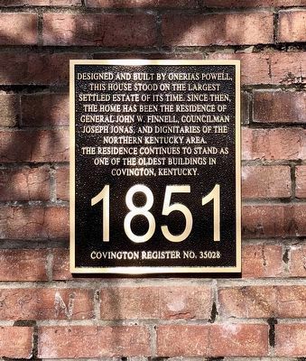
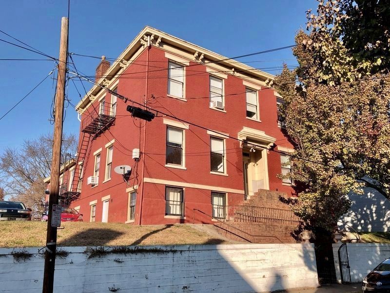
Onerias Powell House
Covington Register No. 35028
Topics. This historical marker is listed in these topic lists: Architecture • Settlements & Settlers. A significant historical year for this entry is 1851.
Location. 39° 4.842′ N, 84° 31.098′ W. Marker is in Covington, Kentucky, in Kenton County. Marker is on Emma Street west of Main Street (U.S. 25/42), on the right when traveling west. Touch for map. Marker is at or near this postal address: 416 Emma St, Covington KY 41011, United States of America. Touch for directions.
Other nearby markers. At least 8 other markers are within walking distance of this marker. Fire Engine Company 4 (within shouting distance of this marker); Grace United Methodist Church (about 600 feet away, measured in a direct line); Built by John B. Kohls (approx. 0.2 miles away); Formerly Bremen Street (approx. 0.2 miles away); Casper Ottens House (approx. ¼ mile away); John G. Carlisle (approx. ¼ mile away); Slave Escape / Controversial Judgment (approx. ¼ mile away); Major League Baseball (approx. ¼ mile away). Touch for a list and map of all markers in Covington.
Regarding Onerias Powell House. According to the Kenton County Historical society, Onerias Powell was the original surveyor of Covington in 1815. He and his brother Abraham also were large landholders in the area at the time.
Credits. This page was last revised on December 4, 2021. It was originally submitted on December 3, 2021, by Duane and Tracy Marsteller of Murfreesboro, Tennessee. This page has been viewed 175 times since then and 30 times this year. Photos: 1, 2. submitted on December 3, 2021, by Duane and Tracy Marsteller of Murfreesboro, Tennessee.

