Pátzcuaro, Michoacán, Mexico — The Pacific Coast (and Central Highlands)
Pátzcuaro's Spring
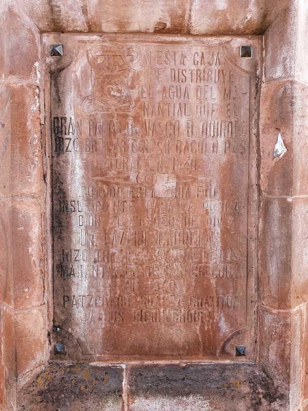
Cuando esta agua fue insuficiente para la población el Sr. Gen. de Div. Dn. Lazaro Cardenas hizo traer caudales de los manantiales de San Gregorio en 1940.
Patzcuaro guarda gratitud a sus bienhechores.
In this box is distributed the water of the spring that the great Father Vasco de Quiroga made to burst forth with his pastoral staff in 1540.
When this water was insufficient for the population, General Lazaro Cardenas had additional water brought from the springs of San Gregorio in 1940.
Pátzcuaro is grateful to its benefactors.
Topics. This historical marker is listed in these topic lists: Industry & Commerce • Settlements & Settlers. A significant historical year for this entry is 1540.
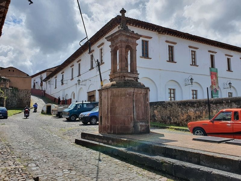
Location. 19° 30.812′ N, 101° 36.431′ W. Marker is in Pátzcuaro, Michoacán. Marker is at the intersection of Alcantarilla and Arciga, in the median on Alcantarilla. Touch for map. Marker is in this post office area: Pátzcuaro MIC 61600, Mexico. Touch for directions.
Other nearby markers. At least 8 other markers are within walking distance of this marker. Founding of the Royal College of San Nicolás Obispo (a few steps from this marker); Centro Cultural Antiguo Colegio Jesuita (within shouting distance of this marker); Consecration of Michoacán's First Cathedral Altar (within shouting distance of this marker); 400th Anniversary of the Death of Vasco de Quiroga (within shouting distance of this marker); Palacio Huitzimengari / Casa de las Artesanías (about 150 meters away, measured in a direct line); Basilica de la Salud (about 180 meters away); La Casa del Naranjo (about 180 meters away); Basílica de Nuestra Señora de la Salud (about 180 meters away). Touch for a list and map of all markers in Pátzcuaro.
Credits. This page was last revised on December 4, 2021. It was originally submitted on December 4, 2021, by J. Makali Bruton of Accra, Ghana. This page has been viewed 50 times since then and 4 times this year. Photos: 1, 2, 3, 4. submitted on December 4, 2021, by J. Makali Bruton of Accra, Ghana.


