Ladysmith in Cowichan Valley, British Columbia — Canada’s West Coast (North America)
Ladysmith

B.C. Ministry of Transportation and Infrastructure via Flickr (CC BY-NC-ND 2.0), June 15, 2016
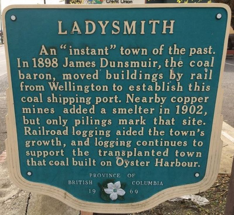
1. Ladysmith Marker
Erected 1969 by Province of British Columbia.
Topics. This historical marker is listed in these topic lists: Industry & Commerce • Settlements & Settlers. A significant historical year for this entry is 1898.
Location. 48° 59.547′ N, 123° 48.984′ W. Marker is in Ladysmith, British Columbia, in Cowichan Valley. Marker is at the intersection of 1st Avenue and Roberts Street, on the right when traveling south on 1st Avenue. Touch for map. Marker is at or near this postal address: 330 1st Ave, Ladysmith BC V9G V9G, Canada. Touch for directions.
Other nearby markers. At least 4 other markers are within 23 kilometers of this marker, measured as the crow flies. The 49th Parallel (approx. 0.8 kilometers away); Harry Manson (approx. 20.2 kilometers away); No. 1 Mine (approx. 21.1 kilometers away); Incredible Forests (approx. 22.5 kilometers away).
Also see . . . History — Heritage. History of the area, from the original inhabitants (the Stz’uminus First Nation people) to its reputation today as a progressive town. (Town of Ladysmith) (Submitted on February 22, 2022, by Duane and Tracy Marsteller of Murfreesboro, Tennessee.)
Credits. This page was last revised on February 22, 2022. It was originally submitted on December 10, 2021, by Duane and Tracy Marsteller of Murfreesboro, Tennessee. This page has been viewed 77 times since then and 10 times this year. Photos: 1. submitted on December 10, 2021, by Duane and Tracy Marsteller of Murfreesboro, Tennessee. 2. submitted on February 22, 2022, by Duane and Tracy Marsteller of Murfreesboro, Tennessee.
Editor’s want-list for this marker. Wide shot of marker and surrounding area in context. • Can you help?
