Hedley in Okanagan-Similkameen, British Columbia — Canada’s West Coast (North America)
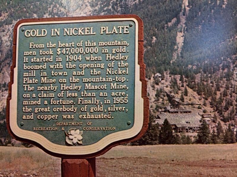
Gold in Nickel Plate

B.C. Ministry of Transportation and Infrastructure via Flickr (CC BY-NC-ND 2.0)
1. Gold in Nickel Plate Marker
Marker is shown at a previous location. It now is mounted on an outside wall of the Hedley Museum & Tourist Booth entrance.
Erected by British Columbia Department of Recreation and Conservation.
Topics. This historical marker is listed in this topic list: Industry & Commerce. A significant historical year for this entry is 1904.
Location. 49° 21.383′ N, 120° 4.674′ W. Marker is in Hedley, British Columbia, in Okanagan-Similkameen. Marker is on Daly Avenue north of Haynes Street, on the left when traveling north. Marker is affixed to the wall at the Hedley Museum & Tourist Booth entrance. Touch for map. Marker is at or near this postal address: 712 Daly Ave, Hedley BC V0X 1K0, Canada. Touch for directions.
Other nearby markers. At least 1 other marker is within 23 kilometers of this marker, measured as the crow flies. An American Railroad (approx. 21.2 kilometers away).
Also see . . . Hedley Mascot Mine. Wikipedia entry on the mine, whose founder took the unusual step of staking a vertical claim. (Submitted on December 12, 2021, by Duane and Tracy Marsteller of Murfreesboro, Tennessee.)
Credits. This page was last revised on February 11, 2022. It was originally submitted on December 10, 2021, by Duane and Tracy Marsteller of Murfreesboro, Tennessee. This page has been viewed 97 times since then and 13 times this year. Photo 1. submitted on December 10, 2021, by Duane and Tracy Marsteller of Murfreesboro, Tennessee.
Editor’s want-list for this marker. Closeup and wide-area photos of relocated marker. Confirm GPS coordinates. • Can you help?