Colleen in Nelson County, Virginia — The American South (Mid-Atlantic)
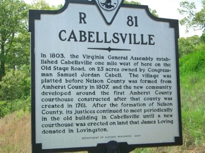
Cabellsville
Erected 2004 by Department of Historic Resources. (Marker Number R-81.)
Topics and series. This historical marker is listed in this topic list: Settlements & Settlers. In addition, it is included in the Virginia Department of Historic Resources (DHR) series list. A significant historical year for this entry is 1803.
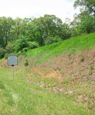
Location. 37° 42.323′ N, 78° 56.329′ W. Marker is in Colleen, Virginia, in Nelson County. Marker is at the intersection of Thomas Nelson Hwy (Virginia Route 29) and Cooperative Way, on the right when traveling south on Thomas Nelson Hwy. Touch for map. Marker is in this post office area: Arrington VA 22922, United States of America. Touch for directions.
Other nearby markers. At least 8 other markers are within 5 miles of this marker, measured as the crow flies. Jimmy Fortune (approx. 1.6 miles away); Earl Henry Hamner, Jr. (approx. 1.6 miles away); Birthplace of Rives (approx. 1.8 miles away); Oak Ridge Estate (approx. 1.8 miles away); The Rivers (approx. 2.9 miles away); Action at Tye River (approx. 3.7 miles away); The Scale House (approx. 3.8 miles away); Hurricane Camille (approx. 4.2 miles away).
Also see . . . A Report Done by a Sixth Grader. In her research she found that the county seat was at one time located in Cabellsville. (Submitted on May 14, 2009, by Syd Whittle of Mesa, Arizona.)
Credits. This page was last revised on December 25, 2019. It was originally submitted on May 11, 2009, by Kathy Walker of Stafford, Virginia. This page has been viewed 1,479 times since then and 89 times this year. Photos: 1, 2. submitted on May 11, 2009, by Kathy Walker of Stafford, Virginia. • Syd Whittle was the editor who published this page.

