Jocotitlán, Mexico State, Mexico — The Central Highlands (North America)
Founding and First Government of Xocotitlán
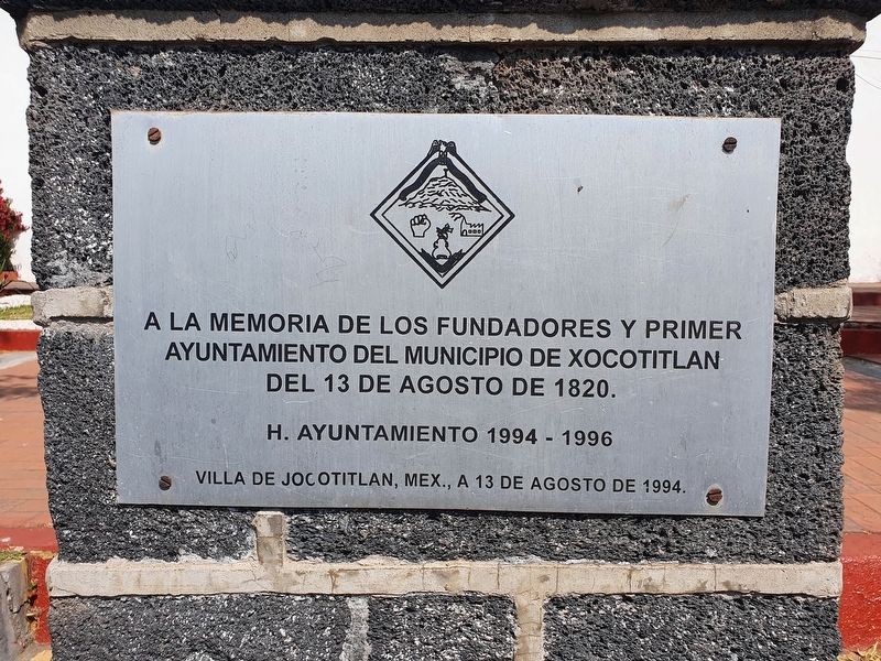
Inscription.
H. Ayuntamiento 1994-1996
Villa de Jocotitlán, Mex., a 13 de agosto de 1994.
To the memory of the founders and first government of the municipality of Xocotitlán on August 13, 1820.
Honorable City Council 1994-1996
Villa de Jocotitlán, México, August 13, 1994.
Erected 1994 by Honorable Ayuntamiento de Jocotitlán.
Topics. This historical marker is listed in this topic list: Settlements & Settlers. A significant historical date for this entry is August 13, 1820.
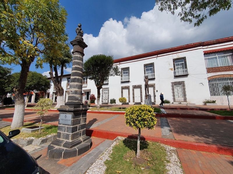
Location. 19° 42.701′ N, 99° 47.15′ W. Marker is in Jocotitlán, Estado de Mexico (Mexico State). Marker is on Constituyentes, on the left when traveling east. The marker is near the Palacio Municipal of Jocotitlán. Touch for map. Marker is in this post office area: Jocotitlán MEX 50700, Mexico. Touch for directions.
Other nearby markers. At least 8 other markers are within 14 kilometers of this marker, measured as the crow flies. Bicentennial of the Battle of Xocotitlán (a few steps from this marker); International Day of the Police (within shouting distance of this marker); Parish of Jesús Nazareno (within shouting distance of this marker); María Gloria Concepción Arce Chimal (about 90 meters away, measured in a direct line); Battle of Jocotitlán (about 90 meters away); Miguel Hidalgo y Costilla (about 120 meters away); Parish Church of Santiago Acotzilapan (approx. 9.2 kilometers away); The Sanctuary of the Señor del Huerto (approx. 13.3 kilometers away). Touch for a list and map of all markers in Jocotitlán.
Credits. This page was last revised on December 28, 2021. It was originally submitted on December 28, 2021, by J. Makali Bruton of Accra, Ghana. This page has been viewed 93 times since then and 7 times this year. Photos: 1, 2, 3. submitted on December 28, 2021, by J. Makali Bruton of Accra, Ghana.


