Tustin in Orange County, California — The American West (Pacific Coastal)
Marine Corps Air Station Tustin
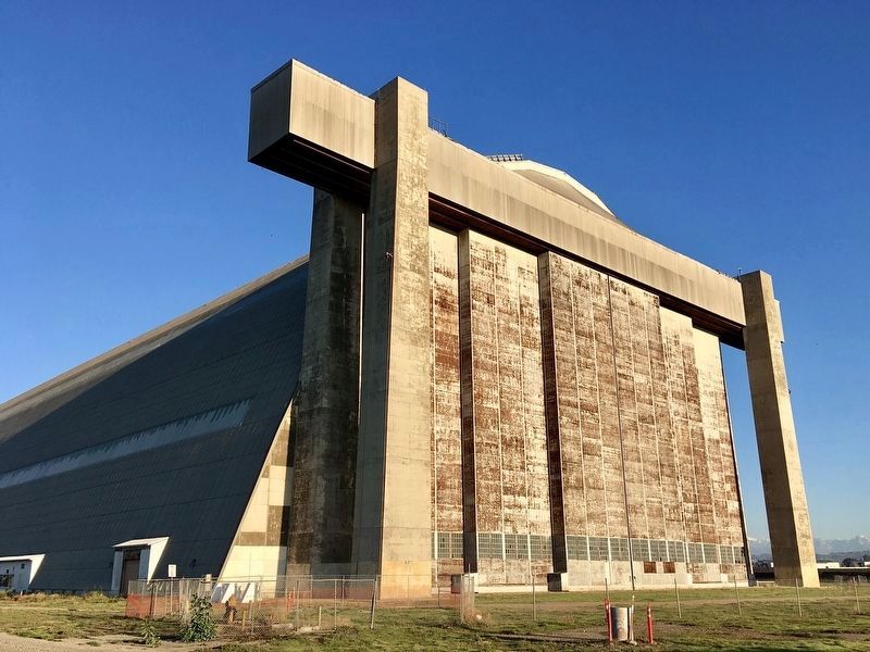
Blimp Hangars
History of the Air Base from 1942 to 1949
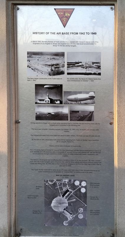
In March 1942, the Navy Bureau of Yards and Docks contracted with Holmes & Narver Consulting Engineers of Los Angeles to design and engineer an LTA base that would accommodate the design for the two airship hangars. The Navy began construction of the Tustin base on April 1, 1942. Six months later, the Naval Air Station Santa Ana was commissioned on October 1, 1942. Airship operations began with a single blimp operating from a concrete mat and mooring mast until the hangars were completed in the following year. The base was complete, including hangars, by October 20, 1943, only 18 months and 25 days after starting. The original estimated cost of the base was about 8 million dollars. The final cost was $10,062,482.08. By the end of 1942, there were 12 K-Class blimps operating from Tustin as Airship Patrol Squadron ZP-31 (Zepplin Patrol 31). Airship patrols were conducted 24 hours a day.
The LTA airship fleet performed far beyond the War Department and the Navy's expectations in terms of both reliability and effectiveness - with a remarkable 87 percent "on-line and operational" rate and 89,000 escort missions through submarine-infested waters for ships loaded with troops, equipment, and supplies. The Navy's LTA program was so effective that it became a victim of its own success. By 1944, just two years after the Tustin hangars were completed, the need for blimp patrols and escort missions along both coasts was fading fast. In 1943, the number of sinkings dropped to 65 from the 1942 high of 454, then to just eight in 1944. The Tustin facility continued to serve as an LTA base until 1949, when it was decommissioned as an active installation and designated an "outlying field" for military units in the area.
Beginnings of the Base
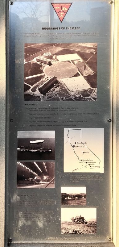
In 1942, shortly after the start of World War II, the War Department (renamed the Department of Defense) sought locations for Lighter-Than-Air (LTA) squadrons (a.k.a. blimps) around the country as a means of protecting the nation's coasts.
Why Blimps?
Blimps had many capabilities which particularly fit them to observation work: They traveled slowly and were able to hover in one spot indefinitely. They could remain out on a mission for 24 hours at a time at a range of 500 miles without refueling. They were practically soundless. They could travel at a low enough height so as not to be picked up by enemy radar. They could take on fuel, supplies, and personnel from ships at sea.
Why Orange County?
Orange County was selected as the area to house and maintain blimps intended to patrol for enemy submarines along the southern California coast from San Diego to Santa Barbara.
In 1941, the Navy negotiated with James Irvine for his vast lima bean field, bordered on one side by the city of Santa Ana and on the other by the city of Tustin. James Irvine was offered, and finally accepted, $100,000 for the Tustin site as well as the El Toro site, the equivalent of about $20 per acre.
Building the Hangars
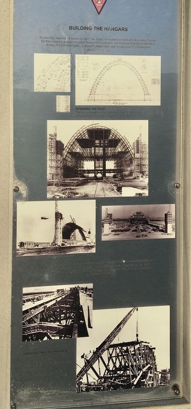
To meet the challenge of designing two of the largest structures ever built almost entirely of wood, the Navy chose designer-engineer Arsham Amirikian who was Principal Engineer of the Navy Bureau of Yards and Docks. Amirikian's design was used to construct 17 LTA hangars around the country.
Designing the Roof
The roof is designed in a "Catenary" form (a term in physics that describes the distinct "half-eggshell” shape of the hangars).
The final design for the hangars was completed in the fall of 1942. Construction began on Hangar 1, also called Building 28, in October 1942, and was completed in July 1943. Construction on Hangar 2, or Building 29, beginning in December 1942, and was completed it in September 1943.
Constructing the Hangars
The hangars were built by James I. Barnes Construction Company of Los Angeles. To build these structures it took: 2,719,000 board feet of lumber. 79 tons of bolts and washers. 30 tons of ring connectors. 33 tons of structural steel.
Naval Air Station / MCAS Tustin Fun Facts
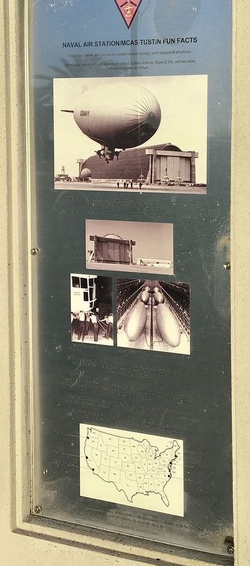
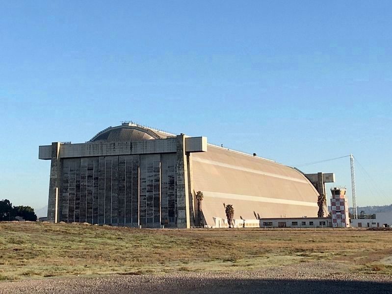
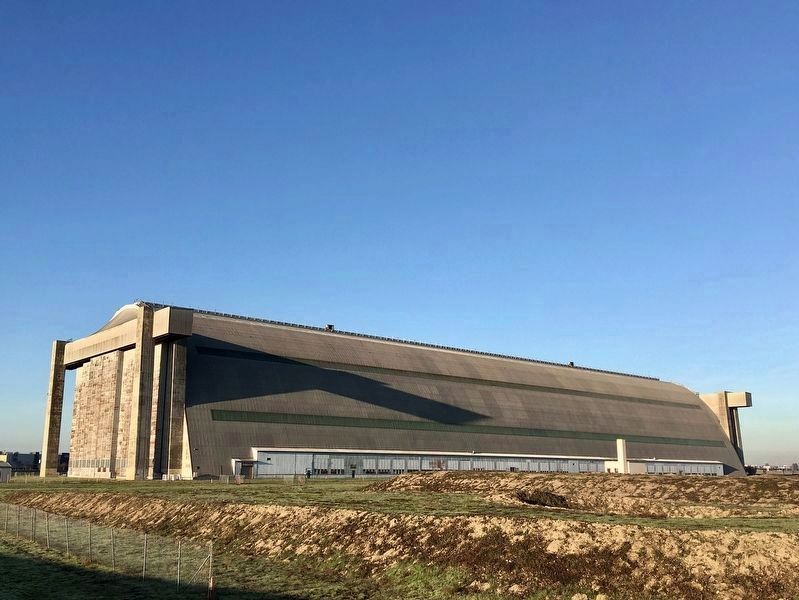
The hangars were and still are the world's largest wooden-arch-supported structures. The hangars were built to harbor helium-filled Lighter-Than-Air Ships (LTA), more commonly known as blimps.
Blimps performed valuable missions including anti-submarine missions to patrol for enemy submarines along the southern California coast. Each hangar was capable of sheltering six airships - an entire squadron of Navy K-Class blimps.
Each hangar is approximately 1,072 feet long, 192 feet high, and 292 feet wide and cover almost 6.8 acres. The hangars are as high as a 17-story building and longer than three consecutive football fields.
Due to their immense size, the doors should be kept open in hot weather; otherwise, atmospheric conditions ensue. The hot air rises to the top of the hangars, condenses, and forms clouds, and then rain falls - all on the inside.
The Tustin LTA facility was the fourth in the Navy's sequence of 17 timber hangars, after Lakehurst, New Jersey, Elizabeth City, North Carolina, and South Weymouth, Massachusetts.
Only seven hangars remain today: two in Tustin, two in Lakehurst, New Jersey, two in Moffett Field near Sunnyvale, California, and one in Tillamook, Oregon.
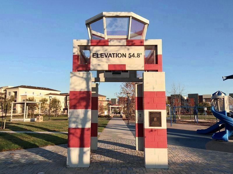
The numbers shown on the "runway" in this garden reflect the numbers that were on the air base runway and are actually points of the compass.
Structures of the Hangars
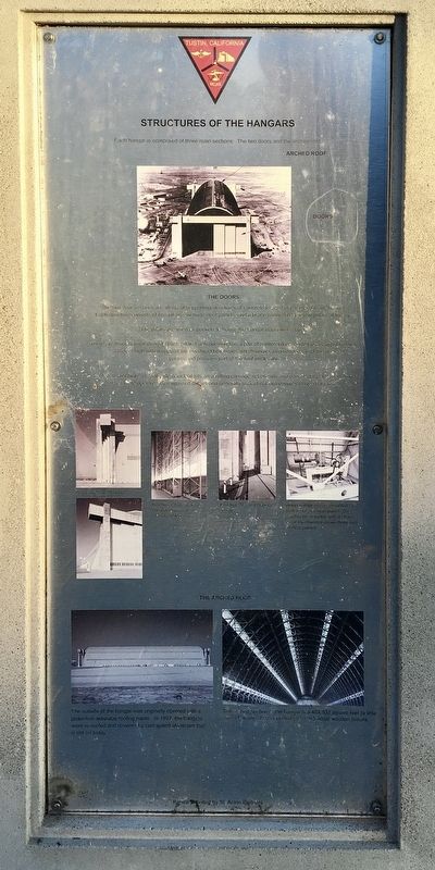
Each hangar is comprised of three main sections: The two doors and the arched roof.
The Doors:
The two door sections are identical supporting structures of concrete located at each end of the hangar. Each structure consists of two pillars, six huge door panels, and a brace connecting the two pillars at the top. The pillars are used as pockets to house the hangar doors when open. There are three hangar doors in each pillar. Each opening has a pair of reinforced concrete towers approximately 145 feet high which support the overhead box beam, which serves to guide the top of the door panels and provides part of the roof enclosure. Each 120-foot high, 37-foot wide door leaf sits on a rolling carriage set on rails and operated by electric motors. They are operated by motorized cables and generally took about two minutes to open and close.
The outside of the hangar was originally constructed with protective asbestos roofing paper. In 1957, the hangars were re-roofed and covered with corrugated aluminum that is still on today.
Inside and Outside the Hangars
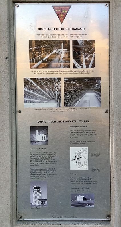
The foundations for each hangar consist of some 1,600 poured-concrete piles, 48-feet deep for Hangar No. 1 and 65-feet deep for Hangar No. 2. The hangar floors consist of several un-reinforced concrete slabs, approximately five inches thick. Each slab is approximately 400 square feet and was poured in a checkerboard pattern. The overall floor area in each hangar is approximately 296,000 square feet, or 6.8 acres. That is the size of about six football fields.
Support Buildings and Structures
Mooring Mats and Masts
Each circular mooring mat was made of concrete and measured approximately 600 feet in diameter. Mooring mats 1, 2, and 3 were the first mats built adjacent to Hangar 1. Mooring Mats 4, 5, and 6 were situated to the east of Hangar 2.
Helium Tank Buildings
Each helium tank building is a one story, 941-square foot concrete structure 30 feet long, 30 feet wide, and 30 feet high. They also have a 6-foot by 6-foot concrete chimney that is about 46 feet tall. Each building had two 12-foot metal roll doors on the wall nearest the hangar beside them.
These buildings produced helium that was delivered to the hangars through a system of underground pipes. The helium tanks themselves were encased in concrete to counteract the upward force of the gas inside them.
Runways
In its conversion to Marine Corps Air Facility (MCAF) Santa Ana for the Korean War in 1951, two paved runways were built over the primary mooring mat: Runway 6/24 - 3,000 feet long. Runway 16/34 - 2,000 feet long.
K-Class Blimp
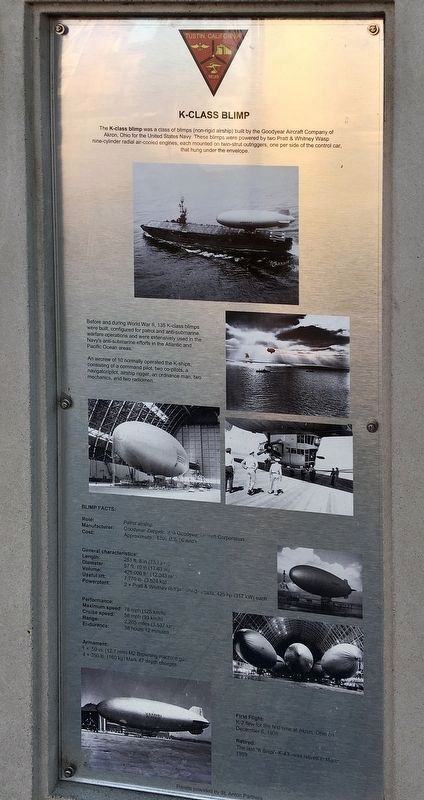
The K-class blimp was a class of blimps (non-rigid airship) built by the Goodyear Aircraft Company of Akron, Ohio for the United States Navy. These blimps were powered by two Pratt & Whitney Wasp nine-cylinder radial air-cooled engines, each mounted on twin-strut outriggers, one per side of the control cab, that hung under the envelope.
Before and during World War II, 135 K-class blimps were built, configured for patrol and anti-submarine warfare operations and were extensively used in the Navy's anti-submarine efforts in the Atlantic and Pacific Ocean areas. An aircrew of 10 normally operated the K-ships, consisting of a command pilot, two co-pilots, a navigator/pilot, airship rigger, an ordnance man, two mechanics, and two radiomen.
Blimp Facts:
Role: Patrol airship. Manufacturer: Goodyear-Zeppelin and Goodyear Aircraft Corporation. Cost: Approximately $300,000 each.
General characteristics:
Length: 251 ft. 8 in (76.73 m). Diameter: 57 ft 10 in (17.63 m). Volume: 425,000 cu ft (12,043 cu m). Useful lift: 7,770 lb (3,524 kg). Powerplant: 2 x Pratt & Whitney R-1340 radials, 425 hp (317 kW) each.
Performance:
Maximum speed: 78 mph (125 km/h), Cruise speed: 58 mph (93 km/h), Range: 2,205 miles (3,537 km), Endurance: 38 hours 12 minutes.
Armament: 1 x .50 in. (12.7 mm) M2 Browning machine gun, 4 x 350 lb.(160 kg) Mark 47 depth charges.
First Flight: K-2 flew for the first time at Akron, Ohio on December 6, 1938. Retired: The last “K Ship” -- K-43 -- was retired in March 1959.
Tustin Air Base After WWII
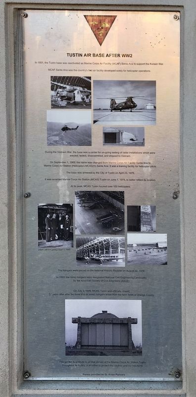
In 1951, the Tustin base was reactivated as Marine Corps Air Facility (MCAF) Santa Ana to support the Korean War. MCAF Santa Ana was the country's first air facility developed solely for helicopter operations.
During the Vietnam War, the base was a center for on-going testing of radar installations which were erected, tested, disassembled, and shipped to Vietnam.
On September 1, 1969, the name was changed from Marine Corps Air Facility Santa Ana to Marine Corps Air Station (Helicopter) - MCAS(H) Santa Ana. It was a training facility for helicopter pilots.
The base was annexed by the City of Tustin on April 23, 1976. It was renamed Marine Corps Air Station (MCAS) Tustin on June 1, 1978, to better reflect its location. At its peak, MCAS Tustin housed over 100 helicopters.
The hangars were placed on the National Historic Register on August 22, 1978. In 1993, the blimp hangars were designated National Civil Engineering Landmarks by the American Society of Civil Engineers (ASCE).
On July 3, 1999, MCAS Tustin was officially closed, 57 years after the base and its iconic hangars arose from the farm fields of Orange County.
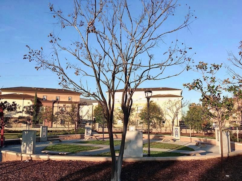
This garden is a tribute to all that served at the Marine Corps Air Station throughout its history in order to protect this country and our freedoms.
Erected 2015 by Anton Development Company.
Topics and series. This historical marker is listed in these topic lists: Air & Space • Architecture • War, World II. In addition, it is included in the ASCE Civil Engineering Landmarks, and the National Register of Historic Places series lists. A significant historical year for this entry is 1942.
Location. 33° 42.173′ N, 117° 49.11′ W. Marker is in Tustin, California, in Orange County. Marker is at the intersection of Park Avenue and Victory Road, on the right when traveling south on Park Avenue. Located in Victory Park, ⅓-mile east of the Tustin Blimp Hangars. Touch for map. Marker is at or near this postal address: 3300 Park Ave, Tustin CA 92782, United States of America. Touch for directions.
Other nearby markers. At least 8 other markers are within 3 miles of this marker, measured as the crow flies. Cogan House (approx. 2.7 miles away); Myford's New Garage (approx. 2.7 miles away); Katie Wheeler Library (approx. 2.7 miles away);
Stagecoach Stop (approx. 2.7 miles away); The Bath House (approx. 2.7 miles away); Columbus Tustin (approx. 2.7 miles away); Living and Working on the Irvine Ranch (approx. 2.7 miles away); The Bunkhouse (approx. 2.7 miles away). Touch for a list and map of all markers in Tustin.
Regarding Marine Corps Air Station Tustin. On November 7, 2023, Hangar 1 (the North Hangar) was destroyed by a fire. It was already in poor condition and planned for demolition. Hangar 2 will be preserved and might be developed as a public indoor sports facility.
Also see . . . Tustin Blimp Hangars. City website includes a 79-page document with 60 photographs. (Submitted on January 12, 2022.)
Credits. This page was last revised on January 14, 2024. It was originally submitted on January 12, 2022, by Craig Baker of Sylmar, California. This page has been viewed 3,154 times since then and 149 times this year. Photos: 1, 2, 3, 4, 5, 6, 7, 8, 9, 10, 11, 12, 13. submitted on January 12, 2022, by Craig Baker of Sylmar, California. 14. submitted on November 7, 2023, by Craig Baker of Sylmar, California.
