Groton in New London County, Connecticut — The American Northeast (New England)
The Construction of Fort Griswold
Stabilization and Preservation of Fort Griswold
— Phase 1 —
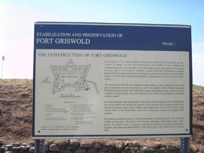
In November 1775, Colonel Jedeiah Elderkin was directed by the Governor and the Council of Safety “to view the circumstances of the harbor at New London and neighboring places, and consider of the most proper place and manner of fortifying the same against our enemies.” Elderkin recommended the fortification of several places in New London and Groton including the summit of the hill on Groton Heights where, “It seems nature had prepared a place to plant cannon for the protection of the harbor.”
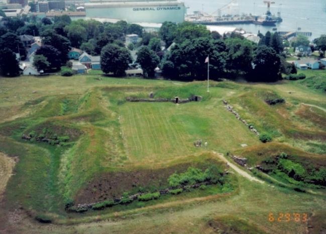
The river-side of the fort was designed so that artillery could command the river and port. It featured two projecting bastions and a low parapet, which offered maximum flexibility in directing the fire of the fort’s cannon. The landward side of the fort, which consisted of high parapet walls and embrasures for cannon, was designed to withstand infantry assault.
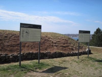
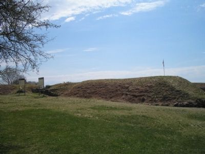
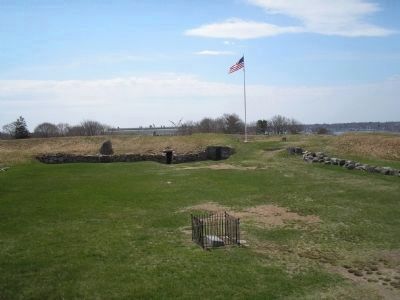
Fort Griswold ranks among the nation’s best-preserved Revolutionary War fortifications. Surviving earthworks include the remains of the ramparts and the parapets of the fort. Wooden platforms, upon which infantry and cannon once stood, were located on the interior faces of the earthworks. Over time, erosion has reduced the height of the parapets.
The phased stabilization project currently underway will help to preserve the fort from further deterioration. The project will include rebuilding deteriorating stone walls, growth of a dense cover of grasses to prevent soil erosion, a long-term maintenance program, and enhancing interpretation of the fort as part of the Thames River Heritage Park.
Topics. This historical marker is listed in these topic lists: Forts and Castles • War, US Revolutionary. A significant historical month for this entry is November 1775.
Location. 41° 21.267′ N, 72° 4.802′ W. Marker is in Groton, Connecticut, in New London County. Marker is on Monument Street, on the left when traveling west. Touch for map. Marker is in this post office area: Groton CT 06340, United States of America. Touch for directions.
Other nearby markers. At least 8 other markers are within walking distance of this marker. The Battle of Groton Heights (here, next to this marker); Defenders of Fort Griswold • Sept • 6th 1781 • (within shouting distance of this marker); Col. William Ledyard (within shouting distance of this marker); Spanish Flagship Gun (within shouting distance of this marker); Groton Battle Monument (within shouting distance of this marker); Death of Major William Montgomery (about 300 feet away, measured in a direct line); Covered Way (about 300 feet away); Ye Ebenezer Avery House (about 400 feet away). Touch for a list and map of all markers in Groton.
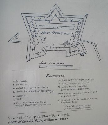
More about this marker. The left side of the marker contains a “Version
of a 1781 British Plan of Fort Griswold. (Battle of Groton Heights, by William W. Harris)”. Indicated on the diagram are the Magazine, Sallee-Port, a ditch leading to a battery below, the Embrazine where Maj. Montgomery fell, Barracks, Well, Points where the Light Company of Grenadiers of the 40th entered, Guns that much annoyed the British troops, Ravelin that covered the gate, a Rock not cut away which gives an entrance into the work, the fraized works, and a curtain to the angle that forms a barbette battery.
Credits. This page was last revised on February 10, 2023. It was originally submitted on May 16, 2009, by Bill Coughlin of Woodland Park, New Jersey. This page has been viewed 1,777 times since then and 22 times this year. Photos: 1, 2, 3, 4, 5. submitted on May 16, 2009, by Bill Coughlin of Woodland Park, New Jersey. 6. submitted on July 24, 2009, by Bill Coughlin of Woodland Park, New Jersey.
