Griffin in Spalding County, Georgia — The American South (South Atlantic)
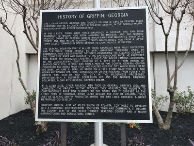
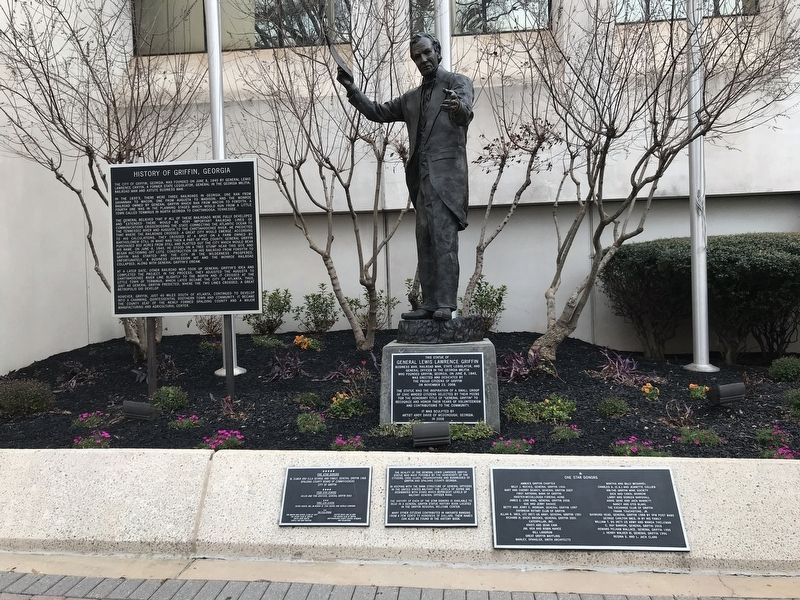
History of Griffin, Georgia
In the 1830's, there were three railroads in Georgia. One ran from Savannah to Macon, one from Augusta to Madison, and the Monroe Railroad owned by General Griffin which ran from Macon to Forsyth. A fourth one was in the planning stages which would run from a little town called Terminus in north Georgia to Chattanooga, Tennessee.
The general believed that if all of these railroads were fully developed and extended there would be very important railroad lines of communications crisscrossing the state connecting the Atlantic Ocean to the Tennessee River and Augusta to the Chattahoochee River. He predicted that where the railroads crossed, a great city would emerge. According to his calculations, they crossed at a spot on a farm owned by Bartholomew Still in what was then a part of Pike County. General Griffin purchased 800 acres from Still and platted out the city which would bear his name. On June 8, 1840, he stood on a tree stump near this site and began auctioning off lots. Construction on his railroad from Forsyth to Griffin was started and the city in the wilderness prospered. Unfortunately, a business depression hit and the Monroe Railroad collapsed, along with General Griffin's dream.
At a later date, other railroad men took up General Griffin's idea and completed the project. In the process, they adjusted the Augusta to Chattahoochee River line slightly to the north and it crossed at the little town of Terminus, which later became the city of Atlanta. Thus, just as General Griffin predicted, where the two lines crossed, a great metropolis did develop.
However, Griffin, just 40 miles south of Atlanta, continued to develop into a charming, quintessential Southern town and community. It became the county seat of the newly formed Spalding County and a major manufacturing and agricultural center.
Topics. This historical marker is listed in these topic lists: Railroads & Streetcars • Settlements & Settlers. A significant historical date for this entry is June 8, 1840.
Location. 33° 14.9′ N, 84° 15.819′ W. Marker is in Griffin, Georgia, in Spalding County. Marker is at the intersection of South Hill Street (Georgia Route 155) and East Solomon Street, on the right when traveling north on South Hill Street. Marker is in front of Griffin's city hall and administrative center. Touch for map. Marker is at or near this postal address: 100 S Hill St, Griffin GA 30223, United States of America. Touch for directions.
Other nearby markers. At least 8 other markers are within walking distance of this marker. Pvt. Alvertis Smith (here, next to this marker); P.F.C. Bobby L. Byars (a few steps from
this marker); P.F.C. James T. Coggins (a few steps from this marker); Pfc. W.T. Akins (a few steps from this marker); Pvt. James Touchstone (within shouting distance of this marker); P.F.C. Monte C. Kinasz (within shouting distance of this marker); Pvt. Cecil R. Moon (within shouting distance of this marker); Sgt. E.S. Wadsworth (within shouting distance of this marker). Touch for a list and map of all markers in Griffin.
Credits. This page was last revised on January 18, 2022. It was originally submitted on January 16, 2022, by Duane and Tracy Marsteller of Murfreesboro, Tennessee. This page has been viewed 248 times since then and 58 times this year. Photos: 1, 2. submitted on January 16, 2022, by Duane and Tracy Marsteller of Murfreesboro, Tennessee.

