Wilkes-Barre in Luzerne County, Pennsylvania — The American Northeast (Mid-Atlantic)
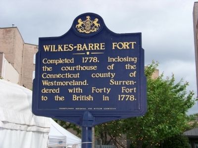
Wilkes-Barre Fort
Erected 1947 by Pennsylvania Historical and Museum Commission.
Topics and series. This historical marker is listed in these topic lists: Forts and Castles • Military • Notable Places • War, US Revolutionary. In addition, it is included in the Pennsylvania Historical and Museum Commission series list. A significant historical year for this entry is 1778.
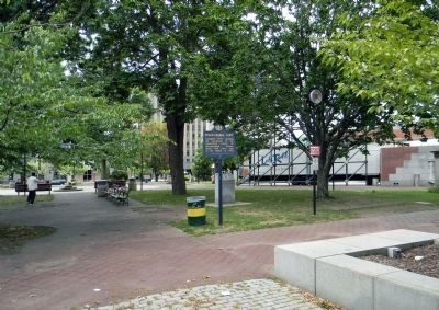
Location. 41° 14.778′ N, 75° 52.903′ W. Marker is in Wilkes-Barre, Pennsylvania, in Luzerne County. Marker is on Public Square. Public Square is off of Main and Market Streets. Touch for map. Marker is in this post office area: Wilkes Barre PA 18702, United States of America. Touch for directions.
Other nearby markers. At least 8 other markers are within walking distance of this marker. Fort Wilkes Barre 1778 (within shouting distance of this marker); Public Square Park (within shouting distance of this marker); The Birthplace of HBO (within shouting distance of this marker); America's First Jazz Festival (within shouting distance of this marker); Birthplace of the AIME (within shouting distance of this marker); The Fine Arts Fiesta (within shouting distance of this marker); 4th-5th-7th-8th Wards WWII Honor Roll (within shouting distance of this marker); William G. McGowan (within shouting distance of this marker). Touch for a list and map of all markers in Wilkes-Barre.
Also see . . . MarkerQuest - Wilkes-Barre Fort. A history of the fort and why it existed in the first place.
Excerpt: Why would Pennsylvania have had a fort which protected the courthouse of a county in Connecticut? On what map does that make any kind of sense?(Submitted on November 3, 2021, by Laura Klotz of Northampton, Pennsylvania.)
Credits. This page was last revised on November 3, 2021. It was originally submitted on May 17, 2009, by Michael Beatty of Hanover Township, Pennsylvania. This page has been viewed 1,500 times since then and 61 times this year. Photos: 1. submitted on May 17, 2009, by Michael Beatty of Hanover Township, Pennsylvania. 2. submitted on August 7, 2013, by PaulwC3 of Northern, Virginia. • Syd Whittle was the editor who published this page.

