Searcy in Butler County, Alabama — The American South (East South Central)
Searcy School House ⎯⎯⎯ Searcy Community
Photographed by Mark Hilton, February 6, 2022
1. Searcy School House Marker
Inscription.
Searcy School House was built in 1922, six miles north of Greenville,
Alabama. This historic building is one of the few original wood-frame
school houses remaining in Butler County. Considered state of the art
for its day, it was built by men of the community to replace an
earlier school that was consolidated with two other schools. Fondly
called the “Little Red School House," Searcy's original one-room school
was established by Professor Isaac Ernest Ward in 1885. Ward
(1861-1929) was a revered educator and community leader. He served
as County Superintendent of Education, 1890-1898, and was principal
of Searcy School for many years. His high educational standards
made Searcy one of the best rural schools in Butler County. The
school was the heart of the community, a focal point for literary and
musical events, spelling bees, speaking and debating events, plays,
parties and holiday programs. The school closed in 1949 due to
dwindling student population. The school house was acquired by the
Searcy Homemakers Club, who maintain it today for club activities.
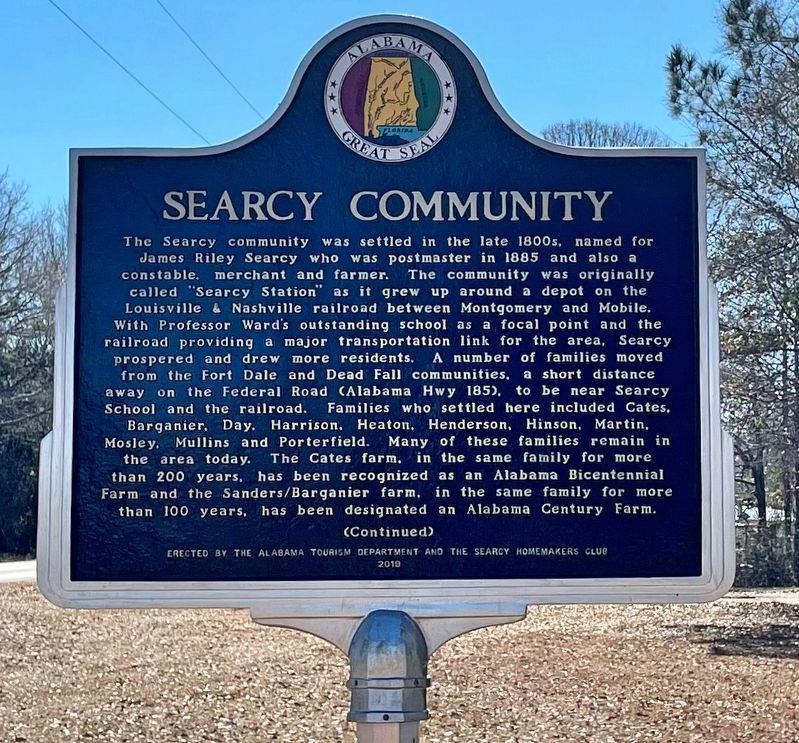
The Searcy community was settled in the late 1800s,
Click or scan to see this page online
named for
James Riley Searcy who was postmaster in 1885 and also a
constable. merchant and farmer. The community was originally
called "Searcy Station" as it grew up around a depot on the
Louisville & Nashville railroad between Montgomery and Mobile.
With Professor Ward's outstanding school as a focal point and the
railroad providing a major transportation link for the area, Searcy
prospered and drew more residents. A number of families moved
from the Fort Dale and Dead Fall communities, a short distance
away on the Federal Road (Alabama Hwy 185). to be near Searcy
School and the railroad. Families who settled here included Cates.
Barganier, Day. Harrison, Heaton, Henderson, Hinson, Martin,
Mosley. Mullins and Porterfield. Many of these families remain in
the area today. The Cates farm, in the same family for more
than 200 years, has been recognized as an Alabama Bicentennial
Farm and the Sanders/Barganier farm, in the same family for more
than 100 years, has been designated an Alabama Century Farm.
Erected 2019 by the Alabama Tourism Department and the Searcy Homemakers Club.
Location. 31° 54.806′ N, 86° 36.146′ W. Marker is in Searcy, Alabama, in Butler County. It is on Airport Road 0.1 miles south of Old Stage Road, on the right when traveling south. Touch for map. Marker is at or near this postal address: 4159 Airport Rd, Greenville AL 36037, United States of America. Touch for directions.
Regionally, this marker is in the American South, specifically in the Deep South, and in the Black Belt. Globally, it is in North America, a Gulf of Mexico state, the Western Hemisphere, the Western World, and the Anglosphere. Historically, it finds itself in what was once New Spain, the territory of the Mississippian Culture, one of the Confederate States of America, and the Antebellum South.
Credits. This page was last revised on February 6, 2022. It was originally submitted on February 6, 2022, by Mark Hilton of Montgomery, Alabama. This page has been viewed 984 times since then and 83 times this year. Photos:1, 2, 3. submitted on February 6, 2022, by Mark Hilton of Montgomery, Alabama.