Potomac West in Alexandria, Virginia — The American South (Mid-Atlantic)
Rosemont
City of Alexandia, Est. 1749
| — | Alexandria Heritage Trail | — |
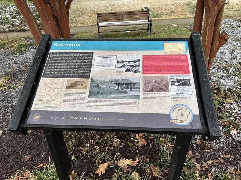
Rosemont began as a streetcar suburb just outside the City of Alexandria. It remains an excellent example of this type of early 20th century development. By 1908, investors from Philadelphia; Washington, D.C.; and northern Virginia — operating as the Rosemont Development Company — began selling lots in what would become the 84-acre Rosemont neighborhood. The largely open, undeveloped land was near Shuter's Hill, where the George Washington Masonic National Memorial now stands. Initial development in Section 1 occurred along Rosemont Avenue and Cedar Street, with later sections opening in 1911 through the 1930s. The sizeable lots on hilly streets with short blocks facing a trolley line were marketed heavily in Washington as a convenient and healthy alternative to city living. Still many of Rosemont's early residents were from Alexandria.
Within a decade, Rosemont had become a middle-class neighborhood of bungalows, Arts and Crafts, and Colonial Revival homes. The developers provided utilities, street lights, telephone service, and, in the early years, a night watchman. Residents played tennis on a court across from
this page online
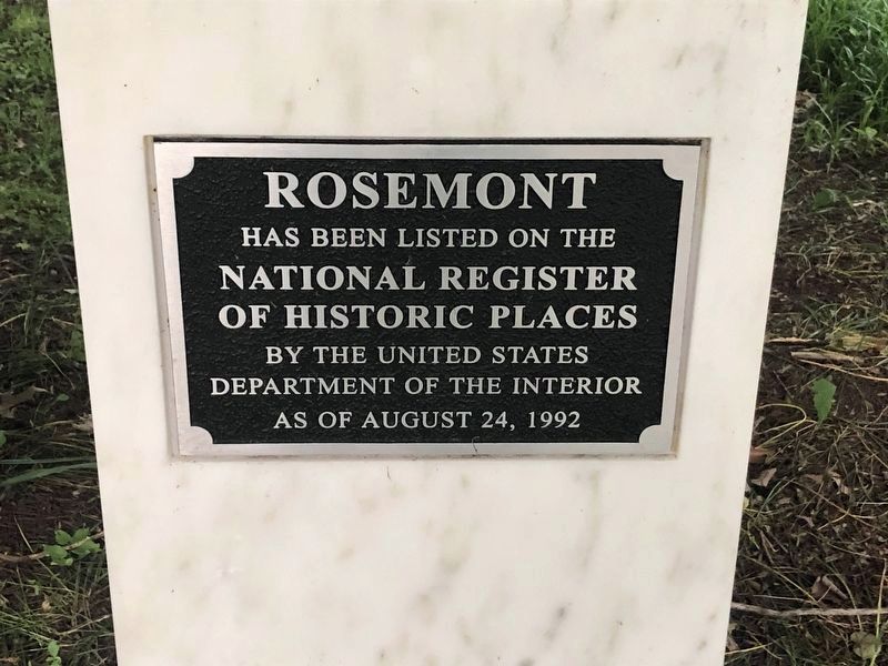
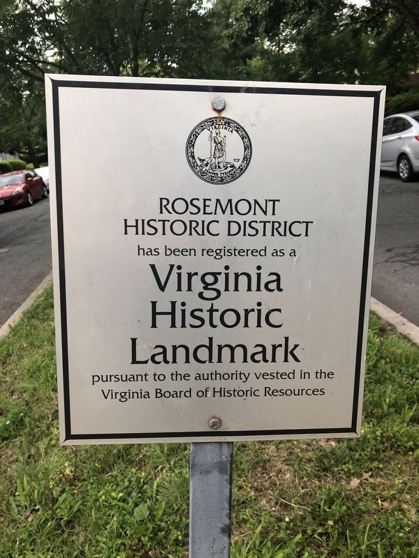
Rosemont became a National Register Historic District in 1992. Its boundaries extend from King Street east to roughly Hooff's Run east of Commonwealth Avenue, north to Rucker Place and W. Walnut Street, and to just south of Sunset Drive.
[Captions:]
Rosemont, Section 1.
Union Station (bottom of map), built in 1905, offered transportation options for Rosemont residents.
Philadelphia architect D. Knickerbocker Boyd designed one of Rosemont's earliest homes at 15 W. Cedar Street in 1908 for Ralph Goldsworthy, a train engineer. The sales agreement included a 20-year covenant noting among its restrictions that now pigs or cows could be kept on the property, nor could it be sold or leased to "any person not of the Causasian race." Architects Waddy Wood and Milton Dana Morrill also designed in the neighborhood, but most early Rosemont homes were designed and constructed by local builders.
Philadelphia-based investors owned the Washington, Alexandria, and Mount Vernon Electric Railway — expanded in 1896 and upgraded in 1905 — that linked Old Town to downtown Washington, D.C., via Washington (later Commonwealth) Avenue. The line gave Rosemont easy access to both cities; sales ads for homes noted the trip to downtown D.C. took only 18 minutes. A trolley station at Rosemont Avenue, shown here ca. 1912, was designed by Milton Dana Morrill in 1909. Another trolley station was built a few blocks north at W. Walnut Street.
Erected by City
Topics and series. This historical marker is listed in these topic lists: Architecture • Railroads & Streetcars • Settlements & Settlers. In addition, it is included in the Virginia, The City of Alexandria series list. A significant historical year for this entry is 1908.
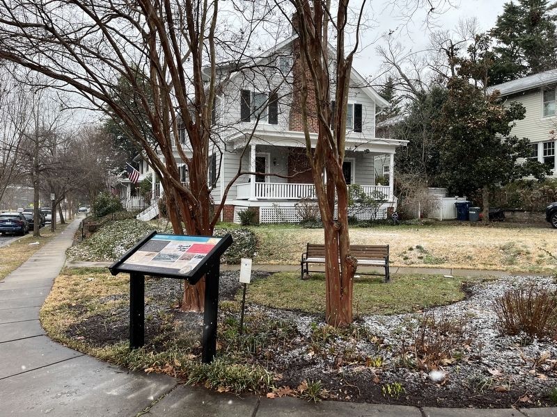
Location. 38° 48.585′ N, 77° 3.66′ W. Marker is in Alexandria, Virginia. It is in Potomac West. It is at the intersection of Commonwealth Avenue and West Rosemont Avenue, on the right when traveling south on Commonwealth Avenue. Touch for map. Marker is at or near this postal address: 104 Commonwealth Ave, Alexandria VA 22301, United States of America. Touch for directions.

Regionally, this marker is in the Washington Metropolitan Area and in Northern Virginia. It is also in the American South, specifically in the Upper South, in the Mid-Atlantic, and on the Eastern Seaboard. Globally, it is in the North Atlantic Region, North America, the Western Hemisphere, the Western World, and the Anglosphere. Historically, it finds itself in what was once the territory of the Mississippian Culture, one of the original Thirteen Colonies,
Photographed by Devry Becker Jones (CC0), May 18, 2019
3. National Register of Historic Places plaque for Rosemont
Other nearby markers. At least 8 other markers are within walking distance of this marker: Original Federal Boundary Stone, District of Columbia, Southwest 2 (approx. 0.2 miles away); World War I Memorial (approx. 0.2 miles away); Alexandria War Memorial (approx. 0.2 miles away); Shuter's Hill (approx. 0.2 miles away); Vietnam War Memorial (approx. 0.2 miles away); Veterans Memorial (approx. 0.2 miles away); Alexandria in the Civil War (approx. ¼ mile away); Fighting Back (approx. ¼ mile away). Touch for a list and map of all markers in Alexandria.
Another marker is no longer nearby. Alexandria (was approx. ¼ mile away but has been replaced with another marker now near it).
Additional keywords. restrictive covenants; racial covenants
Credits. This page was last revised on January 27, 2023. It was originally submitted on February 13, 2022, by Devry Becker Jones of Washington, District of Columbia. This page has been viewed 661 times since then and 32 times this year. Photos: 1, 2. submitted on February 13, 2022, by Devry Becker Jones of Washington, District of Columbia. 3, 4. submitted on May 18, 2019, by Devry Becker Jones of Washington, District of Columbia.
