Millville in Worcester County, Massachusetts — The American Northeast (New England)
Millville Village
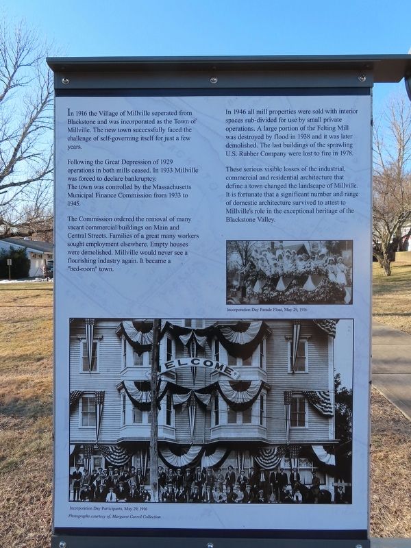
In 1916 the Village of Millville seperated from Blackstone and was incorporated as the Town of Millville. The new town successfully faced the challenge of self-governing itself for just a few years.
Following the Great Depression of 1929 operations in both mills ceased. In 1933 Millville was forced to declare bankruptcy. The town was controlled by the Massachusetts Municipal Finance Commission from 1933 to 1945.
The Commission ordered the removal of many vacant commercial buildings on Main and Central Streets. Families of a great many workers sought employment elsewhere. Empty houses were demolished. Millville would never see a flourishing industry again. It became a "bed-room" town.
In 1946 all mill properties were sold with interior spaces sub-divided for use by small private operations. A large portion of the Felting Mill was destroyed by flood in 1938 and it was later demolished. The last buildings of the sprawling U.S. Rubber Company were lost to fire in 1978.
These serious visible losses of the industrial, commercial and residential architecture that define a town changed the landscape of Millville. It is fortunate that a significant number and range of domestic architecture survived to attest to Millville's role in the exceptional heritage of the Blackstone Valley.
( photo captions )
— Incorporation Day Parade Float, May 29, 1916
— Incorporation Day Participants, May 29, 1916
Photographs courtesy of Margaret Carrol Collection
( back )
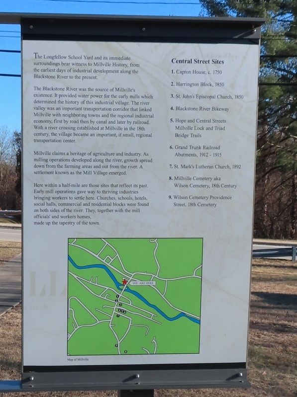
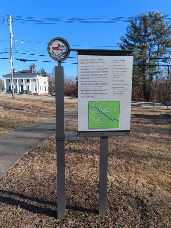
The Longfellow School Yard and its immediate surroundings bear witness to Millville History, from the earliest days of industrial development along the Blackstone River to the present.
The Blackstone River was the source of Millville's existence. It provided water power for the early mills which determined the history of this industrial village. The river valley was an important transportation corridor that linked Millville with neighboring towns and the regional industrial economy, first by road then by canal and later by railroad. With a river crossing established at Millville in the 18th century, the village became an important, if small, regional transportation center.
Millville claims a heritage of agriculture and industry. As milling operations developed along the river, growth spread down from the farming areas and out from the river. A settlement known as the Mill Village emerged.
Here within a half-mile are those sites that reflect its past. Early mill operations gave way to thriving industries bringing workers to settle here. Churches, schools, hotels, social halls, commercial and residential blocks were found on both sides of the river. They, together with the mill officials' and workers homes, made up the tapestry of the town.
Central Street Sites
1. Capron House, c. 1750
2. Harrington Block, 1850
3. St. John's Episcopal Church, 1850
4. Blackstone River Bikeway
5. Hope and Central Streets Millville Lock and Triad Bridge Trails
6. Grand Trunk Railroad Abutments, 1912 - 1915
7. St. Mark's Lutheran Church, 1892
8. Millville Cemetery aka Wilson Cemetery, 18th Century
9. Wilson Cemetery Providence Street, 18th Cemetery
Topics. This historical marker is listed in these topic lists: Industry & Commerce • Settlements & Settlers. A significant historical date for this entry is May 29, 1916.
Location. 42° 1.627′ N, 71° 34.861′ W. Marker is in Millville, Massachusetts, in Worcester County. Marker is at the intersection of Central Street and Fletcher Avenue, on the left when traveling north on Central Street. Touch for map. Marker is in this post office area: Millville MA 01529, United States of America. Touch for directions.
Other nearby markers. At least 8 other markers are within walking distance of this marker. Millville Mills (here, next to this marker); Udor Tower (a few steps from this marker); Samuel Thompson’s Gristmill Stone 1727 (within shouting distance of this marker); The Raceway (within shouting distance of this marker); Longfellow School (within shouting distance of this marker); “Old Cemetery” (about 500 feet away, measured in a direct line); Millville Main Street (about 500 feet away); Millville Veterans Monument (about 500 feet away). Touch for a list and map of all markers in Millville.
Also see . . .
1. Millville, Massachusetts. (Submitted on February 24, 2022, by Michael Herrick of Southbury, Connecticut.)
2. Millville, Massachusetts (Wikipedia). (Submitted on February 24, 2022, by Michael Herrick of Southbury, Connecticut.)
Credits. This page was last revised on February 24, 2022. It was originally submitted on February 24, 2022, by Michael Herrick of Southbury, Connecticut. This page has been viewed 217 times since then and 42 times this year. Photos: 1, 2, 3, 4. submitted on February 24, 2022, by Michael Herrick of Southbury, Connecticut.


